Arrondissement of Morlaix
Located in Finistère, Brittany Region Coordinates: 48°33′03″ N 3°55′36″ W
- Population
- 130,880
- 130.9K
- Elevation
- 77 m
- above sea level
- Local time
- UTC+01:00
- Europe/Paris · UTC+01:00
- Places inside
- 59
- listed under Arrondissement of Morlaix
- Airports
- BES Brest Bretagne airport38 km
- GCI Guernsey Airport138 km
About Arrondissement of Morlaix
Arrondissement of Morlaix is a municipality. Location: Finistère, Brittany Region. Population: 130,880. Elevation: 77 m. The best months to visit are June–September. The nearest airport is Brest Bretagne airport (38 km). Nearby sights include Penzé and Ruisseau le Coatoulsach.
Photos of Arrondissement of Morlaix
-
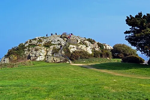
Îlot Sainte-Anne Kergourlay · CC BY-SA 3.0

Climate of Arrondissement of Morlaix
Best months for sightseeingBest months for sightseeing: June–September.
This month · November
A wet month
Day 12° · Night 7° · Rain 121 mm
- Hottest month
- August (day 21°)
- Coldest month
- February (night 4°)
- Wettest month
- December (128 mm)
- Driest month
- July (47 mm)
Bars: average monthly low and high temperature. Below: precipitation. Monthly averages for 1970–2000 at about 18 km resolution, adjusted for elevation. Highlighted months are mild and relatively dry. Source: WorldClim 2.1 (CC BY 4.0).
Show values as a table
| Month | Jan | Feb | Mar | Apr | May | Jun | Jul | Aug | Sep | Oct | Nov | Dec |
|---|---|---|---|---|---|---|---|---|---|---|---|---|
| Average high (°C) | 9° | 9° | 11° | 13° | 16° | 18° | 21° | 21° | 19° | 15° | 12° | 10° |
| Average low (°C) | 4° | 4° | 5° | 6° | 9° | 11° | 13° | 13° | 11° | 9° | 7° | 5° |
| Precipitation (mm) | 126 | 103 | 89 | 71 | 68 | 55 | 47 | 57 | 81 | 102 | 121 | 128 |
Other places to visit in this season: June July August September
How to get to Arrondissement of Morlaix
The nearest airport is Brest Bretagne airport (BES), 38 km to the west as the crow flies. The nearest large city is Brest, 45 km to the southwest.
Airports
- Brest Bretagne airport (BES) Brest 38 kmwest
- Guernsey Airport (GCI) Saint Peter Port 138 kmnortheast
- Jersey Airport (JER) St. Peter 146 kmnortheast
Nearby large cities
- Brest Population: 144.9K 45 kmsouthwest
- Rennes Population: 227.8K 174 kmeast
- Plymouth Population: 260.2K 203 kmnorth
- Nantes Population: 325.1K 231 kmsoutheast
- Exeter Population: 130.7K 243 kmnorth
Straight-line distances; road distances are longer. Airport data: OurAirports.
Day trips from Arrondissement of Morlaix
Within 100 km: 230 historic and cultural sites, 128 natural sites, 236 lakes, rivers and coasts.
0–25 km82 places
- Île de Batz Island 23 kmN
- Ménez Keryéven Mountain 25 kmS
- Roc Trévezel Mountain 16 kmS
- Ménez Toul al Lann Mountain 20 kmSE
25–60 km252 places
- Île Grande Island 38 kmNE
- Kastell Koad Freg Historic site 41 kmNE
- Kastell Tonkedeg Historic site 40 kmE
- Plage de Porsmilin Beach 60 kmW
60–100 km260 places
- Île de Quéménès Island 75 kmW
- Plage du Trez-Hir Beach 62 kmW
- Île aux Rats Island 80 kmS
- Trieux River 69 kmNE
Straight-line distances.
Arrondissement of Morlaix and similar cities
Side by side with cities of similar size in the same country: population, elevation and climate.
| Measure | Arrondissement of Morlaix | Villeurbanne | Besançon | Paris 14 Observatoire |
|---|---|---|---|---|
| Population | 130.9K | 131.4K | 128.4K | 136.5K |
| Elevation | 77 m | 177 m | 300 m | 70 m |
| Summer day (hottest month) | 21° | 27° | 24° | 25° |
| Winter night (coldest month) | 4° | 0° | -1° | 2° |
| Annual rainfall | 1,048 mm | 844 mm | 1,156 mm | 643 mm |
| Best months | Jun–Sep | May–Sep | Jun–Sep | Jun–Sep |
| Distance | — | 735 km | 757 km | 461 km |
Climate values are 1970–2000 monthly averages; straight-line distance.
Places in Arrondissement of Morlaix
59 places- 1 Morlaix 14.7K
- 2 Landivisiau 9.1K
- 3 Saint-Pol-de-Léon 6.6K
- 4 Plouigneau 5.1K
- 5 Saint-Martin-des-Champs 4.6K
- 6 Plourin-lès-Morlaix 4.4K
- 7 Cléder 3.8K
- 8 Plougonven 3.5K
- 9 Plouescat 3.5K
- 10 Roscoff 3.4K
- 11 Carantec 3.1K
- 12 Pleyber-Christ 3.1K
- 13 Saint-Thégonnec Loc-Eguiner 3K
- 14 Taulé 3K
- 15 Plougasnou 2.9K
- 16 Plouvorn 2.9K
- 17 Plouénan 2.5K
- 18 Guiclan 2.5K
- 19 Santec 2.4K
- 20 Plounévez-Lochrist 2.3K
- 21 Sizun 2.3K
- 22 Lanmeur 2.2K
- 23 Plounéventer 2.1K
- 24 Lampaul-Guimiliau 2.1K
- 25 Plouzévédé 1.8K
- 26 Plougoulm 1.8K
- 27 Bodilis 1.6K
- 28 Plouezoc'h 1.6K
- 29 Locquirec 1.4K
- 30 Plougourvest 1.4K
- 31 Guerlesquin 1.3K
- 32 Henvic 1.3K
- 33 Lanhouarneau 1.3K
- 34 Plounéour-Ménez 1.2K
- 35 Sibiril 1.2K
- 36 Plouégat-Guérand 1.1K
- 37 Garlan 1.1K
- 38 Commana 1K
- 39 Guimiliau 1K
- 40 Sainte-Sève 1K
- 41 Guimaëc 958
- 42 Mespaul 944
- 43 Tréflez 944
- 44 Saint-Vougay 903
- 45 Saint-Derrien 808
- 46 Saint-Sauveur 799
- 47 Locquénolé 787
- 48 Plougar 783
- 49 Saint-Servais 781
- 50 Plouégat-Moysan 717
- 51 Le Cloître-Saint-Thégonnec 657
- 52 Saint-Jean-du-Doigt 643
- 53 Tréflaouénan 504
- 54 Locmélar 466
- 55 Île-de-Batz 464
- 56 Botsorhel 424
- 57 Loc-Eguiner 400
- 58 Lannéanou 389
- 59 Trézilidé 378
Bar: population relative to the most populous place in this list.
Nearby attractions & nature
Everything nearby-
Penzé River, Finistère3.6 km N
-
Ruisseau le Coatoulsach River, Finistère3.7 km N
-
Forêt de Lannuzouarn Natural site, Finistère5.6 km NW
-
Bois de Coat-Meur Natural site, Finistère9.7 km SW
-
Tromorgant River, Finistère9.5 km E
-
Dossen River, Finistère10 km NE
-
Monts d'Arrée Mountain, Finistère13 km S
-
Dourcane River, Finistère13 km SW
Other cities and towns in Finistère
-
Morlaix Town, Morlaix7.9 km E
-
Saint-Martin-des-Champs Town, Saint-Martin-des-Champs6.6 km NE
-
Landivisiau Town, Landivisiau12 km SW
-
Arrondissement of Châteaulin Municipality, Finistère33 km S
-
Arrondissement de Brest Municipality, Finistère39 km W
-
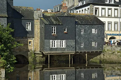 Landerneau Town, Landerneau26 km SW
Sources & licences
Data last updated: