- Population
- 69,934
- 69.9K
- Elevation
- 387 m
- above sea level
- Local time
- UTC+01:00
- Europe/Paris · UTC+01:00
- Places inside
- 108
- listed under Arrondissement of Altkirch
- Airports
- BSL EuroAirport Basel–Mulhouse–Freiburg22 km
- BRN Bern Airport77 km
About Arrondissement of Altkirch
Arrondissement of Altkirch is a municipality. Location: Haut-Rhin, Grand Est. Population: 69,934. Elevation: 387 m. The best months to visit are June–September. The nearest airport is EuroAirport Basel–Mulhouse–Freiburg (22 km). Nearby sights include Bois de Hirtzbach and Saint-Morand.
Climate of Arrondissement of Altkirch
Best months for sightseeingBest months for sightseeing: June–September.
This month · November
A cold month
Day 8° · Night 1° · Rain 73 mm
- Hottest month
- July (day 24°)
- Coldest month
- January (night -2°)
- Wettest month
- May (86 mm)
- Driest month
- March (53 mm)
Bars: average monthly low and high temperature. Below: precipitation. Monthly averages for 1970–2000 at about 18 km resolution, adjusted for elevation. Highlighted months are mild and relatively dry. Source: WorldClim 2.1 (CC BY 4.0).
Show values as a table
| Month | Jan | Feb | Mar | Apr | May | Jun | Jul | Aug | Sep | Oct | Nov | Dec |
|---|---|---|---|---|---|---|---|---|---|---|---|---|
| Average high (°C) | 4° | 5° | 10° | 13° | 18° | 21° | 24° | 24° | 20° | 14° | 8° | 5° |
| Average low (°C) | -2° | -2° | 1° | 3° | 8° | 11° | 13° | 13° | 9° | 6° | 1° | -1° |
| Precipitation (mm) | 61 | 61 | 53 | 63 | 86 | 84 | 77 | 72 | 70 | 70 | 73 | 74 |
Other places to visit in this season: June July August September
How to get to Arrondissement of Altkirch
The nearest airport is EuroAirport Basel–Mulhouse–Freiburg (BSL), 22 km to the east as the crow flies. The nearest large city is Mulhouse, 20 km to the north.
Airports
- EuroAirport Basel–Mulhouse–Freiburg (BSL) Bâle / Mulhouse 22 kmeast
- Bern Airport (BRN) Bern 77 kmsouth
- Zürich Airport (ZRH) Zurich 100 kmeast
Nearby large cities
- Mulhouse Population: 111.4K 20 kmnorth
- Basel Population: 177.6K 26 kmeast
- Freiburg im Breisgau Population: 237.5K 65 kmnortheast
- Bern Population: 121.6K 72 kmsouth
- Besançon Population: 128.4K 99 kmwest
Straight-line distances; road distances are longer. Airport data: OurAirports.
Day trips from Arrondissement of Altkirch
Within 100 km: 415 historic and cultural sites, 1,365 natural sites, 398 lakes, rivers and coasts.
0–25 km67 places
- Etangs Rougeat Lake 14 kmSW
- Pisciculture Lake 15 kmSW
- Etang du Milieu Lake 13 kmSW
- Etangs Rougeat Lake 14 kmSW
25–60 km760 places
- Sankt Petersinsel Island 57 kmS
- Lake Biel Lake 56 kmS
- Inkwilersee Lake 53 kmSE
- Burgaeschisee Lake 56 kmSE
60–100 km1,351 places
- Kleiner Bremgartenwald Mountain 70 kmS
- Fahr Abbey Attraction 93 kmE
- Arbeiterstrandbad Tennwil Beach 80 kmE
- Mauesee-Insel Island 78 kmSE
Straight-line distances.
Arrondissement of Altkirch and similar cities
Side by side with cities of similar size in the same country: population, elevation and climate.
| Measure | Arrondissement of Altkirch | Bourges | Colmar | Valence |
|---|---|---|---|---|
| Population | 69.9K | 68K | 65.4K | 63.9K |
| Elevation | 387 m | 144 m | 193 m | 126 m |
| Summer day (hottest month) | 24° | 26° | 25° | 29° |
| Winter night (coldest month) | -2° | 1° | -1° | 1° |
| Annual rainfall | 844 mm | 717 mm | 654 mm | 888 mm |
| Best months | Jun–Sep | Jun–Sep | May–Sep | May–Sep |
| Distance | — | 369 km | 56 km | 345 km |
Climate values are 1970–2000 monthly averages; straight-line distance.
Places in Arrondissement of Altkirch
108 places- 1 Altkirch 5.8K
- 2 Illfurth 2.5K
- 3 Dannemarie 2.3K
- 4 Hirsingue 2.1K
- 5 Hochstatt 2.1K
- 6 Carspach 2K
- 7 Waldighofen 1.5K
- 8 Hirtzbach 1.4K
- 9 Illtal 1.4K
- 10 Seppois-le-Bas 1.4K
- 11 Spechbach 1.3K
- 12 Bernwiller 1.2K
- 13 Aspach 1.1K
- 14 Muespach-le-Haut 1.1K
- 15 Pfetterhouse 1K
- 16 Tagolsheim 918
- 17 Walheim 902
- 18 Montreux-Vieux 894
- 19 Muespach 892
- 20 Durmenach 850
- 21 Ballersdorf 822
- 22 Wittersdorf 814
- 23 Steinsoultz 779
- 24 Luemschwiller 775
- 25 Balschwiller 771
- 26 Frœningen 717
- 27 Retzwiller 712
- 28 Oltingue 704
- 29 Roppentzwiller 699
- 30 Hagenbach 693
- 31 Chavannes-sur-l'Étang 690
- 32 Ferrette 687
- 33 Vieux-Ferrette 674
- 34 Riespach 664
- 35 Heimersdorf 662
- 36 Friesen 641
- 37 Hindlingen 641
- 38 Heidwiller 608
- 39 Traubach-le-Haut 606
- 40 Manspach 573
- 41 Durlinsdorf 568
- 42 Saint-Bernard 558
- 43 Mœrnach 550
- 44 Werentzhouse 549
- 45 Bisel 543
- 46 Kœstlach 508
- 47 Raedersdorf 508
- 48 Jettingen 506
- 49 Seppois-le-Haut 500
- 50 Traubach-le-Bas 491
- 51 Hecken 480
- 52 Bouxwiller 465
- 53 Wolschwiller 461
- 54 Bettendorf 452
- 55 Feldbach 435
- 56 Fislis 430
- 57 Mooslargue 425
- 58 Valdieu-Lutran 420
- 59 Bréchaumont 411
- 60 Obermorschwiller 404
Bar: population relative to the most populous place in this list.
Nearby attractions & nature
Everything nearby-
Bois de Hirtzbach Natural site, Haut-Rhin2 km W
-
Saint-Morand Attraction, Grand Est5 km N
-
Thalbach River, Haut-Rhin6.1 km NE
-
Gersbach River, Haut-Rhin7.7 km SE
-
Barrenwackgraben River, Haut-Rhin8.6 km NW
-
Roesbaechlein River, Haut-Rhin9.8 km NW
-
Largue River, Haut-Rhin11 km N
-
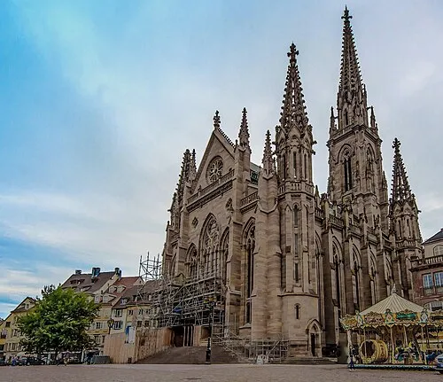 Temple Saint-Étienne Attraction, Grand Est20 km NE
Sources & licences
Data last updated: