- Population
- 357,005
- 357K
- Elevation
- 255 m
- above sea level
- Local time
- UTC+01:00
- Europe/Paris · UTC+01:00
- Places inside
- 79
- listed under Arrondissement of Mulhouse
- Airports
- BSL EuroAirport Basel–Mulhouse–Freiburg15 km
- BRN Bern Airport89 km
About Arrondissement of Mulhouse
Arrondissement of Mulhouse is a municipality. Location: Haut-Rhin, Grand Est. Population: 357,005. Elevation: 255 m. The best months to visit are May–September. The nearest airport is EuroAirport Basel–Mulhouse–Freiburg (15 km). Nearby sights include Forêt Domaniale de la Hardt Sud and Temple Saint-Étienne.
Photos of Arrondissement of Mulhouse
-
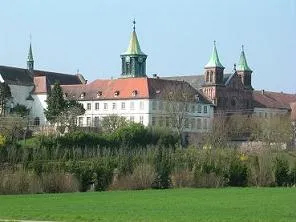
Abbaye Notre-Dame d'Oelenberg Frere Theophane · CC BY-SA 3.0 -
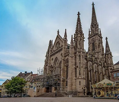
Temple Saint-Étienne Mahé Petit Garçon Curieux · CC BY-SA 3.0


Climate of Arrondissement of Mulhouse
Best months for sightseeingBest months for sightseeing: May–September.
This month · November
A cold month
Day 9° · Night 2° · Rain 58 mm
- Hottest month
- July (day 25°)
- Coldest month
- January (night -1°)
- Wettest month
- May (76 mm)
- Driest month
- March (42 mm)
Bars: average monthly low and high temperature. Below: precipitation. Monthly averages for 1970–2000 at about 18 km resolution, adjusted for elevation. Highlighted months are mild and relatively dry. Source: WorldClim 2.1 (CC BY 4.0).
Show values as a table
| Month | Jan | Feb | Mar | Apr | May | Jun | Jul | Aug | Sep | Oct | Nov | Dec |
|---|---|---|---|---|---|---|---|---|---|---|---|---|
| Average high (°C) | 5° | 6° | 11° | 15° | 19° | 23° | 25° | 25° | 21° | 15° | 9° | 6° |
| Average low (°C) | -1° | -1° | 2° | 4° | 9° | 12° | 14° | 13° | 10° | 6° | 2° | 0° |
| Precipitation (mm) | 48 | 49 | 42 | 53 | 76 | 73 | 69 | 64 | 59 | 58 | 58 | 61 |
Other places to visit in this season: May June July August September
How to get to Arrondissement of Mulhouse
The nearest airport is EuroAirport Basel–Mulhouse–Freiburg (BSL), 15 km to the southeast as the crow flies. The nearest large city is Mulhouse, 8 km to the northwest.
Airports
- EuroAirport Basel–Mulhouse–Freiburg (BSL) Bâle / Mulhouse 15 kmsoutheast
- Bern Airport (BRN) Bern 89 kmsouth
- Zürich Airport (ZRH) Zurich 90 kmeast
Nearby large cities
- Mulhouse Population: 111.4K 8 kmnorthwest
- Basel Population: 177.6K 21 kmsoutheast
- Freiburg im Breisgau Population: 237.5K 46 kmnortheast
- Bern Population: 121.6K 84 kmsouth
- Zurich Population: 415.4K 94 kmsoutheast
Straight-line distances; road distances are longer. Airport data: OurAirports.
Day trips from Arrondissement of Mulhouse
Within 100 km: 452 historic and cultural sites, 1,485 natural sites, 441 lakes, rivers and coasts.
0–25 km117 places
- Rheinhafen Kleinhüningen Lake 19 kmSE
- Neuer Teich Lake 22 kmSE
- Birs River 23 kmSE
- Römisch-katholische Kirche Binningen Attraction 23 kmSE
25–60 km923 places
- Inkwilersee Lake 60 kmS
- Etang de la Gruère Lake 59 kmSW
- Etangs Rougeat Lake 33 kmSW
- Basler Weiher Lake 37 kmSE
60–100 km1,338 places
- Kleiner Bremgartenwald Mountain 82 kmS
- Fahr Abbey Attraction 85 kmSE
- Arbeiterstrandbad Tennwil Beach 76 kmSE
- Sankt Petersinsel Island 73 kmS
Straight-line distances.
Arrondissement of Mulhouse and similar cities
Side by side with cities of similar size in the same country: population, elevation and climate.
| Measure | Arrondissement of Mulhouse | Nice | Nantes | Marne La Vallée |
|---|---|---|---|---|
| Population | 357K | 342.7K | 325.1K | 318.3K |
| Elevation | 255 m | 25 m | 19 m | 96 m |
| Summer day (hottest month) | 25° | 28° | 25° | 24° |
| Winter night (coldest month) | -1° | 5° | 3° | 1° |
| Annual rainfall | 710 mm | 807 mm | 794 mm | 635 mm |
| Best months | May–Sep | May–Sep | Jun–Sep | Jun–Sep |
| Distance | — | 445 km | 677 km | 375 km |
Climate values are 1970–2000 monthly averages; straight-line distance.
Places in Arrondissement of Mulhouse
79 places- 1 Mulhouse 109K
- 2 Saint-Louis 20.6K
- 3 Wittenheim 14.6K
- 4 Illzach 14.5K
- 5 Rixheim 14.1K
- 6 Kingersheim 13.2K
- 7 Riedisheim 12.3K
- 8 Wittelsheim 10.4K
- 9 Pfastatt 9.5K
- 10 Brunstatt-Didenheim 7.8K
- 11 Huningue 7.2K
- 12 Lutterbach 6.4K
- 13 Sausheim 5.5K
- 14 Kembs 5.2K
- 15 Habsheim 4.8K
- 16 Blotzheim 4.5K
- 17 Village-Neuf 4.2K
- 18 Bollwiller 4K
- 19 Staffelfelden 4K
- 20 Bartenheim 3.8K
- 21 Morschwiller-le-Bas 3.7K
- 22 Richwiller 3.7K
- 23 Sierentz 3.7K
- 24 Hégenheim 3.4K
- 25 Pulversheim 2.9K
- 26 Hésingue 2.7K
- 27 Baldersheim 2.6K
- 28 Zillisheim 2.6K
- 29 Rosenau 2.3K
- 30 Ruelisheim 2.3K
- 31 Ungersheim 2.3K
- 32 Reiningue 2K
- 33 Ottmarsheim 1.8K
- 34 Bantzenheim 1.6K
- 35 Landser 1.6K
- 36 Battenheim 1.6K
- 37 Eschentzwiller 1.5K
- 38 Flaxlanden 1.5K
- 39 Dietwiller 1.5K
- 40 Hombourg 1.3K
- 41 Heimsbrunn 1.3K
- 42 Hagenthal-le-Bas 1.2K
- 43 Schlierbach 1.2K
- 44 Leymen 1.2K
- 45 Berrwiller 1.2K
- 46 Bruebach 1.1K
- 47 Buschwiller 1K
- 48 Zimmersheim 1K
- 49 Feldkirch 990
- 50 Attenschwiller 959
- 51 Niffer 953
- 52 Chalampé 950
- 53 Folgensbourg 903
- 54 Uffheim 876
- 55 Petit-Landau 832
- 56 Galfingue 804
- 57 Rantzwiller 800
- 58 Wentzwiller 745
- 59 Steinbrunn-le-Bas 722
- 60 Helfrantzkirch 700
Bar: population relative to the most populous place in this list.
Nearby attractions & nature
Everything nearby-
Forêt Domaniale de la Hardt Sud Natural site, Haut-Rhin4.8 km E
-
Temple Saint-Étienne Attraction, Grand Est6.7 km NW
-
Parc Alfred Wallach Natural site, Grand Est4.8 km NW
-
Forêt Domaniale de la Hardt Natural site, Haut-Rhin8.6 km NE
-
Doller River, Haut-Rhin8.6 km NW
-
Cité de l'Automobile Museum, Grand Est8.3 km NW
-
Largue River, Haut-Rhin12 km W
-
Bois de Nonnenbruch Natural site, Haut-Rhin14 km NW
Sources & licences
Data last updated: