Arrondissement of Le Havre
Located in Seine-Maritime, Normandy Coordinates: 49°36′43″ N 0°23′26″ E
- Population
- 384,798
- 384.8K
- Elevation
- 121 m
- above sea level
- Local time
- UTC+01:00
- Europe/Paris · UTC+01:00
- Places inside
- 149
- listed under Arrondissement of Le Havre
- Airports
- DOL Deauville Normandie airport32 km
- CFR Caen Carpiquet airport78 km
About Arrondissement of Le Havre
Arrondissement of Le Havre is a municipality. Location: Seine-Maritime, Normandy. Population: 384,798. Elevation: 121 m. The best months to visit are June–September. The nearest airport is Deauville Normandie airport (32 km). Nearby sights include Cap du Hode and Bois de la Hèse.
Photos of Arrondissement of Le Havre
-
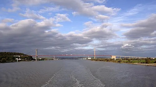
Tancarville Bridge Helmut Seger · CC BY-SA 4.0

Climate of Arrondissement of Le Havre
Best months for sightseeingBest months for sightseeing: June–September.
This month · November
A cold month
Day 11° · Night 6° · Rain 84 mm
- Hottest month
- August (day 21°)
- Coldest month
- February (night 3°)
- Wettest month
- December (86 mm)
- Driest month
- July (48 mm)
Bars: average monthly low and high temperature. Below: precipitation. Monthly averages for 1970–2000 at about 18 km resolution, adjusted for elevation. Highlighted months are mild and relatively dry. Source: WorldClim 2.1 (CC BY 4.0).
Show values as a table
| Month | Jan | Feb | Mar | Apr | May | Jun | Jul | Aug | Sep | Oct | Nov | Dec |
|---|---|---|---|---|---|---|---|---|---|---|---|---|
| Average high (°C) | 7° | 8° | 10° | 12° | 16° | 18° | 20° | 21° | 19° | 15° | 11° | 8° |
| Average low (°C) | 3° | 3° | 4° | 5° | 8° | 11° | 13° | 13° | 12° | 9° | 6° | 4° |
| Precipitation (mm) | 77 | 63 | 58 | 51 | 56 | 55 | 48 | 49 | 68 | 82 | 84 | 86 |
Other places to visit in this season: June July August September
How to get to Arrondissement of Le Havre
The nearest airport is Deauville Normandie airport (DOL), 32 km to the southwest as the crow flies. For international flights: Beauvais-Tillé airport (BVA) (126 km). The nearest large city is Le Havre, 24 km to the southwest.
Airports
- Deauville Normandie airport (DOL) Deauville 32 kmsouthwest
- Caen Carpiquet airport (CFR) Caen 78 kmsouthwest
- Beauvais-Tillé airport (BVA) Beauvais 126 kmeast
Nearby large cities
- Le Havre Population: 186K 24 kmsouthwest
- Rouen Population: 116.3K 55 kmeast
- Caen Population: 110.6K 72 kmsouthwest
- Eastbourne Population: 101.7K 129 kmnorth
- Cergy-Pontoise Population: 183.4K 138 kmsoutheast
Straight-line distances; road distances are longer. Airport data: OurAirports.
Day trips from Arrondissement of Le Havre
Within 100 km: 195 historic and cultural sites, 72 natural sites, 75 lakes, rivers and coasts.
0–25 km35 places
- Plage du Butin Beach 24 kmSW
- La Grande Mare Lake 23 kmSE
- Mont Courel Mountain 22 kmS
- Forêt de Saint-Arnoult Natural site 23 kmE
25–60 km92 places
- Plage de Riva Bella Beach 59 kmSW
- Plage de Cabourg Beach 54 kmSW
- Plage du Temple Beach 49 kmSW
- Plage du Casino Beach 48 kmSW
60–100 km215 places
- Biotropica Natural site 69 kmSE
- Gold Beach Beach 74 kmSW
- Juno Beach Beach 67 kmSW
- Sword Beach Beach 62 kmSW
Straight-line distances.
Arrondissement of Le Havre and similar cities
Side by side with cities of similar size in the same country: population, elevation and climate.
| Measure | Arrondissement of Le Havre | Nice | Nantes | Marne La Vallée |
|---|---|---|---|---|
| Population | 384.8K | 342.7K | 325.1K | 318.3K |
| Elevation | 121 m | 25 m | 19 m | 96 m |
| Summer day (hottest month) | 21° | 28° | 25° | 24° |
| Winter night (coldest month) | 3° | 5° | 3° | 1° |
| Annual rainfall | 777 mm | 807 mm | 794 mm | 635 mm |
| Best months | Jun–Sep | May–Sep | Jun–Sep | Jun–Sep |
| Distance | — | 841 km | 303 km | 185 km |
Climate values are 1970–2000 monthly averages; straight-line distance.
Places in Arrondissement of Le Havre
149 places- 61 Mannevillette 842
- 62 Valmont 841
- 63 Yport 834
- 64 Saint-Jean-de-Folleville 830
- 65 Saint-Pierre-en-Port 830
- 66 La Trinité-du-Mont 798
- 67 Sandouville 797
- 68 Colleville 757
- 69 Les Trois-Pierres 738
- 70 Gommerville 728
- 71 Épretot 726
- 72 Toussaint 726
- 73 Hattenville 715
- 74 Heuqueville 712
- 75 Sainte-Hélène-Bondeville 702
- 76 Le Tilleul 697
- 77 Grand-Camp 694
- 78 Bec-de-Mortagne 674
- 79 Bordeaux-Saint-Clair 665
- 80 Thérouldeville 665
- 81 Beuzevillette 657
- 82 Saint-Gilles-de-la-Neuville 657
- 83 Bernières 652
- 84 Saint-Vincent-Cramesnil 641
- 85 Trouville 638
- 86 Életot 630
- 87 Rouville 628
- 88 Alvimare 620
- 89 Graimbouville 617
- 90 Saint-Martin-du-Bec 605
- 91 Bolleville 590
- 92 Vattetot-sous-Beaumont 581
- 93 Ypreville-Biville 578
- 94 Anglesqueville-l'Esneval 573
- 95 Parc-d'Anxtot 571
- 96 Tourville-les-Ifs 570
- 97 Saint-Jean-de-la-Neuville 563
- 98 Theuville-aux-Maillots 550
- 99 Raffetot 502
- 100 Beaurepaire 499
- 101 Ganzeville 487
- 102 Saint-Maclou-la-Brière 485
- 103 Annouville-Vilmesnil 484
- 104 Auberville-la-Renault 463
- 105 Notre-Dame-du-Bec 454
- 106 Oudalle 452
- 107 La Poterie-Cap-d'Antifer 450
- 108 Grainville-Ymauville 442
- 109 Vergetot 439
- 110 Lintot 437
- 111 Sausseuzemare-en-Caux 437
- 112 Thiergeville 412
- 113 Gerville 411
- 114 Maniquerville 404
- 115 Gerponville 402
- 116 Criquebeuf-en-Caux 387
- 117 Daubeuf-Serville 384
- 118 Thiétreville 376
- 119 Hermeville 371
- 120 Sainte-Marie-au-Bosc 368
Bar: population relative to the most populous place in this list.
Nearby attractions & nature
Everything nearby-
Cap du Hode Natural site, Seine-Maritime15 km S
-
Bois de la Hèse Natural site, Seine-Maritime13 km SE
-
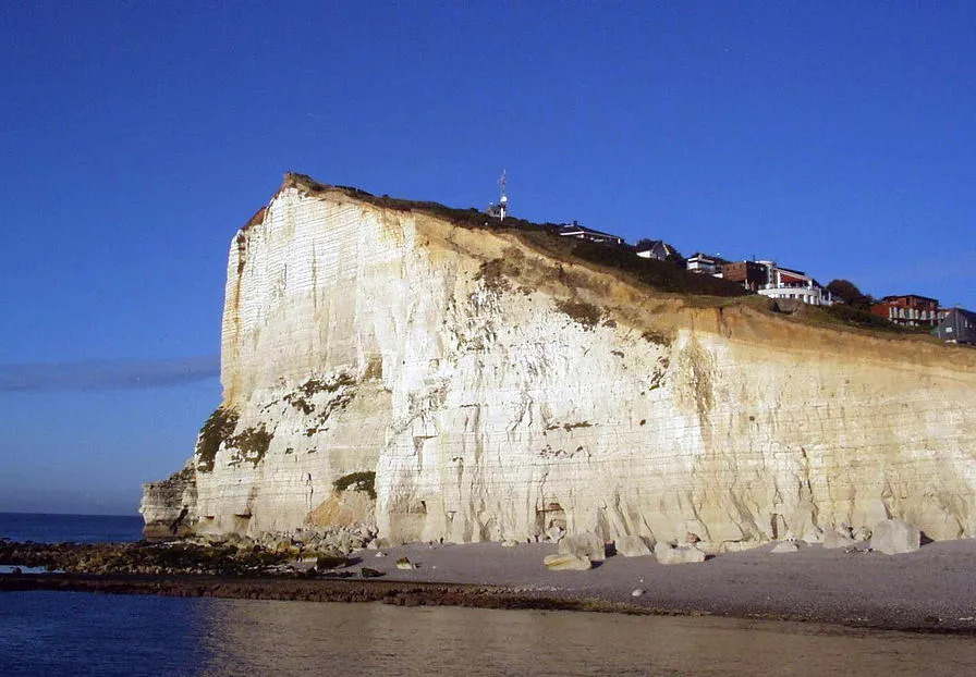 Cap Fagnet Natural site, Normandy17 km N
-
Forêt de Montgeon Natural site, Seine-Maritime21 km SW
-
Forêt de Saint-Arnoult Natural site, Seine-Maritime23 km E
-
Lézarde River, Seine-Maritime18 km SW
-
Bois Armel Natural site, Eure23 km S
-
Mont Courel Mountain, Fatouville-Grestain22 km S
Sources & licences
Data last updated: