Lavernhe
Located in Sévérac d'Aveyron, Arrondissement of Rodez Coordinates: 44°18′27″ N 3°00′06″ E
- Population
- 247
- 247
- Elevation
- 700 m
- above sea level
- Local time
- UTC+01:00
- Europe/Paris · UTC+01:00
- Airports
- RDZ Rodez–Aveyron Airport43 km
- AUR Aurillac airport80 km
About Lavernhe
Lavernhe is a village. Location: Sévérac d'Aveyron, Arrondissement of Rodez. Population: 247. Elevation: 700 m. The best months to visit are June–September. The nearest airport is Rodez–Aveyron Airport (43 km). Nearby sights include Ruisseau Olip and Mont Seigné.
Climate of Lavernhe
Best months for sightseeingBest months for sightseeing: June–September.
This month · November
A cold month
Day 10° · Night 3° · Rain 67 mm
- Hottest month
- July (day 25°)
- Coldest month
- January (night -1°)
- Wettest month
- October (90 mm)
- Driest month
- July (37 mm)
Bars: average monthly low and high temperature. Below: precipitation. Monthly averages for 1970–2000 at about 18 km resolution, adjusted for elevation. Highlighted months are mild and relatively dry. Source: WorldClim 2.1 (CC BY 4.0).
Show values as a table
| Month | Jan | Feb | Mar | Apr | May | Jun | Jul | Aug | Sep | Oct | Nov | Dec |
|---|---|---|---|---|---|---|---|---|---|---|---|---|
| Average high (°C) | 7° | 8° | 11° | 13° | 17° | 21° | 25° | 25° | 21° | 15° | 10° | 8° |
| Average low (°C) | -1° | 0° | 1° | 3° | 8° | 10° | 13° | 13° | 10° | 7° | 3° | 0° |
| Precipitation (mm) | 72 | 61 | 51 | 63 | 71 | 57 | 37 | 54 | 65 | 90 | 67 | 68 |
Other places to visit in this season: June July August September
How to get to Lavernhe
The nearest airport is Rodez–Aveyron Airport (RDZ), 43 km to the west as the crow flies. The nearest large city is Montpellier, 105 km to the southeast.
Airports
- Rodez–Aveyron Airport (RDZ) Rodez/Marcillac 43 kmwest
- Aurillac airport (AUR) Aurillac 80 kmnorthwest
- Castres Mazamet Airport (DCM) Castres 101 kmsouthwest
Nearby large cities
- Montpellier Population: 248.3K 105 kmsoutheast
- Nîmes Population: 148.2K 121 kmsoutheast
- Toulouse Population: 511.7K 147 kmsouthwest
- Clermont-Ferrand Population: 147.9K 164 kmnorth
- Saint-Etienne Population: 176.3K 166 kmnortheast
Straight-line distances; road distances are longer. Airport data: OurAirports.
Day trips from Lavernhe
Within 100 km: 148 historic and cultural sites, 463 natural sites, 170 lakes, rivers and coasts.
0–25 km20 places
- Lac de Pareloup Lake 23 kmSW
- Puy de Malavergne Mountain 24 kmN
- Puy de Lacalm Mountain 22 kmNW
- pic de Montaigu Mountain 22 kmSE
25–60 km198 places
- Lac de Charpal Lake 58 kmNE
- Lac de Maury Lake 48 kmNW
- Truc du Midi Mountain 36 kmNE
- Truc de l'Homme Mountain 54 kmN
60–100 km563 places
- Ancien îlot Gambetta Island 82 kmNW
- Lac du Bouchet Lake 92 kmNE
- Lac du Salagou Lake 78 kmS
- Lac du barrage de Naussac Lake 81 kmNE
Straight-line distances.
Nearby attractions & nature
Everything nearby-
Ruisseau Olip River, Aveyron6.5 km NW
-
Mont Seigné Mountain, Saint-Laurent-de-Lévézou12 km SW
-
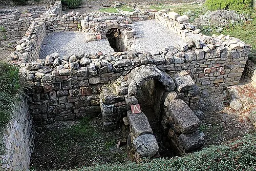 La Graufesenque Historic site, Millau25 km S
-
Puy de Campech Mountain, Sainte-Eulalie-d'Olt21 km NW
-
Le Lévézou Mountain, Aveyron20 km SW
-
Bois de Galinières Natural site, Aveyron14 km NW
Sources & licences
Data last updated: