Saint-André
Located in Arrondissement of Céret, Pyrénées-Orientales Coordinates: 42°33′04″ N 2°58′24″ E
- Population
- 3,388
- 3.4K
- Elevation
- 37 m
- above sea level
- Local time
- UTC+01:00
- Europe/Paris · UTC+01:00
- Places inside
- 2
- listed under Saint-André
- Airports
- PGF Perpignan-Rivesaltes (Llabanère) Airport23 km
- GRO Girona-Costa Brava Airport74 km
About Saint-André
Saint-André is a village. Location: Arrondissement of Céret, Pyrénées-Orientales. Population: 3,388. Elevation: 37 m. The best months to visit are May–October. The nearest airport is Perpignan-Rivesaltes (Llabanère) Airport (23 km). Nearby sights include Ribera de Sureda and la Ribereta.
Photos of Saint-André
-
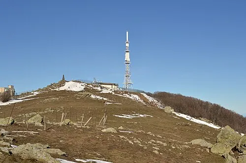
Puig Neulós Artico2 · CC BY-SA 3.0

Climate of Saint-André
Best months for sightseeingBest months for sightseeing: May–October.
This month · November
Outside the best season
Day 16° · Night 7° · Rain 49 mm
- Hottest month
- July (day 29°)
- Coldest month
- January (night 4°)
- Wettest month
- October (76 mm)
- Driest month
- July (16 mm)
Bars: average monthly low and high temperature. Below: precipitation. Monthly averages for 1970–2000 at about 18 km resolution, adjusted for elevation. Highlighted months are mild and relatively dry. Source: WorldClim 2.1 (CC BY 4.0).
Show values as a table
| Month | Jan | Feb | Mar | Apr | May | Jun | Jul | Aug | Sep | Oct | Nov | Dec |
|---|---|---|---|---|---|---|---|---|---|---|---|---|
| Average high (°C) | 12° | 13° | 16° | 18° | 21° | 25° | 29° | 28° | 25° | 20° | 16° | 13° |
| Average low (°C) | 4° | 5° | 7° | 9° | 12° | 16° | 19° | 18° | 15° | 12° | 7° | 5° |
| Precipitation (mm) | 51 | 40 | 43 | 50 | 50 | 37 | 16 | 35 | 54 | 76 | 49 | 58 |
Other places to visit in this season: May June July August September October
How to get to Saint-André
The nearest airport is Perpignan-Rivesaltes (Llabanère) Airport (PGF), 23 km to the north as the crow flies. For international flights: Girona-Costa Brava Airport (GRO) (74 km). The nearest large city is Perpignan, 17 km to the north.
Airports
- Perpignan-Rivesaltes (Llabanère) Airport (PGF) Perpignan/Rivesaltes 23 kmnorth
- Girona-Costa Brava Airport (GRO) Girona 74 kmsouth
- Béziers Vias airport (BZR) Béziers 91 kmnorth
Nearby large cities
- Perpignan Population: 110.7K 17 kmnorth
- Girona Population: 100.3K 64 kmsouth
- Mataró Population: 127K 120 kmsouth
- Sabadell Population: 211.7K 133 kmsouthwest
- Terrassa Population: 218.5K 135 kmsouthwest
Straight-line distances; road distances are longer. Airport data: OurAirports.
Day trips from Saint-André
Within 100 km: 241 historic and cultural sites, 1,180 natural sites, 302 lakes, rivers and coasts.
0–25 km164 places
- Platja de Perafita Beach 18 kmSE
- Puig Joan Mountain 17 kmSE
- Platja de Canyelles Beach 24 kmSE
- Platja del Borró Beach 24 kmSE
25–60 km570 places
- Platja de Port-alguer Beach 38 kmSE
- Platja de l'Estartit Beach 59 kmS
- Cala Mongó Beach 52 kmS
- Platja del Rec del Molí Beach 49 kmS
60–100 km989 places
- Platja de Lloret Beach 95 kmS
- Platja de Canyelles Beach 94 kmS
- Platja de Port Pelegrí Beach 76 kmS
- Platgeta d'en Cosme Beach 76 kmS
Straight-line distances.
Places in Saint-André
2 placesBar: population relative to the most populous place in this list.
Cities & villages1
- Tatzó d'Amunt · Village
Nearby attractions & nature
Everything nearby-
Ribera de Sureda River, Pyrénées-Orientales1.2 km SW
-
la Ribereta River, Pyrénées-Orientales1.6 km N
-
Puig de Sant Miquel Mountain, Argelès-sur-Mer3.8 km S
-
Ribera de la Maçana River, Pyrénées-Orientales3.3 km S
-
Puig Nalt Mountain, Sorède4.1 km S
-
Castell d'Ultrera Historic site, Argelès-sur-Mer4 km S
Sources & licences
Data last updated: