Kenzingen
Located in Landkreis Emmendingen, Freiburg Region Coordinates: 48°12′00″ N 7°46′00″ E
- Population
- 10,748
- 10.7K
- Elevation
- 172 m
- above sea level
- Local time
- UTC+01:00
- Europe/Berlin · UTC+01:00
- Places inside
- 10
- listed under Kenzingen
- Airports
- SXB Strasbourg Airport39 km
- FKB Karlsruhe Baden-Baden Airport68 km
About Kenzingen
Kenzingen is a village. Location: Landkreis Emmendingen, Freiburg Region. Population: 10,748. Elevation: 172 m. The best months to visit are May–September. The nearest airport is Strasbourg Airport (39 km). Nearby sights include Dorfbach and Forlenwald.
Photos of Kenzingen
-
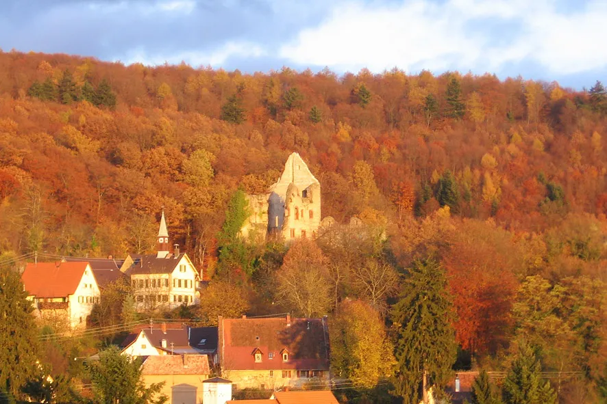
Burg Landeck Katrin Schubert Schlosszottel · CC BY-SA 3.0

Climate of Kenzingen
Best months for sightseeingBest months for sightseeing: May–September.
This month · November
A cold month
Day 9° · Night 3° · Rain 81 mm
- Hottest month
- July (day 25°)
- Coldest month
- January (night -1°)
- Wettest month
- June (98 mm)
- Driest month
- March (63 mm)
Bars: average monthly low and high temperature. Below: precipitation. Monthly averages for 1970–2000 at about 18 km resolution, adjusted for elevation. Highlighted months are mild and relatively dry. Source: WorldClim 2.1 (CC BY 4.0).
Show values as a table
| Month | Jan | Feb | Mar | Apr | May | Jun | Jul | Aug | Sep | Oct | Nov | Dec |
|---|---|---|---|---|---|---|---|---|---|---|---|---|
| Average high (°C) | 5° | 6° | 11° | 15° | 20° | 22° | 25° | 25° | 20° | 15° | 9° | 6° |
| Average low (°C) | -1° | 0° | 2° | 5° | 9° | 12° | 14° | 14° | 10° | 7° | 3° | 0° |
| Precipitation (mm) | 65 | 65 | 63 | 66 | 97 | 98 | 89 | 75 | 77 | 78 | 81 | 83 |
Other places to visit in this season: May June July August September
How to get to Kenzingen
The nearest airport is Strasbourg Airport (SXB), 39 km to the north as the crow flies. The nearest large city is Freiburg im Breisgau, 24 km to the south.
Airports
- Strasbourg Airport (SXB) Strasbourg 39 kmnorth
- Karlsruhe Baden-Baden Airport (FKB) Rheinmünster 68 kmnorth
- EuroAirport Basel–Mulhouse–Freiburg (BSL) Bâle / Mulhouse 69 kmsouth
Nearby large cities
- Freiburg im Breisgau Population: 237.5K 24 kmsouth
- Strasbourg Population: 274.8K 43 kmnorth
- Mulhouse Population: 111.4K 60 kmsouthwest
- Basel Population: 177.6K 73 kmsouth
- Karlsruhe Population: 283.8K 102 kmnortheast
Straight-line distances; road distances are longer. Airport data: OurAirports.
Day trips from Kenzingen
Within 100 km: 552 historic and cultural sites, 2,419 natural sites, 557 lakes, rivers and coasts.
0–25 km192 places
- Matschelsee Lake 23 kmN
- Tunisee Lake 15 kmS
- Vögelestein Mountain 18 kmSE
- Schillinger Berg Mountain 15 kmE
25–60 km1,173 places
- Unditz River 27 kmN
- Rench River 56 kmN
- Titisee Lake 44 kmSE
- Schluchsee Lake 52 kmSE
60–100 km2,163 places
- Büselweier Lake 90 kmS
- Etangs Rougeat Lake 94 kmSW
- Mettmenhaslisee Lake 97 kmSE
- Basler Weiher Lake 86 kmS
Straight-line distances.
Places in Kenzingen
10 placesBar: population relative to the most populous place in this list.
Cities & villages5
- Bombach · Village
- Hecklingen · Village
- Kirnhalden · Village
- Nordweil · Village
- Wonnental · Village
Mountains & nature3
- Auberg · Mountain
- Künzlisberg · Mountain
- Rollberg · Mountain
Heritage & sights1
- Ruine Lichteneck · Historic site
Nearby attractions & nature
Everything nearby-
Dorfbach River, Baden-Wurttemberg0.8 km S
-
Forlenwald Natural site, Baden-Wurttemberg3.1 km SE
-
Kahlenberg Mountain, Ringsheim4.4 km NE
-
Fernecker Tal Natural site, Baden-Wurttemberg4.7 km SE
-
Bleichbach River, Baden-Wurttemberg3.8 km NW
-
St. Michaelsberg Mountain, Riegel am Kaiserstuhl6.3 km S
Sources & licences
Data last updated: