- Elevation
- 180 m
- above sea level
- Local time
- UTC+01:00
- Europe/Berlin · UTC+01:00
- Airports
- STR Stuttgart Airport52 km
- MHG Mannheim-City Airport58 km
About Hipfelhof
Hipfelhof is a village. Location: Heilbronn, Stadtkreis Heilbronn. Elevation: 180 m. The best months to visit are May–September. The nearest airport is Stuttgart Airport (52 km). Nearby sights include Rosenbuckel and Hüttberg.
Photos of Hipfelhof
-
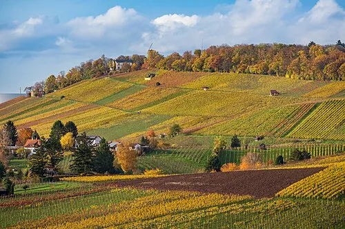
Wartberg Roman Eisele · CC BY-SA 4.0 -
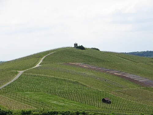
Staufenberg User:Rosenzweig · CC BY-SA 3.0 -
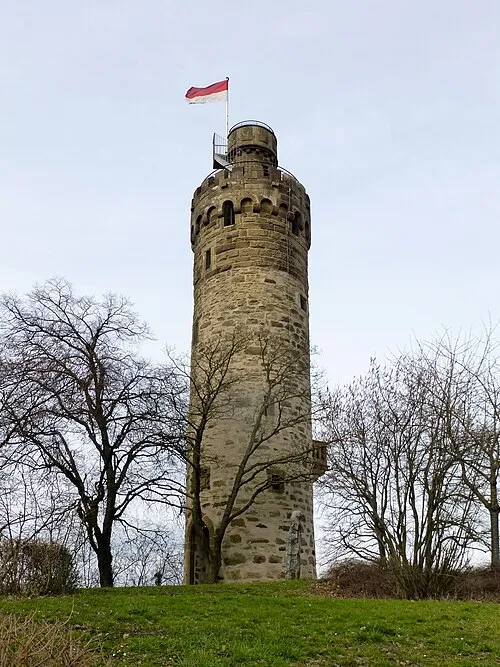
Heuchelberger Warte Muck · CC BY-SA 4.0 -
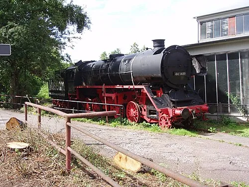
South German Railway Museum Xocolatl 18:34, 2 July 2007 · Public domain


Climate of Hipfelhof
Best months for sightseeingBest months for sightseeing: May–September.
This month · November
A cold month
Day 8° · Night 2° · Rain 65 mm
- Hottest month
- July (day 25°)
- Coldest month
- January (night -1°)
- Wettest month
- June (83 mm)
- Driest month
- April (51 mm)
Bars: average monthly low and high temperature. Below: precipitation. Monthly averages for 1970–2000 at about 18 km resolution, adjusted for elevation. Highlighted months are mild and relatively dry. Source: WorldClim 2.1 (CC BY 4.0).
Show values as a table
| Month | Jan | Feb | Mar | Apr | May | Jun | Jul | Aug | Sep | Oct | Nov | Dec |
|---|---|---|---|---|---|---|---|---|---|---|---|---|
| Average high (°C) | 4° | 6° | 11° | 15° | 20° | 22° | 25° | 24° | 20° | 14° | 8° | 5° |
| Average low (°C) | -1° | -1° | 2° | 4° | 9° | 12° | 14° | 13° | 10° | 6° | 2° | 0° |
| Precipitation (mm) | 54 | 53 | 54 | 51 | 81 | 83 | 75 | 60 | 61 | 64 | 65 | 68 |
Other places to visit in this season: May June July August September
How to get to Hipfelhof
The nearest airport is Stuttgart Airport (STR), 52 km to the south as the crow flies. The nearest large city is Heilbronn, 6 km to the east.
Airports
- Stuttgart Airport (STR) Stuttgart 52 kmsouth
- Mannheim-City Airport (MHG) Mannheim 58 kmnorthwest
- Karlsruhe Baden-Baden Airport (FKB) Rheinmünster 89 kmsouthwest
Nearby large cities
- Heilbronn Population: 120.7K 6 kmeast
- Stuttgart Population: 612.7K 42 kmsouth
- Heidelberg Population: 143.3K 43 kmnorthwest
- Pforzheim Population: 119.3K 45 kmsouthwest
- Karlsruhe Population: 283.8K 57 kmwest
Straight-line distances; road distances are longer. Airport data: OurAirports.
Day trips from Hipfelhof
Within 100 km: 1,193 historic and cultural sites, 3,913 natural sites, 861 lakes, rivers and coasts.
0–25 km385 places
- Annasee Lake 17 kmSE
- Zigeunerstock Mountain 11 kmNE
- Wunnenstein Mountain 17 kmSE
- Wolfsberg Mountain 16 kmSE
25–60 km1,920 places
- Hessental Concentration Camp Historic site 46 kmE
- Elsenz River 37 kmNW
- Lauter River 56 kmS
- Insel Flotzgrün Island 53 kmW
60–100 km3,662 places
- Umpfer River 60 kmNE
- Uzbach River 86 kmNE
- Modau River 88 kmNW
- Lauter River 99 kmSE
Straight-line distances.
Nearby attractions & nature
Everything nearby-
Rosenbuckel Mountain, Heilbronn0.9 km N
-
Hüttberg Mountain, Heilbronn1.8 km SE
-
Hammelsberg Mountain, Heilbronn2.9 km N
-
Böllingerturm Landmark, Heilbronn2.5 km N
-
South German Railway Museum Museum, Heilbronn4 km SE
-
Rotbach River, Baden-Wurttemberg1.7 km NE
Other cities and towns in Heilbronn
-
 Biberach Village, Heilbronn3.8 km N
-
 Klingenberg Village, Heilbronn4.4 km S
-
Kirchhausen Village, Heilbronn3.8 km NW
-
Neckargartach Neighbourhood, Heilbronn4.1 km E
-
Böckingen Neighbourhood, Heilbronn4.2 km SE
-
 Sontheim Village, Heilbronn5.6 km SE
Sources & licences
Data last updated: