Landkreis Ravensburg
Located in Tübingen Region, Baden-Wurttemberg Coordinates: 47°49′45″ N 9°47′43″ E
- Population
- 291,102
- 291.1K
- Elevation
- 698 m
- above sea level
- Local time
- UTC+01:00
- Europe/Berlin · UTC+01:00
- Places inside
- 39
- listed under Landkreis Ravensburg
- Airports
- FDH Bodensee Airport Friedrichshafen28 km
- FMM Memmingen Allgau Airport38 km
About Landkreis Ravensburg
Landkreis Ravensburg is a municipality. Location: Tübingen Region, Baden-Wurttemberg. Population: 291,102. Elevation: 698 m. The best months to visit are June–September. The nearest airport is Bodensee Airport Friedrichshafen (28 km). Nearby sights include Stockweiher and Weberholz.
Photos of Landkreis Ravensburg
-
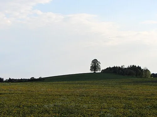
Wachbühl Bene16 · CC BY-SA 3.0 -
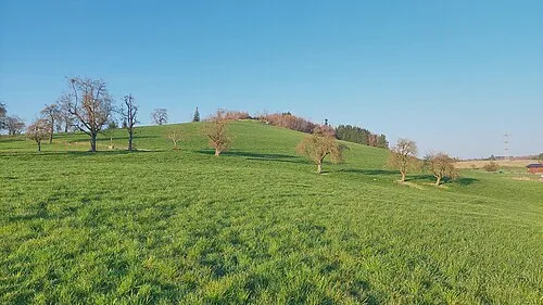
Hochberg Harald Hetzner · CC0


Climate of Landkreis Ravensburg
Best months for sightseeingBest months for sightseeing: June–September.
This month · November
A cold month
Day 6° · Night 0° · Rain 98 mm
- Hottest month
- July (day 22°)
- Coldest month
- January (night -4°)
- Wettest month
- June (148 mm)
- Driest month
- January (68 mm)
Bars: average monthly low and high temperature. Below: precipitation. Monthly averages for 1970–2000 at about 18 km resolution, adjusted for elevation. Highlighted months are mild and relatively dry. Source: WorldClim 2.1 (CC BY 4.0).
Show values as a table
| Month | Jan | Feb | Mar | Apr | May | Jun | Jul | Aug | Sep | Oct | Nov | Dec |
|---|---|---|---|---|---|---|---|---|---|---|---|---|
| Average high (°C) | 1° | 3° | 7° | 11° | 17° | 19° | 22° | 21° | 17° | 12° | 6° | 3° |
| Average low (°C) | -4° | -4° | -1° | 2° | 7° | 10° | 12° | 12° | 8° | 4° | 0° | -3° |
| Precipitation (mm) | 68 | 71 | 76 | 97 | 122 | 148 | 144 | 132 | 105 | 84 | 98 | 84 |
Other places to visit in this season: June July August September
How to get to Landkreis Ravensburg
The nearest airport is Bodensee Airport Friedrichshafen (FDH), 28 km to the southwest as the crow flies. The nearest large city is Ulm, 65 km to the north.
Airports
- Bodensee Airport Friedrichshafen (FDH) Friedrichshafen 28 kmsouthwest
- Memmingen Allgau Airport (FMM) Memmingen 38 kmnortheast
- Sankt Gallen Altenrhein Airport (ACH) St. Gallen 42 kmsouthwest
Nearby large cities
- Ulm Population: 120.5K 65 kmnorth
- Reutlingen Population: 112.6K 86 kmnorthwest
- Winterthur Population: 111.8K 88 kmsouthwest
- Augsburg Population: 301.1K 102 kmnortheast
- Zurich Population: 415.4K 107 kmsouthwest
Straight-line distances; road distances are longer. Airport data: OurAirports.
Day trips from Landkreis Ravensburg
Within 100 km: 588 historic and cultural sites, 4,485 natural sites, 1,160 lakes, rivers and coasts.
0–25 km279 places
- Obersee Lake 7 kmSE
- Zeller See Lake 22 kmNW
- Zellersee Lake 8 kmSE
- Wuhrmühleweiher Lake 11 kmSE
25–60 km1,435 places
- Mainau Island 47 kmW
- Dominikanerinsel Konstanz Island 50 kmW
- Weiher Diepoldsau Lake 50 kmS
- Uttwiler Weiher Lake 44 kmSW
60–100 km4,519 places
- Strandbad Steckborn Beach 65 kmW
- Insel Werd Island 72 kmW
- Walensee Lake 91 kmSW
- Pfäffikersee Lake 93 kmSW
Straight-line distances.
Landkreis Ravensburg and similar cities
Side by side with cities of similar size in the same country: population, elevation and climate.
| Measure | Landkreis Ravensburg | Wiesbaden | Karlsruhe | Augsburg |
|---|---|---|---|---|
| Population | 291.1K | 288.8K | 283.8K | 301.1K |
| Elevation | 698 m | 147 m | 118 m | 489 m |
| Summer day (hottest month) | 22° | 24° | 25° | 23° |
| Winter night (coldest month) | -4° | -1° | -1° | -4° |
| Annual rainfall | 1,229 mm | 653 mm | 765 mm | 852 mm |
| Best months | Jun–Sep | May–Sep | May–Sep | Jun–Aug |
| Distance | — | 275 km | 167 km | 102 km |
Climate values are 1970–2000 monthly averages; straight-line distance.
Places in Landkreis Ravensburg
39 places- 1 Ravensburg 50.6K
- 2 Wangen im Allgäu 28.4K
- 3 Weingarten 24.9K
- 4 Leutkirch im Allgäu 24.2K
- 5 Bad Waldsee 20.8K
- 6 Isny im Allgäu 15.1K
- 7 Bad Wurzach 14.9K
- 8 Aulendorf 10.4K
- 9 Kißlegg 9.5K
- 10 Baienfurt 7.4K
- 11 Argenbühl 6.7K
- 12 Horgenzell 5.4K
- 13 Baindt 5.3K
- 14 Fronreute 5K
- 15 Wilhelmsdorf 4.8K
- 16 Vogt 4.7K
- 17 Berg 4.4K
- 18 Amtzell 4.2K
- 19 Wolpertswende 4.1K
- 20 Schlier 4.1K
- 21 Altshausen 4K
- 22 Wolfegg 3.9K
- 23 Waldburg 3.3K
- 24 Bodnegg 3.2K
- 25 Bergatreute 3.2K
- 26 Grünkraut 3.1K
- 27 Aitrach 3K
- 28 Aichstetten 2.9K
- 29 Achberg 1.7K
- 30 Ebersbach-Musbach 1.7K
- 31 Ebenweiler 1.4K
- 32 Riedhausen 838
- 33 Hoßkirch 736
- 34 Boms 717
- 35 Königseggwald 681
- 36 Fleischwangen 651
- 37 Eichstegen 533
- 38 Unterwaldhausen 279
- 39 Guggenhausen 193
Bar: population relative to the most populous place in this list.
Nearby attractions & nature
Everything nearby-
Stockweiher Lake, Baden-Wurttemberg2.9 km E
-
Weberholz Natural site, Baden-Wurttemberg3.5 km N
-
Holzmühleweiher Lake, Baden-Wurttemberg4.7 km E
-
Heißer Forst Natural site, Baden-Wurttemberg5.7 km SW
-
Erbisreuter Forst Natural site, Baden-Wurttemberg5.9 km W
-
Baienfurter Forst Natural site, Baden-Wurttemberg6.3 km W
-
Rohrsee Lake, Baden-Wurttemberg5.9 km NE
-
Bergatreuter Forst Natural site, Baden-Wurttemberg6.7 km W
Sources & licences
Data last updated: