Landkreis Biberach
Located in Tübingen Region, Baden-Wurttemberg Coordinates: 48°06′14″ N 9°46′14″ E
- Population
- 207,415
- 207.4K
- Elevation
- 581 m
- above sea level
- Local time
- UTC+01:00
- Europe/Berlin · UTC+01:00
- Places inside
- 45
- listed under Landkreis Biberach
- Airports
- FMM Memmingen Allgau Airport37 km
- FDH Bodensee Airport Friedrichshafen52 km
About Landkreis Biberach
Landkreis Biberach is a municipality. Location: Tübingen Region, Baden-Wurttemberg. Population: 207,415. Elevation: 581 m. The best months to visit are June–September. The nearest airport is Memmingen Allgau Airport (37 km). Nearby sights include Schwarzenbach and Wolfental.
Climate of Landkreis Biberach
Best months for sightseeingBest months for sightseeing: June–September.
This month · November
A cold month
Day 6° · Night 0° · Rain 66 mm
- Hottest month
- July (day 22°)
- Coldest month
- January (night -4°)
- Wettest month
- June (112 mm)
- Driest month
- January (46 mm)
Bars: average monthly low and high temperature. Below: precipitation. Monthly averages for 1970–2000 at about 18 km resolution, adjusted for elevation. Highlighted months are mild and relatively dry. Source: WorldClim 2.1 (CC BY 4.0).
Show values as a table
| Month | Jan | Feb | Mar | Apr | May | Jun | Jul | Aug | Sep | Oct | Nov | Dec |
|---|---|---|---|---|---|---|---|---|---|---|---|---|
| Average high (°C) | 2° | 3° | 8° | 12° | 17° | 20° | 22° | 22° | 18° | 12° | 6° | 3° |
| Average low (°C) | -4° | -4° | 0° | 2° | 7° | 10° | 12° | 12° | 8° | 5° | 0° | -2° |
| Precipitation (mm) | 46 | 48 | 51 | 68 | 93 | 112 | 108 | 97 | 76 | 63 | 66 | 56 |
Other places to visit in this season: June July August September
How to get to Landkreis Biberach
The nearest airport is Memmingen Allgau Airport (FMM), 37 km to the east as the crow flies. The nearest large city is Ulm, 37 km to the northeast.
Airports
- Memmingen Allgau Airport (FMM) Memmingen 37 kmeast
- Bodensee Airport Friedrichshafen (FDH) Friedrichshafen 52 kmsouth
- Sankt Gallen Altenrhein Airport (ACH) St. Gallen 71 kmsouth
Nearby large cities
- Ulm Population: 120.5K 37 kmnortheast
- Reutlingen Population: 112.6K 60 kmnorthwest
- Stuttgart Population: 612.7K 87 kmnorthwest
- Augsburg Population: 301.1K 89 kmeast
- Winterthur Population: 111.8K 103 kmsouthwest
Straight-line distances; road distances are longer. Airport data: OurAirports.
Day trips from Landkreis Biberach
Within 100 km: 881 historic and cultural sites, 3,776 natural sites, 1,119 lakes, rivers and coasts.
0–25 km209 places
- Zeller See Lake 15 kmSW
- Steeger See Lake 19 kmSW
- Stadtsee Lake 20 kmS
- Schwaigfurter Weiher Lake 16 kmSW
25–60 km1,654 places
- Eckbühel Mountain 57 kmS
- Rickenbach River 56 kmS
- Rickenbach River 57 kmS
- Gwiggerbach River 58 kmS
60–100 km3,913 places
- Mainau Island 62 kmSW
- Dominikanerinsel Konstanz Island 66 kmSW
- Strandbad Steckborn Beach 78 kmSW
- Insel Werd Island 84 kmSW
Straight-line distances.
Landkreis Biberach and similar cities
Side by side with cities of similar size in the same country: population, elevation and climate.
| Measure | Landkreis Biberach | Lübeck | Hagen | Rostock |
|---|---|---|---|---|
| Population | 207.4K | 212.2K | 199K | 198.3K |
| Elevation | 581 m | 16 m | 111 m | 18 m |
| Summer day (hottest month) | 22° | 22° | 23° | 22° |
| Winter night (coldest month) | -4° | -2° | -1° | -2° |
| Annual rainfall | 884 mm | 674 mm | 980 mm | 596 mm |
| Best months | Jun–Sep | Jun–Aug | Jun–Aug | Jun–Aug |
| Distance | — | 645 km | 398 km | 686 km |
Climate values are 1970–2000 monthly averages; straight-line distance.
Places in Landkreis Biberach
45 places- 1 Biberach an der Riß 34.6K
- 2 Laupheim 22.8K
- 3 Riedlingen 11.2K
- 4 Ochsenhausen 9.4K
- 5 Bad Schussenried 9K
- 6 Schemmerhofen 8.8K
- 7 Schwendi 7.1K
- 8 Ertingen 5.4K
- 9 Warthausen 5.3K
- 10 Achstetten 5.1K
- 11 Mietingen 4.7K
- 12 Maselheim 4.7K
- 13 Bad Buchau 4.7K
- 14 Eberhardzell 4.6K
- 15 Rot an der Rot 4.5K
- 16 Ummendorf 4.5K
- 17 Mittelbiberach 4.4K
- 18 Burgrieden 4.3K
- 19 Kirchdorf an der Iller 4K
- 20 Uttenweiler 3.8K
- 21 Langenenslingen 3.6K
- 22 Erolzheim 3.4K
- 23 Berkheim 3.3K
- 24 Ingoldingen 3.2K
- 25 Dettingen an der Iller 2.8K
- 26 Dürmentingen 2.7K
- 27 Tannheim 2.5K
- 28 Unlingen 2.4K
- 29 Hochdorf 2.4K
- 30 Kirchberg an der Iller 2.2K
- 31 Steinhausen an der Rottum 2.2K
- 32 Altheim 2.2K
- 33 Attenweiler 1.9K
- 34 Gutenzell-Hürbel 1.8K
- 35 Erlenmoos 1.8K
- 36 Wain 1.7K
- 37 Oggelshausen 902
- 38 Betzenweiler 747
- 39 Tiefenbach 546
- 40 Alleshausen 531
- 41 Kanzach 508
- 42 Dürnau 487
- 43 Allmannsweiler 317
- 44 Seekirch 289
- 45 Moosburg 231
Bar: population relative to the most populous place in this list.
Nearby attractions & nature
Everything nearby-
Schwarzenbach River, Baden-Wurttemberg1 km SE
-
Wolfental Natural site, Baden-Wurttemberg2.3 km S
-
Rotbach River, Baden-Wurttemberg1.9 km E
-
Hahnengehau Natural site, Baden-Wurttemberg4 km W
-
Boschach Wald Natural site, Baden-Wurttemberg4.9 km E
-
Forstwald Natural site, Baden-Wurttemberg5 km SW
-
Umlach River, Baden-Wurttemberg4.6 km SE
-
Mühlbach River, Baden-Wurttemberg4.6 km SW
Other cities and towns in Tübingen Region
-
Biberach an der Riss Town, Biberach an der Riß1.9 km SE
-
Landkreis Ravensburg Municipality, Tübingen Region31 km S
-
Alb-Donau-Kreis Municipality, Tübingen Region35 km N
-
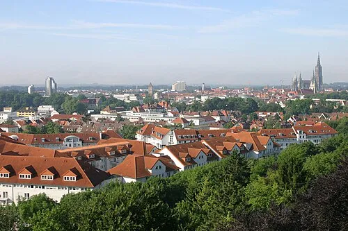 Ulm City, Ulm, Universitätsstadt37 km NE
-
Ochsenhausen Town, Ochsenhausen14 km E
-
Bad Schussenried Town, Bad Schussenried14 km SW
Sources & licences
Data last updated: