Kalksbuch
Located in Landkreis Reutlingen, Tübingen Region Coordinates: 48°27′23″ N 9°31′41″ E
- Elevation
- 866 m
- above sea level
- Local time
- UTC+01:00
- Europe/Berlin · UTC+01:00
- Airports
- STR Stuttgart Airport34 km
- FMM Memmingen Allgau Airport74 km
About Kalksbuch
Kalksbuch is a mountain. Location: Landkreis Reutlingen, Tübingen Region. Elevation: 866 m. The best months to visit are June–September. The nearest airport is Stuttgart Airport (34 km). Nearby sights include Hursch and Oberes Böttental.
Photos of Kalksbuch
-
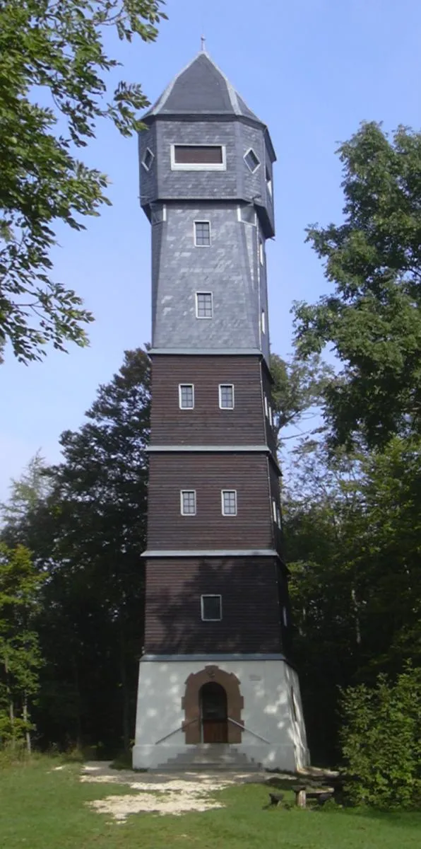
Römerstein Ssch · CC BY-SA 3.0 -
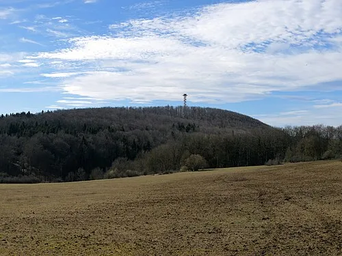
Hursch Jörg Braukmann · CC BY-SA 4.0


Climate of Kalksbuch
Best months for sightseeingBest months for sightseeing: June–September.
This month · November
A cold month
Day 5° · Night -2° · Rain 77 mm
- Hottest month
- August (day 20°)
- Coldest month
- January (night -6°)
- Wettest month
- June (119 mm)
- Driest month
- February (63 mm)
Bars: average monthly low and high temperature. Below: precipitation. Monthly averages for 1970–2000 at about 18 km resolution, adjusted for elevation. Highlighted months are mild and relatively dry. Source: WorldClim 2.1 (CC BY 4.0).
Show values as a table
| Month | Jan | Feb | Mar | Apr | May | Jun | Jul | Aug | Sep | Oct | Nov | Dec |
|---|---|---|---|---|---|---|---|---|---|---|---|---|
| Average high (°C) | 0° | 1° | 6° | 10° | 15° | 17° | 20° | 20° | 16° | 10° | 5° | 1° |
| Average low (°C) | -6° | -5° | -2° | 1° | 5° | 8° | 10° | 10° | 7° | 3° | -2° | -4° |
| Precipitation (mm) | 66 | 63 | 71 | 77 | 100 | 119 | 106 | 97 | 73 | 71 | 77 | 76 |
Other places to visit in this season: June July August September
How to get to Kalksbuch
The nearest airport is Stuttgart Airport (STR), 34 km to the northwest as the crow flies. The nearest large city is Reutlingen, 24 km to the west.
Airports
- Stuttgart Airport (STR) Stuttgart 34 kmnorthwest
- Memmingen Allgau Airport (FMM) Memmingen 74 kmsoutheast
- Bodensee Airport Friedrichshafen (FDH) Friedrichshafen 87 kmsouth
Nearby large cities
- Reutlingen Population: 112.6K 24 kmwest
- Ulm Population: 120.5K 35 kmeast
- Stuttgart Population: 612.7K 45 kmnorthwest
- Pforzheim Population: 119.3K 77 kmnorthwest
- Heilbronn Population: 120.7K 79 kmnorth
Straight-line distances; road distances are longer. Airport data: OurAirports.
Day trips from Kalksbuch
Within 100 km: 851 historic and cultural sites, 3,651 natural sites, 869 lakes, rivers and coasts.
0–25 km471 places
- Blautopf Lake 19 kmE
- Zwiefalter Alb Mountain 22 kmSW
- Ziegelberg Mountain 24 kmSW
- Schneiderhau Mountain 15 kmW
25–60 km1,851 places
- Lauter River 28 kmNW
- Lauter River 28 kmE
- Zeller See Lake 52 kmS
- Steeger See Lake 56 kmS
60–100 km3,049 places
- Hessental Concentration Camp Historic site 74 kmN
- Mainau Island 87 kmS
- Dominikanerinsel Konstanz Island 92 kmS
- Strandbad Steckborn Beach 98 kmSW
Straight-line distances.
Nearest towns and villages
-
Römerstein Village, Landkreis Reutlingen4.7 km N
-
Münsingen Village, Landkreis Reutlingen5.5 km SW
-
 Gruorn Village, Landkreis Reutlingen2 km SW
-
Altes Lager Town, Münsingen4.4 km S
-
Münsingen Town, Münsingen5.5 km SW
-
Egelstein Village, Landkreis Reutlingen4 km S
Nearby attractions & nature
Everything nearby-
Hursch Mountain, Baden-Wurttemberg1.6 km N
-
Oberes Böttental Natural site, Baden-Wurttemberg0.8 km SE
-
Mönchberg Mountain, Baden-Wurttemberg1.8 km SE
-
Gramelauh Mountain, Baden-Wurttemberg2 km NE
-
Dietenbühl Mountain, Landkreis Reutlingen3 km W
-
Gänsewag Mountain, Landkreis Reutlingen2.9 km S
-
Mönchberg Mountain, Römerstein3.6 km NW
-
Hergenbuch Natural site, Baden-Wurttemberg2.9 km E
More nature in Germany
-
Römerstein Mountain, Römerstein6.1 km N
-
Hartenberg Mountain, Römerstein4.2 km N
-
Hauwäldle Mountain, Römerstein4.4 km N
-
Hohloch Mountain, Münsingen4.7 km S
-
Kriegsberg Mountain, Römerstein4.9 km N
-
Burgberg Mountain, Münsingen5.2 km SW
Sources & licences
Data last updated: · 2 independent sources