- Elevation
- 466 m
- above sea level
- Local time
- UTC+01:00
- Europe/Berlin · UTC+01:00
- Airports
- NUE Nuremberg Airport72 km
- STR Stuttgart Airport98 km
About Schopflohe
Schopflohe is a village. Location: Fremdingen, Landkreis Donau-Ries. Elevation: 466 m. The best months to visit are June–September. The nearest airport is Nuremberg Airport (72 km). Nearby sights include Öttinger Forst and Aidelsberg.
Climate of Schopflohe
Best months for sightseeingBest months for sightseeing: June–September.
This month · November
A cold month
Day 6° · Night 0° · Rain 61 mm
- Hottest month
- August (day 23°)
- Coldest month
- January (night -4°)
- Wettest month
- June (88 mm)
- Driest month
- February (53 mm)
Bars: average monthly low and high temperature. Below: precipitation. Monthly averages for 1970–2000 at about 18 km resolution, adjusted for elevation. Highlighted months are mild and relatively dry. Source: WorldClim 2.1 (CC BY 4.0).
Show values as a table
| Month | Jan | Feb | Mar | Apr | May | Jun | Jul | Aug | Sep | Oct | Nov | Dec |
|---|---|---|---|---|---|---|---|---|---|---|---|---|
| Average high (°C) | 2° | 4° | 8° | 13° | 18° | 21° | 23° | 23° | 19° | 13° | 6° | 3° |
| Average low (°C) | -4° | -3° | 0° | 3° | 7° | 10° | 12° | 12° | 8° | 4° | 0° | -2° |
| Precipitation (mm) | 55 | 53 | 54 | 56 | 74 | 88 | 82 | 70 | 57 | 63 | 61 | 67 |
Other places to visit in this season: June July August September
How to get to Schopflohe
The nearest airport is Nuremberg Airport (NUE), 72 km to the northeast as the crow flies. The nearest large city is Fürth, 66 km to the northeast.
Airports
- Nuremberg Airport (NUE) Nuremberg 72 kmnortheast
- Stuttgart Airport (STR) Stuttgart 98 kmwest
- Memmingen Allgau Airport (FMM) Memmingen 112 kmsouth
Nearby large cities
- Fürth Population: 132K 66 kmnortheast
- Nuremberg Population: 515.5K 68 kmnortheast
- Ingolstadt Population: 120.7K 73 kmeast
- Ulm Population: 120.5K 74 kmsouthwest
- Augsburg Population: 301.1K 74 kmsoutheast
Straight-line distances; road distances are longer. Airport data: OurAirports.
Day trips from Schopflohe
Within 100 km: 1,316 historic and cultural sites, 2,901 natural sites, 671 lakes, rivers and coasts.
0–25 km203 places
- Kreutweiher Lake 16 kmNE
- Klarweiher Lake 15 kmNE
- Altmühlsee Lake 25 kmNE
- Hahnenkammsee Lake 18 kmE
25–60 km1,069 places
- Hessental Concentration Camp Historic site 54 kmW
- Zusam River 37 kmSE
- Igelsbachsee Lake 36 kmNE
- Großer Lindleinsee Lake 51 kmNW
60–100 km3,616 places
- Spitzelberg Mountain 96 kmNE
- Stollenberg Mountain 93 kmNE
- Deckersberg Mountain 91 kmNE
- Umpfer River 83 kmNW
Straight-line distances.
Nearby attractions & nature
Everything nearby-
Öttinger Forst Natural site, Bavaria4 km NE
-
Aidelsberg Mountain, Wilburgstetten4.9 km W
-
Maihingen, ehemals Klosterkirche Maria Immaculata Attraction, Maihingen5.7 km S
-
Weiltinger Forst Natural site, Bavaria6.2 km NW
-
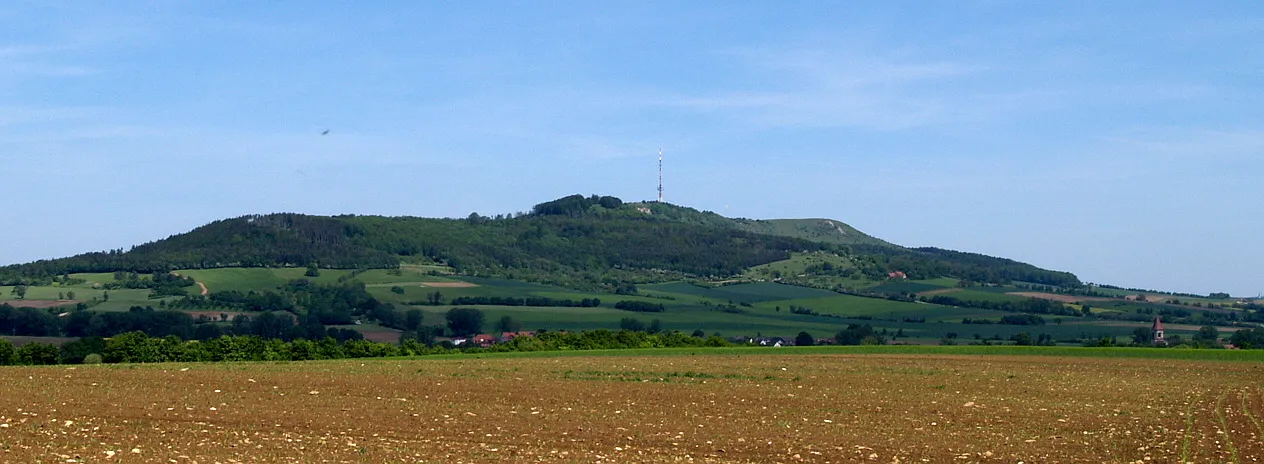 Hesselberg Mountain, Ehingen10 km N
-
Kastell Ruffenhofen Historic site, Wittelshofen7.5 km N
Sources & licences
Data last updated: