Ingolstadt
Located in Kreisfreie Stadt Ingolstadt, Upper Bavaria Coordinates: 48°46′00″ N 11°24′53″ E
- Population
- 141,185
- 141.2K
- Elevation
- 376 m
- above sea level
- Local time
- UTC+01:00
- Europe/Berlin · UTC+01:00
- Places inside
- 51
- listed under Ingolstadt
- Airports
- MUC Munich Airport53 km
- NUE Nuremberg Airport85 km
About Ingolstadt
Ingolstadt is a village. Location: Kreisfreie Stadt Ingolstadt, Upper Bavaria. Population: 141,185. Elevation: 376 m. The best months to visit are May–September. The nearest airport is Munich Airport (53 km). Nearby sights include Schutter and Augraben.
Photos of Ingolstadt
-
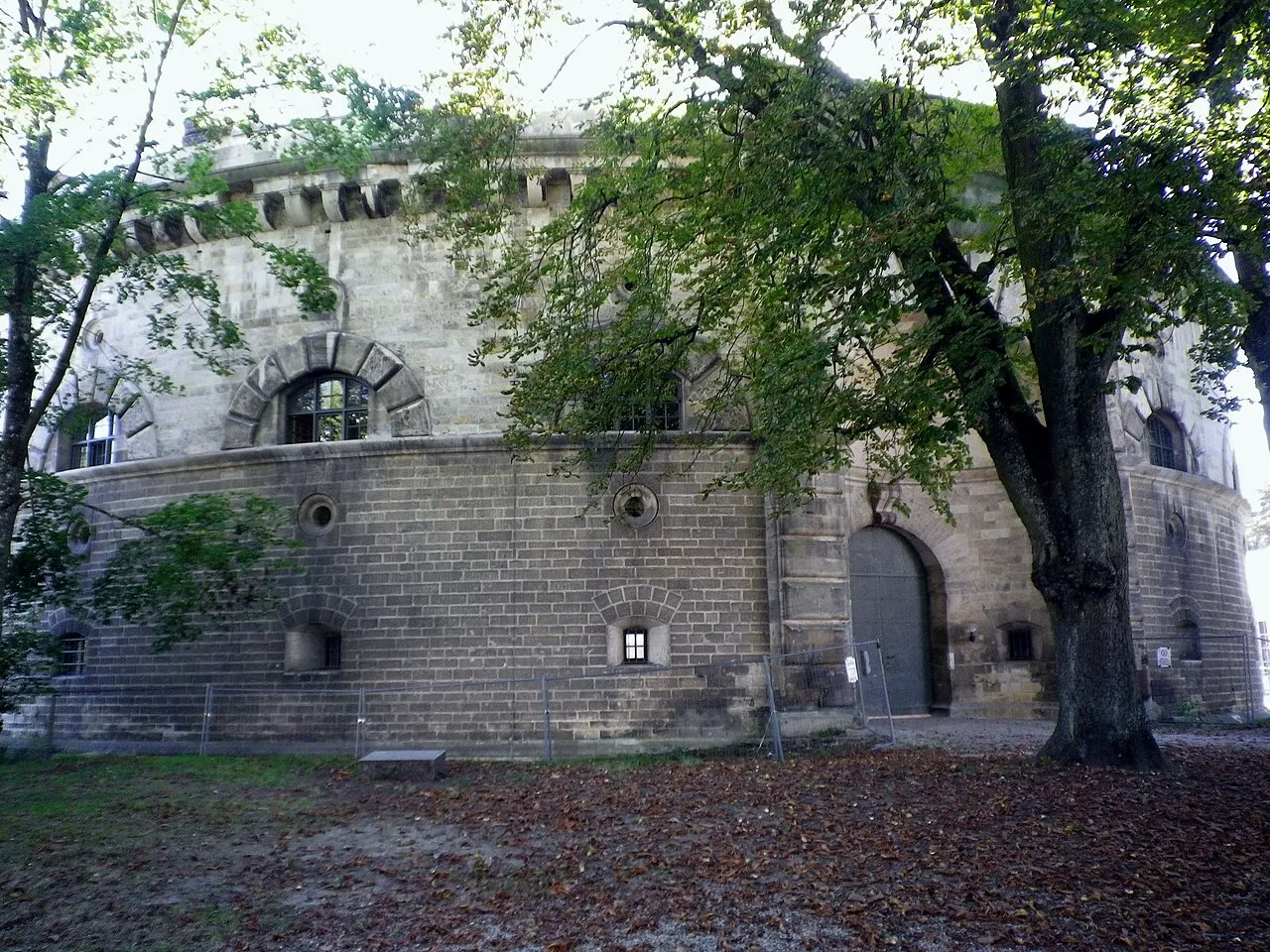
Baur Redoubt Chrisi1964 · CC BY-SA 4.0 -
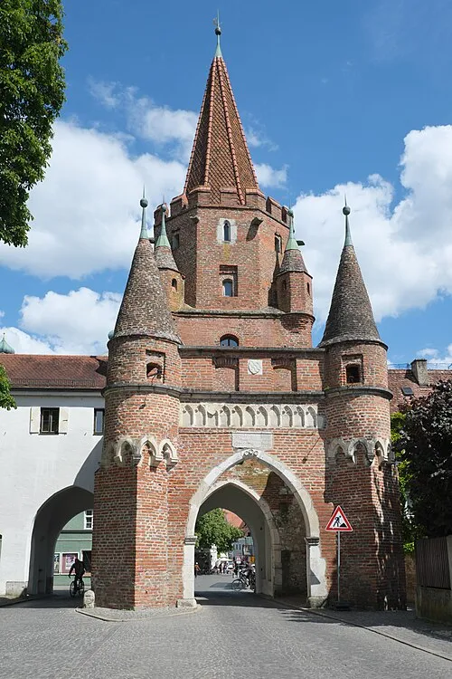
Cross Gate GFreihalter · CC BY-SA 4.0 -
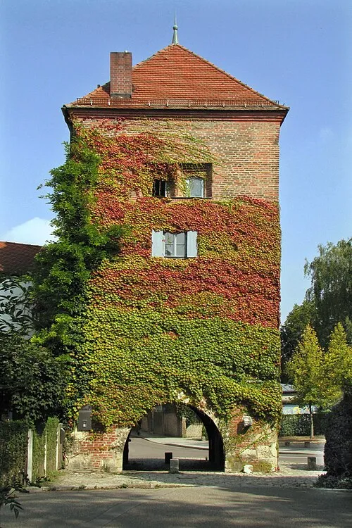
Mynzberg Gate Mura40 · CC BY-SA 4.0 -
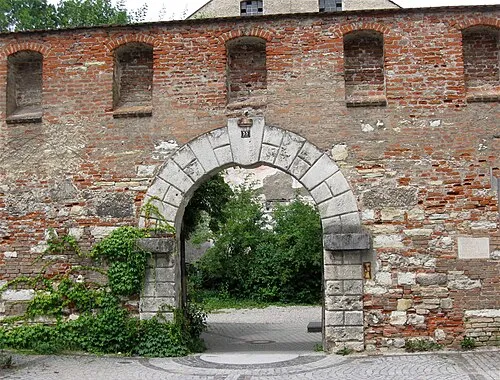
Hard Bastion Rufus46 · CC BY-SA 3.0 -
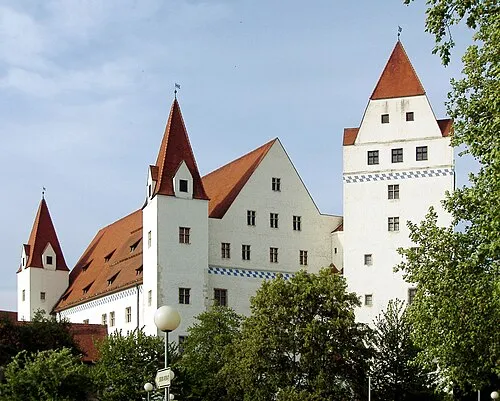
New Castle Christian Karl · CC BY-SA 3.0


Climate of Ingolstadt
Best months for sightseeingBest months for sightseeing: May–September.
This month · November
A cold month
Day 6° · Night 0° · Rain 57 mm
- Hottest month
- July (day 24°)
- Coldest month
- January (night -4°)
- Wettest month
- July (89 mm)
- Driest month
- February (43 mm)
Bars: average monthly low and high temperature. Below: precipitation. Monthly averages for 1970–2000 at about 18 km resolution, adjusted for elevation. Highlighted months are mild and relatively dry. Source: WorldClim 2.1 (CC BY 4.0).
Show values as a table
| Month | Jan | Feb | Mar | Apr | May | Jun | Jul | Aug | Sep | Oct | Nov | Dec |
|---|---|---|---|---|---|---|---|---|---|---|---|---|
| Average high (°C) | 2° | 4° | 9° | 13° | 19° | 22° | 24° | 24° | 19° | 13° | 6° | 3° |
| Average low (°C) | -4° | -4° | 0° | 3° | 8° | 11° | 13° | 12° | 8° | 4° | 0° | -2° |
| Precipitation (mm) | 47 | 43 | 45 | 52 | 70 | 87 | 89 | 77 | 60 | 59 | 57 | 57 |
Other places to visit in this season: May June July August September
How to get to Ingolstadt
The nearest airport is Munich Airport (MUC), 53 km to the southeast as the crow flies. The nearest large city is Ingolstadt, 1 km to the east.
Airports
- Munich Airport (MUC) Munich 53 kmsoutheast
- Nuremberg Airport (NUE) Nuremberg 85 kmnorth
- Memmingen Allgau Airport (FMM) Memmingen 123 kmsouthwest
Nearby large cities
- Ingolstadt Population: 120.7K 1 kmeast
- Regensburg Population: 151.4K 57 kmnortheast
- Augsburg Population: 301.1K 58 kmsouthwest
- Munich Population: 1.5M 71 kmsouth
- Nuremberg Population: 515.5K 80 kmnorth
Straight-line distances; road distances are longer. Airport data: OurAirports.
Day trips from Ingolstadt
Within 100 km: 855 historic and cultural sites, 1,951 natural sites, 441 lakes, rivers and coasts.
0–25 km132 places
- Unterweiher Lake 18 kmE
- Oberweiher Lake 20 kmE
- Sommerberg Mountain 17 kmN
- Schutterberg Mountain 20 kmW
25–60 km801 places
- Zusam River 49 kmW
- Stauweiher Lake 55 kmSE
- Igelsbachsee Lake 56 kmNW
- Ausgleichweiher Lake 52 kmSE
60–100 km2,314 places
- Spitzelberg Mountain 88 kmN
- Stollenberg Mountain 87 kmN
- Deckersberg Mountain 80 kmN
- elf-pavlik's tent Historic site 67 kmS
Straight-line distances.
Places in Ingolstadt
51 placesBar: population relative to the most populous place in this list.
Cities & villages23
- Dünzlau · Village
- Etting · Village
- Feldkirchen · Village
- Hagau · Village
- Hundszell · Village
- Knoglersfreude · Village
- Kothau · Village
- Mailing · Village
- Mühlhausen · Village
- Niederfeld · Village
- Oberbrunnenreuth · Village
- Oberhaunstadt · Village
- Pettenhofen · Village
- Ringsee · Village
- Rothenthurm · Village
- Seehof · Village
- Siechenhaus · Village
- Spitalhof · Village
- Unsernherrn · Village
- Unterbrunnenreuth · Village
- Unterhaunstadt · Village
- Winden · Neighbourhood
- Zuchering · Village
Heritage & sights23
- Audi Museum Mobile · Museum
- Baur Redoubt · Historic site
- Caponier 94 · Historic site
- Cross Gate · Historic site
- Dallwigk Cavalier · Historic site
- Duke's Chest Castle · Historic site
- Elbracht Cavalier · Historic site
- Hard Bastion · Historic site
- Hepp Cavalier · Historic site
- Heydeck Cavalier · Historic site
- Liebfrauenmünster Ingolstadt · Attraction
- Mynzberg Gate · Historic site
- New Castle · Historic site
- New Cross Gate · Historic site
- New Feldkirchner Gate · Historic site
- Pocket Tower · Historic site
- Ravelin 79 · Historic site
- Rechberg Bastion · Historic site
- Schutterhof Caponier · Historic site
- Stadtmuseum Ingolstadt · Museum
- Tilly Reduit · Historic site
- Triva Redoubt · Historic site
- Two Bridges Cavalier · Historic site
Nearby attractions & nature
Everything nearby-
Schutter River, Bavaria1.2 km SE
-
Augraben River, Bavaria3.2 km NE
-
Haunstädter Bach River, Bavaria3.4 km NE
-
Retzgraben River, Bavaria3.5 km NE
-
Schleiferschütt Natural site, Bavaria5.1 km W
-
Große Schütt Natural site, Bavaria5.1 km SW
Sources & licences
Data last updated: