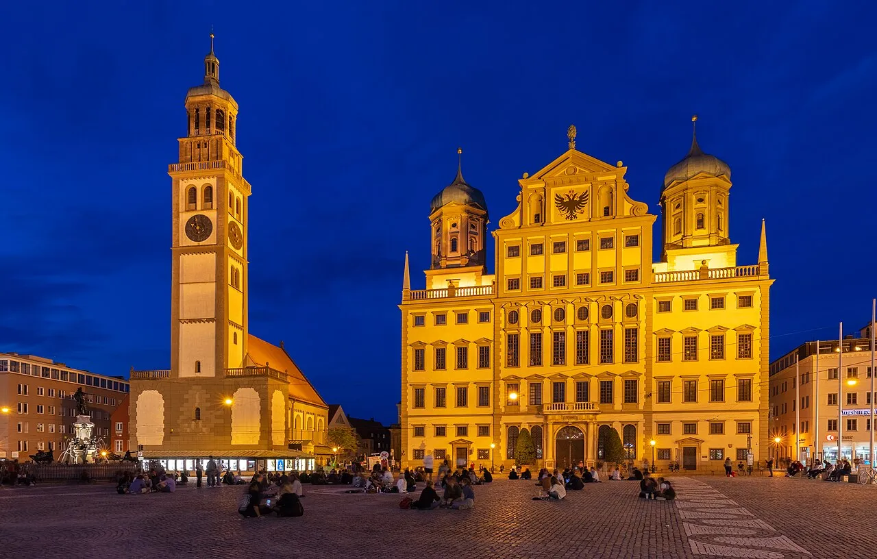
- Population
- 13,124,737
- 13.1M
- Elevation
- 503 m
- above sea level
- Local time
- UTC+01:00
- Europe/Berlin · UTC+01:00
- Places inside
- 4,094
- listed under Bavaria
- Airports
- NUE Nuremberg Airport63 km
- MUC Munich Airport75 km
About Bavaria
Bavaria is a region. Location: Germany. Population: 13,124,737.
Bavaria, officially the Free State of Bavaria, is a landlocked state of Germany. It borders the states of Baden-Württemberg to the west, Hesse to the north-west, and Thuringia and Saxony to the north, as well as the countries of Switzerland and Austria to the south and the Czech Republic to the east. The state's capital and largest city is Munich; other major cities include Nuremberg, Augsburg, Regensburg, and Ingolstadt.
Source: Wikipedia · CC BY-SA 4.0
Travel notes for Bavaria
From Wikivoyage
Bavaria (German: Bayern) is the largest federal state (Bundesland) of Germany, situated in the south-east of the country. Spanning an area of 70,540 km² with 13.2 million inhabitants, it extends from the middle German hills down into the Alps. Bavarian folk culture has significantly influenced the international perception of Germany.
Paradoxically, much of the region shares closer cultural affinities with its southern neighbours, Austria and Switzerland, than with other parts of Germany. Common stereotypes associated with Bavaria often focus on traditional leather breeches (Lederhosen), various types of sausages, and a significant beer-drinking culture.
Nevertheless, the federal state provides a diverse range of attractions and heritage for visitors that extends far beyond these traditional tropes. Along with the Rhineland and Berlin, it is Germany's most popular tourist destination, so expect long lines and high prices, especially in summer and in ski resorts in winter.
Understand+
Bavarians are regarded as some of the most independent and tradition-oriented inhabitants of Germany. There is a profound loyalty to regional roots, and as the most autonomous of the German states, many residents prioritise their Bavarian identity over their national one. While common cultural associations involving beer, sausages, and traditional dress such as Lederhosen originated in this region, such customs are now primarily observed in rural areas - particularly towards the Austrian Alps in the south and the forests bordering the Czech Republic and Bohemia.
In contrast to the rural imagery, contemporary Bavaria is highly metropolitan. The major urban centers are increasingly cosmopolitan, blending traditional heritage with international influences. While Bavaria remains more influenced by Catholicism than the northern states, church membership has declined significantly, reflecting broader European trends.
The capital, Munich, serves as a vibrant, liberal hub with a large international population, including a substantial English-speaking community. However, the city has not lost its roots; while it is a magnet for newcomers, you will still find many multi-generational Munich families who maintain the city's unique dialect and customs. This mix of "new" and "old" residents creates the famous Münchner Mischung (Munich mix), where global tech-industry professionals and traditional local artisans share the same beer garden tables.
Bavaria is bordered by the German federal states of Baden-Württemberg, Hesse, Thuringia and Saxony in the west and north, as well as the Czech Republic in the east and Austria and Switzerland in the south.
History:
Get in+
A Bavarian has held the post of German federal minister of transportation continuously since 2005 and it shows in the quality of long distance transportation infrastructure serving Bavaria.
By plane:
Most international travellers will arrive at Munich Airport (MUC IATA), which is the sixth busiest airport in Europe with a large number of international and intercontinental flights. Other alternatives are the airports of Nuremberg (NUE IATA) and Salzburg (SZG IATA). Furthermore, Memmingen Airport (FMM IATA) is a destination for a number of low-cost airlines. Würzburg is also reasonably close (direct 1:25 hour ICE connections to the airport) to Frankfurt Airport (FRA IATA), Germany's busiest airport, Lufthansa's main European hub), that it might be best for some travellers to arrive there.
By train:
From Berlin:
With the completion of the high speed rail line between Nuremberg and Erfurt, the travel time on high speed ICE trains between Berlin and Munich has been reduced to about 4.5 hours, with 3 daily ICE Sprinters completing the trip in just 4 hours. Tickets can be had starting at €19 when bought in advance or up to €130 when bought immediately prior to departure or on the train.
From the rest of Germany:
See Germany - Get around by train.
See also rail travel in Germany
The main routes Frankfurt-Nuremberg and Stuttgart-Munich are not yet upgraded for speeds higher than 160 km/h (99 mph) and 200 km/h (120 mph) respectively along much of their length, leading to comparatively long travel times. That said, the Stuttgart-Ulm line is being upgraded with a tentative opening date some time in the 2020s.
From Austria:
There are plenty of long-distance trains (category EC, ICE and Railjet) from Vienna, Linz, Salzburg, Villach and Klagenfurt. If you travel in a group and want to save money, use a regional trains with combination of Einfach-Raus-Ticket and Bayern-Ticket.
From France:
Source: Wikivoyage · CC BY-SA 4.0 · abridged
Places bordering Bavaria
Twin towns and sister cities of Bavaria
- Georgia· United States
Source: Wikidata. Only places with a page on this site are shown.
Population of Bavaria over time
| 1970 | 10,479,386 | |
|---|---|---|
| 1987 | 10,902,643 | |
| 2008 | 12,519,728 | |
| 2009 | 12,510,331 | |
| 2010 | 12,538,696 | |
| 2011 | 12,443,372 | |
| 2012 | 12,519,571 | |
| 2013 | 12,604,244 | |
| 2015 | 12,843,514 | |
| 2016 | 12,930,751 | |
| 2019 | 13,124,737 | |
| 2022 | 13,038,724 |
Censuses and official estimates; source: Wikidata.
Climate of Bavaria
Best months for sightseeingBest months for sightseeing: June–August.
This month · November
A cold month
Day 5° · Night 0° · Rain 61 mm
- Hottest month
- July (day 23°)
- Coldest month
- January (night -4°)
- Wettest month
- June (88 mm)
- Driest month
- February (50 mm)
Bars: average monthly low and high temperature. Below: precipitation. Monthly averages for 1970–2000 at about 18 km resolution, adjusted for elevation. Highlighted months are mild and relatively dry. Source: WorldClim 2.1 (CC BY 4.0).
Show values as a table
| Month | Jan | Feb | Mar | Apr | May | Jun | Jul | Aug | Sep | Oct | Nov | Dec |
|---|---|---|---|---|---|---|---|---|---|---|---|---|
| Average high (°C) | 1° | 3° | 8° | 12° | 18° | 20° | 23° | 22° | 18° | 12° | 5° | 2° |
| Average low (°C) | -4° | -4° | -1° | 2° | 7° | 10° | 12° | 12° | 8° | 4° | 0° | -3° |
| Precipitation (mm) | 56 | 50 | 52 | 52 | 72 | 88 | 88 | 75 | 60 | 60 | 61 | 66 |
How to get to Bavaria
The nearest airport is Nuremberg Airport (NUE), 63 km to the northwest as the crow flies. The nearest large city is Ingolstadt, 27 km to the south.
Airports
- Nuremberg Airport (NUE) Nuremberg 63 kmnorthwest
- Munich Airport (MUC) Munich 75 kmsouth
- Memmingen Allgau Airport (FMM) Memmingen 146 kmsouthwest
Nearby large cities
- Ingolstadt Population: 120.7K 27 kmsouth
- Regensburg Population: 151.4K 44 kmeast
- Nuremberg Population: 515.5K 59 kmnorthwest
- Fürth Population: 132K 65 kmnorthwest
- Erlangen Population: 102.7K 75 kmnorthwest
Straight-line distances; road distances are longer. Airport data: OurAirports.
Places in Bavaria
4,094 placesCities & villages1
- Waldreichenbach · Village
Mountains & nature37
- Waldschwaige · Natural site
- Waldsteingebirge · Mountain
- Wallholz · Natural site
- Waltinger Forst · Natural site
- Wamberger Wald · Natural site
- Wandlwald · Natural site
- Wart · Natural site
- Wart · Natural site
- Warther Holz · Natural site
- Wasbrunn · Natural site
- Wasserhölzer · Natural site
- Wasserstein · Mountain
- Wattenhauser Holz · Natural site
- Watzmanngletscher · Natural site
- Weberberg · Mountain
- Wehringer Holz · Natural site
- Weichselgartenholz · Natural site
- Weidach · Natural site
- Weidach · Natural site
- Weidbachsgrund · Natural site
- Weidenhain · Natural site
- Weidenhart · Natural site
- Weidenholz · Natural site
- Weiderholz · Natural site
- Weid Filz · Natural site
- Weidholz · Natural site
- Weiding · Natural site
- Weidlach · Natural site
- Weidlach · Natural site
- Weigler · Natural site
- Weiherbuchet · Natural site
- Weihergehau · Natural site
- Weihergehau · Natural site
- Weihergehau · Natural site
- Weiherholz · Natural site
- Weiher Holz · Natural site
- Weiherloh · Natural site
Lakes, rivers & coasts22
- Waldsee · Lake
- Waldsee · Lake
- Waltenhofenbach · River
- Wannigsbach · River
- Wappbach · River
- Warmatsgundbach · River
- Weberaubach · River
- Wechselgraben · River
- Wehrbach · River
- Weibersbach · River
- Weidenbach · River
- Weidenbach · River
- Weidenbach · River
- Weidenbach · River
- Weidleinsbach · River
- Weidleinsgraben · River
- Weidmoosgraben · River
- Weidsee · Lake
- Weiherbach · River
- Weiherbach · River
- Weihergraben · River
- Weihersbach · River
Largest cities and towns
-
Augsburg Village, Kreisfreie Stadt Augsburg301.1K
-
Würzburg Village, Kreisfreie Stadt Würzburg133.3K
-
Munich Village, Munich, Urban District1.5M
-
Munich, Urban District Municipality, Upper Bavaria1.5M
-
Munich Municipality, Upper Bavaria354.4K
-
Munich City, Munich1.5M
-
Landkreis Augsburg Municipality, Swabia263.4K
-
Landkreis Rosenheim Municipality, Upper Bavaria258.8K
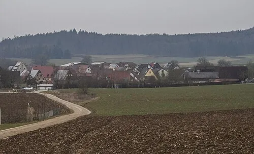
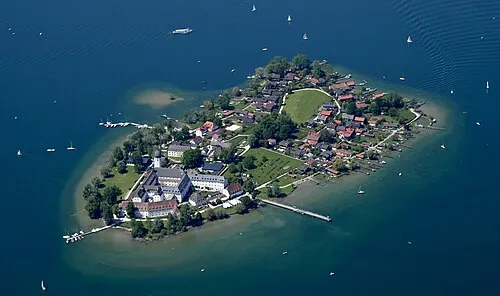
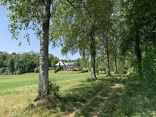
Nature and heritage in Bavaria
Sources & licences
Data last updated: · 2 independent sources