Eifelkreis Bitburg-Prüm
Located in Rhineland-Palatinate, Germany Coordinates: 50°04′33″ N 6°22′48″ E
- Population
- 99,788
- 99.8K
- Elevation
- 340 m
- above sea level
- Local time
- UTC+01:00
- Europe/Berlin · UTC+01:00
- Places inside
- 234
- listed under Eifelkreis Bitburg-Prüm
- Airports
- LUX Luxembourg-Findel International Airport51 km
- HHN Frankfurt-Hahn Airport65 km
About Eifelkreis Bitburg-Prüm
Eifelkreis Bitburg-Prüm is a municipality. Location: Rhineland-Palatinate, Germany. Population: 99,788. Elevation: 340 m. The best months to visit are June–August. The nearest airport is Luxembourg-Findel International Airport (51 km). Nearby sights include Dierbach and Bohnenbach.
Photos of Eifelkreis Bitburg-Prüm
-
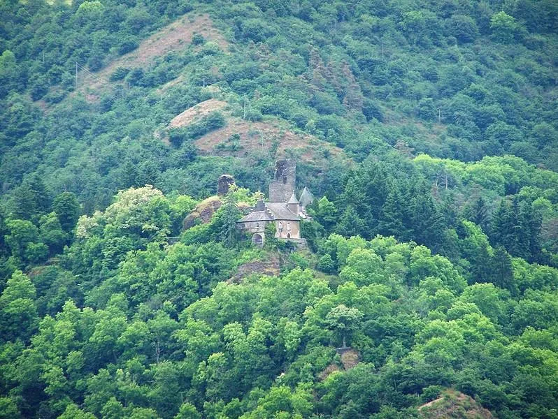
Schloß Falkenstein Brbbl · CC BY-SA 3.0

Climate of Eifelkreis Bitburg-Prüm
Best months for sightseeingBest months for sightseeing: June–August.
This month · November
A cold month
Day 7° · Night 2° · Rain 89 mm
- Hottest month
- August (day 22°)
- Coldest month
- February (night -1°)
- Wettest month
- December (97 mm)
- Driest month
- April (63 mm)
Bars: average monthly low and high temperature. Below: precipitation. Monthly averages for 1970–2000 at about 18 km resolution, adjusted for elevation. Highlighted months are mild and relatively dry. Source: WorldClim 2.1 (CC BY 4.0).
Show values as a table
| Month | Jan | Feb | Mar | Apr | May | Jun | Jul | Aug | Sep | Oct | Nov | Dec |
|---|---|---|---|---|---|---|---|---|---|---|---|---|
| Average high (°C) | 4° | 5° | 9° | 12° | 17° | 20° | 22° | 22° | 18° | 13° | 7° | 4° |
| Average low (°C) | -1° | -1° | 1° | 3° | 8° | 10° | 12° | 12° | 9° | 6° | 2° | 0° |
| Precipitation (mm) | 88 | 69 | 80 | 63 | 73 | 77 | 78 | 64 | 79 | 81 | 89 | 97 |
How to get to Eifelkreis Bitburg-Prüm
The nearest airport is Luxembourg-Findel International Airport (LUX), 51 km to the south as the crow flies. The nearest large city is Trier, 40 km to the southeast.
Airports
- Luxembourg-Findel International Airport (LUX) Luxembourg 51 kmsouth
- Frankfurt-Hahn Airport (HHN) Frankfurt am Main (Lautzenhausen) 65 kmeast
- Liège Airport (LGG) Grâce-Hollogne 91 kmnorthwest
Nearby large cities
- Trier Population: 100.1K 40 kmsoutheast
- Aachen Population: 265.2K 81 kmnorth
- Liège Population: 195.3K 85 kmnorthwest
- Bonn Population: 330.6K 89 kmnortheast
- Koblenz Population: 107.3K 91 kmeast
Straight-line distances; road distances are longer. Airport data: OurAirports.
Day trips from Eifelkreis Bitburg-Prüm
Within 100 km: 419 historic and cultural sites, 2,857 natural sites, 783 lakes, rivers and coasts.
0–25 km344 places
- Steinkopf Mountain 20 kmNW
- Reinersberg Mountain 24 kmNW
- Preis Berg Mountain 21 kmNW
- Schwirzbierg Mountain 23 kmW
25–60 km1,142 places
- Lac de Nisramont Lake 52 kmW
- Lac de Robertville Lake 45 kmNW
- Mont de la Tour de Coo Mountain 51 kmNW
- Steiner Berg Mountain 31 kmNW
60–100 km2,573 places
- Île du Moulin Island 78 kmNW
- Île Monsin Island 84 kmNW
- Île de Franche Garenne Island 85 kmNW
- Lac de la Gileppe Lake 63 kmNW
Straight-line distances.
Eifelkreis Bitburg-Prüm and similar cities
Side by side with cities of similar size in the same country: population, elevation and climate.
| Measure | Eifelkreis Bitburg-Prüm | Trier | Erlangen | Schwerin |
|---|---|---|---|---|
| Population | 99.8K | 100.1K | 102.7K | 96.6K |
| Elevation | 340 m | 141 m | 290 m | 48 m |
| Summer day (hottest month) | 22° | 24° | 24° | 23° |
| Winter night (coldest month) | -1° | 0° | -3° | -2° |
| Annual rainfall | 938 mm | 817 mm | 745 mm | 628 mm |
| Best months | Jun–Aug | Jun–Sep | May–Sep | Jun–Aug |
| Distance | — | 40 km | 337 km | 526 km |
Climate values are 1970–2000 monthly averages; straight-line distance.
Places in Eifelkreis Bitburg-Prüm
234 places- 121 Leidenborn 193
- 122 Lahr 190
- 123 Brecht 188
- 124 Steinborn 175
- 125 Weidingen 174
- 126 Seinsfeld 173
- 127 Wilsecker 173
- 128 Hosten 172
- 129 Oberweiler 171
- 130 Jucken 169
- 131 Hütterscheid 167
- 132 Menningen 164
- 133 Rodershausen 162
- 134 Heckhuscheid 157
- 135 Hüttingen bei Lahr 147
- 136 Preischeid 145
- 137 Kleinlangenfeld 143
- 138 Euscheid 142
- 139 Großkampenberg 141
- 140 Winterscheid 140
- 141 Obergeckler 136
- 142 Oberlascheid 135
- 143 Zendscheid 132
- 144 Großlangenfeld 132
- 145 Seiwerath 130
- 146 Scharfbillig 129
- 147 Eßlingen 120
- 148 Heisdorf 117
- 149 Giesdorf 115
- 150 Dingdorf 115
- 151 Mülbach 115
- 152 Auw an der Kyll 114
- 153 Heilbach 112
- 154 Mützenich 112
- 155 Dackscheid 106
- 156 Heilenbach 104
- 157 Halsdorf 102
- 158 Neuendorf 100
- 159 Gentingen 98
- 160 Hargarten 98
- 161 Brimingen 97
- 162 Pittenbach 97
- 163 Stockem 96
- 164 Lauperath 95
- 165 Olsdorf 93
- 166 Nimsreuland 93
- 167 Niederweiler 93
- 168 Altscheid 92
- 169 Koxhausen 92
- 170 Kyllburgweiler 92
- 171 Philippsheim 90
- 172 Plascheid 90
- 173 Hommerdingen 90
- 174 Echtershausen 89
- 175 Dauwelshausen 89
- 176 Reipeldingen 88
- 177 Lierfeld 85
- 178 Bauler 83
- 179 Berkoth 82
- 180 Lascheid 82
Bar: population relative to the most populous place in this list.
Nearby attractions & nature
Everything nearby-
Dierbach River, Rhineland-Palatinate0.6 km E
-
Bohnenbach River, Rhineland-Palatinate0.9 km NW
-
Weiherbach River, Rhineland-Palatinate2.2 km NW
-
Geweber Wald Natural site, Rhineland-Palatinate2.9 km E
-
Wald Scheid Natural site, Rhineland-Palatinate5.4 km SE
-
Kleiner Ehlenzbach River, Rhineland-Palatinate5 km E
-
Hardt Wald Natural site, Rhineland-Palatinate5.8 km E
-
Die Hecke Natural site, Rhineland-Palatinate6.1 km NE
Sources & licences
Data last updated: