- Population
- 39
- 39
- Elevation
- 448 m
- above sea level
- Local time
- UTC+02:00
- Europe/Athens · UTC+02:00
- Airports
- CHQ Chania International Airport52 km
- HER Heraklion International Nikos Kazantzakis Airport143 km
About Perivólia
Perivólia is a village. Location: Kissamos, Chania. Population: 39. Elevation: 448 m. The best months to visit are May–October. The nearest airport is Chania International Airport (52 km). Nearby sights include Voulolimni Beach and Aspri Limni Beach.
Climate of Perivólia
Best months for sightseeingBest months for sightseeing: May–October.
This month · November
Outside the best season
Day 17° · Night 11° · Rain 87 mm
- Hottest month
- July (day 28°)
- Coldest month
- February (night 7°)
- Wettest month
- January (128 mm)
- Driest month
- July (2 mm)
Bars: average monthly low and high temperature. Below: precipitation. Monthly averages for 1970–2000 at about 18 km resolution, adjusted for elevation. Highlighted months are mild and relatively dry. Source: WorldClim 2.1 (CC BY 4.0).
Show values as a table
| Month | Jan | Feb | Mar | Apr | May | Jun | Jul | Aug | Sep | Oct | Nov | Dec |
|---|---|---|---|---|---|---|---|---|---|---|---|---|
| Average high (°C) | 12° | 12° | 14° | 18° | 22° | 26° | 28° | 28° | 25° | 21° | 17° | 14° |
| Average low (°C) | 7° | 7° | 8° | 10° | 14° | 18° | 20° | 20° | 18° | 14° | 11° | 8° |
| Precipitation (mm) | 128 | 102 | 78 | 35 | 15 | 4 | 2 | 3 | 15 | 63 | 87 | 107 |
Other places to visit in this season: May June July August September October
How to get to Perivólia
The nearest airport is Chania International Airport (CHQ), 52 km to the east as the crow flies. The nearest large city is Piraeus, 286 km to the north.
Airports
- Chania International Airport (CHQ) Souda 52 kmeast
- Heraklion International Nikos Kazantzakis Airport (HER) Heraklion 143 kmeast
- Santorini International Airport (JTR) Santorini Island 204 kmnortheast
Nearby large cities
- Piraeus Population: 163.7K 286 kmnorth
- Athens Population: 664K 291 kmnorth
Straight-line distances; road distances are longer. Airport data: OurAirports.
Nearby attractions & nature
Everything nearby-
Voulolimni Beach Beach, Kissamos8.8 km SW
-
Aspri Limni Beach Beach, Kissamos9.8 km SW
-
Nisída Diapóri Island, Crete7.2 km W
-
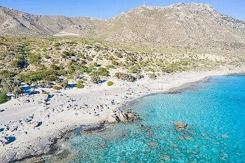 Kedrodasos Beach Beach, Chania11 km SW
-
Agía Marina Attraction, Platanias23 km NE
Sources & licences
Data last updated: