Kalimno Island
Local name: Κάλυμνος
Located in Dodecanese, South Aegean Coordinates: 36°58′33″ N 26°58′52″ E

- Elevation
- 512 m
- above sea level
- Local time
- UTC+02:00
- Europe/Athens · UTC+02:00
- Airports
- KGS Kos International Airport "Ippokratis"22 km
- BJV Milas Bodrum International Airport68 km
About Kalimno Island
Kalimno Island is an island. Location: Dodecanese, South Aegean.
Kalymnos (Greek: Κάλυμνος; Modern Greek pronunciation: [ˈkalimnos]) is a Greek island and municipality in the southeastern Aegean Sea. It belongs to the Dodecanese island chain, between the islands of Kos (south, at a distance of 12 km (7 mi)) and Leros (north, at a distance of less than 2 km (1 mi)), with the latter being linked to it through a series of islets. Kalymnos lies between two and five hours away by sea from the island of Rhodes.
Source: Wikipedia · CC BY-SA 4.0
Photos of Kalimno Island
-

Koray · CC BY-SA 4.0 -

Koray · CC BY-SA 4.0 -

Ultimouomo · CC BY-SA 4.0


Travel notes for Kalimno Island
From Wikivoyage
Kalymnos is an island in the Dodecanese group of the South Aegean Islands of Greece. It is known for its sunshine and limestone rock climbing cliffs.
Understand+
Kalymnos is most commonly visited during the summer months as Greek nationals and tourists escape the mainland heat for the sea breezes. Still, the summer months of July and August can be quite warm with daily high temperatures ranging in the mid-thirties Celsius. Spring (May - June) and autumn (September - October) tend to be more comfortable but more variable in terms of daily temperatures. Towards the end of October, the colder winds come in from the north, bringing winter, and the temperature drops drastically.
Cities:
Pothia - the commercial and civic centre of Kalymnos
Massouri - the tourist centre of Kalymnos
Emborios - a picturesque and unspoilt village on the northwestern coast of the island
Vathi - a small village on the east coast with a beautiful "hidden" harbour
Other destinations:
Pserimos - an even smaller island lying between Kalymnos and Turkey
Telendos - an island lying off the coast of Myrties and Massouri, reachable by boat from a small pier in Myrties. Good for a day trip (beaches, restaurant, walking and climbing).
Get in+
By plane:
1 Kalymnos Island National Airport (JKL IATA) (a few kilometers from Pothia). Sky Express from Athens, Astypalaia, Kos, Leros, Rhodes. Airsea Lines also flies schedule seaplane service from Lavrio Port, a few kilometres west of Athens, to Kalymnos. (updated May 2019)
The next closest airport is on nearby Kos (KGS IATA) which has a regularly scheduled service on Olympic Airlines, and is well-served by low-cost airlines during the summer months to Central and Western European nations.
By boat:
Most visitors arrive from the nearby island of Kos via frequent ferry service. There are two services; 'Anem Ferries' runs a large boat, the 'Olympios Appollon' or The 'Olympios Zeus' which can take vehicles, and the 'Kalymnos Star', a smaller, faster, passenger-only boat (occasionally replaced by the even smaller 'Kalymnos Dolphin'). Both vessels arrive in Pothia on Kalymnos. Both ferries depart from Mastihari on Kos island. Each makes several sailings a day, the number depending on the season and trade. There are alo a number of direct ferries from Kos town which stop at Pothia - they run every day from Rhodes to Athens and stop en route. Also the Dodecanese Express - a fast and classy catamaran runs almost every day from Kos town also, as do the -Flying Dolphins - cigar-shaped hyrofols.
It is also possible to travel directly to Kos as well as Bodrum, Turkey, and other nearby Greek islands. There is regularly scheduled ferry service from Athens year-round, and a seasonal service to Thessaloniki in the summer months.
Source: Wikivoyage · CC BY-SA 4.0 · abridged
Climate of Kalimno Island
Best months for sightseeingBest months for sightseeing: May, September–October.
This month · November
Outside the best season
Day 16° · Night 10° · Rain 83 mm
- Hottest month
- July (day 30°)
- Coldest month
- January (night 5°)
- Wettest month
- January (153 mm)
- Driest month
- July (1 mm)
Bars: average monthly low and high temperature. Below: precipitation. Monthly averages for 1970–2000 at about 18 km resolution, adjusted for elevation. Highlighted months are mild and relatively dry. Source: WorldClim 2.1 (CC BY 4.0).
Show values as a table
| Month | Jan | Feb | Mar | Apr | May | Jun | Jul | Aug | Sep | Oct | Nov | Dec |
|---|---|---|---|---|---|---|---|---|---|---|---|---|
| Average high (°C) | 11° | 11° | 14° | 18° | 23° | 28° | 30° | 30° | 26° | 21° | 16° | 13° |
| Average low (°C) | 5° | 5° | 7° | 9° | 13° | 18° | 20° | 20° | 17° | 13° | 10° | 7° |
| Precipitation (mm) | 153 | 116 | 81 | 37 | 17 | 6 | 1 | 3 | 13 | 49 | 83 | 149 |
How to get to Kalimno Island
The nearest airport is Kos International Airport "Ippokratis" (KGS), 22 km to the southeast as the crow flies. The nearest large city is Aydin, 123 km to the northeast.
Airports
- Kos International Airport "Ippokratis" (KGS) Kos Island 22 kmsoutheast
- Milas Bodrum International Airport (BJV) Bodrum 68 kmnortheast
- Samos Airport (SMI) Samos Island 80 kmnorth
Nearby large cities
- Aydin Population: 163K 123 kmnortheast
- Karabağlar Population: 479.3K 157 kmnorth
- Nazilli Population: 119.4K 158 kmnortheast
- Konak Population: 332.3K 158 kmnorth
- Izmir Population: 2.9M 160 kmnorth
Straight-line distances; road distances are longer. Airport data: OurAirports.
Day trips from Kalimno Island
Within 100 km: 49 historic and cultural sites, 111 natural sites, 121 lakes, rivers and coasts.
0–25 km11 places
- Nisída Krevvatió Island 17 kmE
- Tüllüce Adası Island 22 kmE
- Çatal Adası Island 22 kmE
- Büyükkiremit Adası Island 24 kmNE
25–60 km109 places
- Gümbet Plajı Beach 38 kmE
- Bardakçı Plajı Beach 39 kmE
- Paşatarlası Plajı Beach 41 kmE
- Kumbahçe Plajı Beach 41 kmE
60–100 km161 places
- Moní Megális Panagías Attraction 81 kmN
- Iasos Historic site 63 kmNE
- Kadınlar Plajı Beach 99 kmN
- Taşlık Plajı Beach 69 kmSE
Straight-line distances.
Nearest towns and villages
Nearby attractions & nature
Everything nearby-
Yassıada Island, Muğla Province19 km E
-
Çavuş Adası Island, Muğla Province21 km E
-
Çobanada Island, Muğla Province21 km E
-
Nisída Krevvatió Island, Dodecanese17 km E
-
Topan Adası Island, Muğla Province18 km E
-
Çatal Adası Island, Muğla Province22 km E
-
Tüllüce Adası Island, Muğla Province22 km E
-
Büyükkiremit Adası Island, Muğla Province24 km NE
More lakes, rivers and coasts in Greece
-
Psathonísi Island, Dodecanese46 km NW
-
Makronísi Island, Dodecanese47 km NW
-
Komomro Island Island, Dodecanese53 km NW
-
Psathonísi Island, Dodecanese56 km N
-
Nisída Lignó Island, Dodecanese70 km SW
-
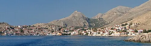 Halki Island, Dodecanese98 km SE
Sources & licences
Data last updated: · 2 independent sources