Sátoraljaújhely
Located in Sátoraljaújhely District, Borsod-Abauj Zemplen county Coordinates: 48°23′42″ N 21°39′31″ E
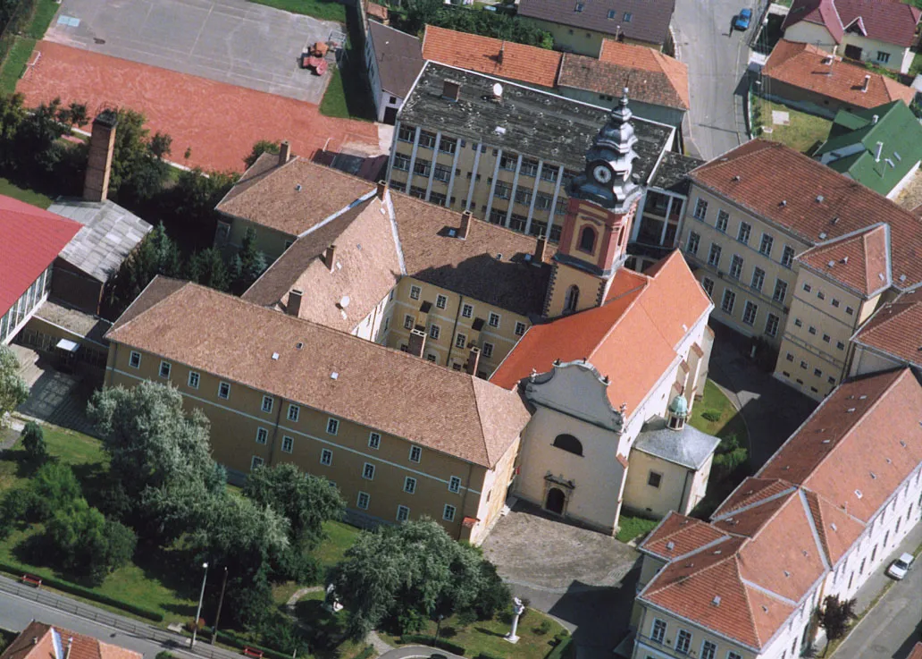
- Population
- 18,052
- 18.1K
- Elevation
- 108 m
- above sea level
- Local time
- UTC+01:00
- Europe/Budapest · UTC+01:00
- Airports
- KSC Košice International Airport43 km
- DEB Debrecen International Airport101 km
About Sátoraljaújhely
Sátoraljaújhely is a city. Location: Sátoraljaújhely District, Borsod-Abauj Zemplen county. Population: 18,052. Elevation: 108 m.
Sátoraljaújhely (German: Neustadt am Zeltberg; Slovak: Nové Mesto pod Šiatrom) is a town located in Borsod-Abaúj-Zemplén county in northern Hungary along the Slovak border.
Source: Wikipedia · CC BY-SA 4.0
Photos of Sátoraljaújhely
-

Ipipedia · CC BY-SA 4.0 -

Ipipedia · CC BY-SA 4.0 -

Trifonovné Karajz Borbála · CC0 -

Ondava Przykuta · CC BY-SA 4.0


Travel notes for Sátoraljaújhely
From Wikivoyage
Sátoraljaújhely (Hungarian pronunciation: [ˈʃaːtorɒjjɒuːjhɛj], German: Neustadt am Zeltberg, Slovak: Nové Mesto pod Šiatrom, Yiddish: איהעל or אוהעלי) is a town in Borsod-Abaúj-Zemplén County on the border with Slovakia. It is 82 km (51 mi) east from the county capital Miskolc.
Nearby town Pálháza is also described here.
Understand+
Sátor-alja (meaning "under the tent", referring to the tent-shaped hill nearby) was a settlement from the Conquest of Hungary until the Tatars destroyed the town. It was rebuilt in the 13th century, although there was disagreement among the citizens concerning the name: some wanted to keep the original name, and some wanted to rename it új hely ("new place").
Sátoraljaújhely was granted town status in 1261 by King Stephen V, and a castle was also built around that time. It has often played an important role in the region's history: revolts against Habsburg rule began there in the 17th and 18th centuries.
Sátoraljaújhely has always been an important town in culture. Ferenc Kazinczy, one of the reformers of the Hungarian language, lived here in the 18th century. At the turn of the 20th century the town was home to a small but important Jewish community: some 4,500 of the town's 13,000 residents were Jewish.
1 Tourinform Zemplén, Hősök tere 3, ☏ +36 47 321-458, satoraljaujhely@tourinform.hu. Mon–Fri 09:00–17:00. Tourist information. Maps, free brochures, souvenirs. Bike rental: weekdays: 2500 Ft per day, weekends: 4000 Ft per day. (updated Feb 2020)
Get in+
By train:
Sátoraljaújhely:
Trains are available in every two hours from Budapest-Keleti pályaudvar via Miskolc, Szerencs and Sárospatak. The journey takes more than 3 hours and costs 4730 Ft.
1 Sátoraljaújhely Train Station, Fasor utca 19, ☏ +36 1 349-4949, informacio@mav-start.hu. Ticket office: 03:00–22:30. (updated Feb 2020)
Slovenské Nové Mesto:
Slovenské Nové Mesto (Újhely) Train Station is in Slovakia, but very close to Sátoraljaújhely. Trains are available from Košice (Kassa) in every 1–2 hours. The journey takes about an hour, and costs €3.35. Other direct connections are: Čierna nad Tisou (Tiszacsernyő), Kyiv (Ukraine).
2 Slovenské Nové Mesto Train Station, Hraničná 13/10, ☏ +421 2 2029-2000, hovorca@zsr.sk. (updated Feb 2020)
Source: Wikivoyage · CC BY-SA 4.0 · abridged
Places bordering Sátoraljaújhely
- Slovenské Nové Mesto
Twin towns and sister cities of Sátoraljaújhely
- Franeker· The Netherlands
Source: Wikidata. Only places with a page on this site are shown.
Population of Sátoraljaújhely over time
| 2018 | 14,253 | |
|---|---|---|
| 2021 | 13,554 | |
| 2022 | 13,531 | |
| 2023 | 13,122 | |
| 2024 | 12,973 | |
| 2025 | 12,653 | |
| 2026 | 12,388 |
Censuses and official estimates; source: Wikidata.
Climate of Sátoraljaújhely
Best months for sightseeingBest months for sightseeing: May–September.
This month · November
A cold month
Day 7° · Night 1° · Rain 48 mm
- Hottest month
- July (day 25°)
- Coldest month
- January (night -5°)
- Wettest month
- June (81 mm)
- Driest month
- February (30 mm)
Bars: average monthly low and high temperature. Below: precipitation. Monthly averages for 1970–2000 at about 18 km resolution, adjusted for elevation. Highlighted months are mild and relatively dry. Source: WorldClim 2.1 (CC BY 4.0).
Show values as a table
| Month | Jan | Feb | Mar | Apr | May | Jun | Jul | Aug | Sep | Oct | Nov | Dec |
|---|---|---|---|---|---|---|---|---|---|---|---|---|
| Average high (°C) | 1° | 4° | 10° | 15° | 21° | 23° | 25° | 25° | 21° | 15° | 7° | 2° |
| Average low (°C) | -5° | -3° | 0° | 5° | 10° | 13° | 14° | 14° | 10° | 5° | 1° | -3° |
| Precipitation (mm) | 31 | 30 | 32 | 47 | 62 | 81 | 80 | 67 | 53 | 44 | 48 | 43 |
Other places to visit in this season: May June July August September
How to get to Sátoraljaújhely
The nearest airport is Košice International Airport (KSC), 43 km to the northwest as the crow flies. For international flights: Debrecen International Airport (DEB) (101 km). The nearest large city is Košice, 46 km to the northwest.
Airports
- Košice International Airport (KSC) Košice 43 kmnorthwest
- Debrecen International Airport (DEB) Debrecen 101 kmsouth
- Satu Mare International Airport (SUJ) Satu Mare 120 kmsoutheast
Nearby large cities
- Košice Population: 225K 46 kmnorthwest
- Nyíregyháza Population: 117.7K 49 kmsouth
- Miskolc Population: 154.5K 73 kmsouthwest
- Debrecen Population: 202.4K 96 kmsouth
- Satu Mare Population: 112.5K 111 kmsoutheast
Straight-line distances; road distances are longer. Airport data: OurAirports.
Day trips from Sátoraljaújhely
Within 100 km: 21 historic and cultural sites, 39 natural sites, 11 lakes, rivers and coasts.
0–25 km5 places
- Ondava River 14 kmNE
- Laborec River 22 kmNE
- Zabarla Mountain 21 kmW
- Remete-hegy Mountain 25 kmNW
25–60 km15 places
- Zemplínska šírava Lake 51 kmNE
- Slanské Pohorie Mountain 48 kmN
- Torysa River 35 kmNW
- Topľa River 40 kmN
60–100 km51 places
- Branisko Mountain 94 kmNW
- Spišská Kapitula Attraction 95 kmNW
- Spiš Castle Historic site 94 kmNW
- Morské Oko Lake 70 kmNE
Straight-line distances.
Nearby attractions & nature
Everything nearby-
Sátoraljaújhely Ghetto Historic site, Borsod-Abauj Zemplen county0.3 km NW
-
Ondava River, Košice Region14 km NE
-
Zabarla Mountain, Borsod-Abauj Zemplen county21 km W
-
 Laborec River, Košice Region22 km NE
-
Remete-hegy Mountain, Borsod-Abauj Zemplen county25 km NW
Sources & licences
Data last updated: · 2 independent sources