- Population
- 31,239
- 31.2K
- Elevation
- 16 m
- above sea level
- Local time
- UTC+00:00
- Europe/Dublin · UTC+00:00
- Airports
- DUB Dublin Airport17 km
- IOM Isle of Man Airport133 km
About Dún Laoghaire
Dún Laoghaire is a town. Location: Dún Laoghaire-Rathdown, Leinster. Population: 31,239. Elevation: 16 m.
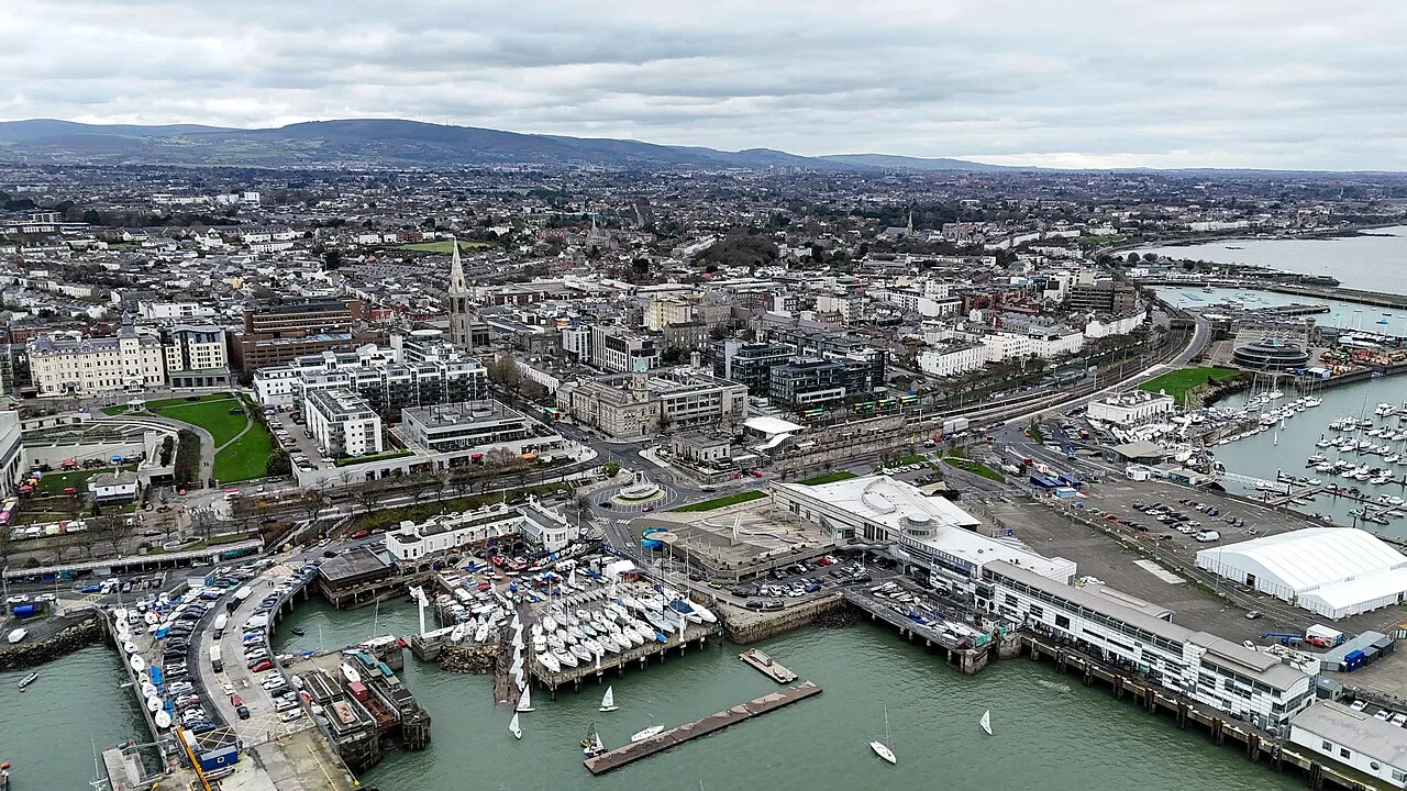
Dún Laoghaire ( dun LEER-ee, Irish: [ˌd̪ˠuːn̪ˠ ˈl̪ˠeːɾʲə, - ˈl̪ˠiːɾʲə]) is a suburban coastal town on the southside of Dublin, Ireland. The town was built up alongside a small existing settlement following 1816 legislation that allowed the building of a major port to serve Dublin. It was known as Dunleary in the English language, until it was renamed Kingstown in honour of George IV's 1821 visit, and in 1920 was given its present name, which is the original Irish form from which "Dunleary" was anglicised.
Source: Wikipedia · CC BY-SA 4.0
Photos of Dún Laoghaire
-

United Kingdom Hydrographic Office · Public domain -

William Murphy from Dublin, Ireland · CC BY-SA 2.0 -

William Murphy from Dublin, Ireland · CC BY-SA 2.0 -

Gareth James · CC BY-SA 2.0 -

Alicia Fagerving · CC BY-SA 3.0


Travel notes for Dún Laoghaire
From Wikivoyage
Dún Laoghaire (pronounced "Dunleary") is a port 10 km south of Dublin. It's no longer the ferry port, but has strong associations with James Joyce, who wrote and set the opening scenes of Ulysses here.
Understand+
The port was a 19th-century creation, renamed "Kingstown" for the 1821 visit of King George IV. Dublin was the ancient port, but the approach was hazardous, with several tragic shipwrecks. An alternative harbour was sought and Howth and Dún Laoghaire competed for this role. Howth lost out because it kept silting up, so for almost 200 years Dún Laoghaire was the main port of entry to Ireland, with ferries from England and Wales, and connected to the city by Ireland's first railway. In the early 21st century Dublin regained its role with greatly improved docks and approaches, and a motorway tunnel so that vehicles could bypass city congestion. The ferry terminals moved there and Dún Laoghaire harbour became much quieter, though cruise liners sometimes call.
The town was historically in County Dublin, which has been divided so it's now in Dún Laoghaire-Rathdown County, which in 2022 had a population of 234,000.
Get in+
By train:
DART trains run every 10 min from Malahide and Howth through central Dublin (Connolly, Tara St and Pearse stations) and the southern suburbs to 1 Dún Laoghaire Mallin Station. The trains continue south to Dalkey, Bray and Greystones. All these stations are within the Dublin "short hop zone", see Dublin#Get around for fares.
Four or five mainline trains per day call on the route between Dublin Connolly, Wexford and Rosslare, which has ferries from Fishguard and Pembroke.
From Belfast, Newry, Drogheda or Sligo, change at Connolly for the Dart train. From other cities such as Galway, Limerick or Cork, trains run to Dublin Heuston, take the tram to reach Connolly.
By bus:
Dublin Bus 46a runs here from city centre every 10 min. The route is from Phoenix Park, Dublin Northside through Phibsborough, O'Connell St downtown, then south via Leeson St, Donnybrook, and Stillorgan Rd (N11) to Foxrock then turning up Kill Lane, Mountjoy and York Rd to Dún Laoghaire railway station.
Aircoach 703 runs hourly between Dublin Airport and Dún Laoghaire, stopping by the Royal Marine Hotel, and continuing to Dalkey and Killeney. It's scheduled to take an hour but is often snarled in southside traffic. Aircoach 702 from the airport to Bray and Greystones runs further inland via Cabinteely and Loughlinstown.
Inter-city buses bypass Dún Laoghaire so you have to travel into central Dublin and come out again. The closest approach is by the bus from Wexford, which calls at Loughlinstown 4 km south, you could pick up a local bus or taxi there. But the train would bring you to town centre.
By boat:
Source: Wikivoyage · CC BY-SA 4.0 · abridged
Twin towns and sister cities of Dún Laoghaire
- Izumo· Japan
Source: Wikidata. Only places with a page on this site are shown.
Climate of Dún Laoghaire
Best months for sightseeingBest months for sightseeing: June–September.
This month · November
A cold month
Day 10° · Night 4° · Rain 77 mm
- Hottest month
- July (day 20°)
- Coldest month
- January (night 2°)
- Wettest month
- December (82 mm)
- Driest month
- April (52 mm)
Bars: average monthly low and high temperature. Below: precipitation. Monthly averages for 1970–2000 at about 18 km resolution, adjusted for elevation. Highlighted months are mild and relatively dry. Source: WorldClim 2.1 (CC BY 4.0).
Show values as a table
| Month | Jan | Feb | Mar | Apr | May | Jun | Jul | Aug | Sep | Oct | Nov | Dec |
|---|---|---|---|---|---|---|---|---|---|---|---|---|
| Average high (°C) | 8° | 8° | 10° | 12° | 15° | 18° | 20° | 19° | 17° | 14° | 10° | 9° |
| Average low (°C) | 2° | 2° | 3° | 4° | 7° | 10° | 12° | 11° | 10° | 7° | 4° | 3° |
| Precipitation (mm) | 78 | 62 | 60 | 52 | 53 | 58 | 58 | 75 | 68 | 81 | 77 | 82 |
Other places to visit in this season: June July August September
How to get to Dún Laoghaire
The nearest airport is Dublin Airport (DUB), 17 km to the northwest as the crow flies. The nearest large city is Dublin, 9 km to the northwest.
Airports
- Dublin Airport (DUB) Dublin 17 kmnorthwest
- Isle of Man Airport (IOM) Castletown, Rushen 133 kmnortheast
- George Best Belfast City Airport (BHD) Belfast 148 kmnorth
Nearby large cities
- Dublin Population: 1M 9 kmnorthwest
- Belfast Population: 348K 146 kmnorth
- Limerick Population: 102.3K 181 kmwest
- Birkenhead Population: 325.3K 208 kmeast
- Liverpool Population: 496.8K 211 kmeast
Straight-line distances; road distances are longer. Airport data: OurAirports.
Day trips from Dún Laoghaire
Within 100 km: 286 historic and cultural sites, 469 natural sites, 343 lakes, rivers and coasts.
0–25 km164 places
- Sandymount Strand Beach 6 kmNW
- Portmarnock Beach Beach 14 kmN
- North Bull Island Island 9 kmN
- Lambay Island Island 23 kmN
25–60 km386 places
- Wicklow Mountains Mountain 27 kmSW
- Rockabill Island 35 kmN
- Pollboy Bridge Landmark 54 kmNW
- Skerries Islands Island 32 kmN
60–100 km548 places
- White Island Island 99 kmNW
- Black Island Island 100 kmNW
- Large Island Island 68 kmNW
- Small Island Island 68 kmNW
Straight-line distances.
Nearby attractions & nature
Everything nearby-
Scotsmans Bay Natural site, Leinster1.9 km E
-
Dalkey Hill Mountain, Dún Laoghaire-Rathdown3.4 km SE
-
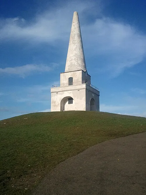 Killiney Hill Mountain, Dún Laoghaire-Rathdown3.5 km SE
-
Dalkey Island Island, Leinster4.5 km SE
-
Killiney Bay Natural site, Leinster4.7 km SE
-
Dublin Bay Natural site, Leinster4.8 km N
-
Merrion Strand Beach, Dublin City4.7 km NW
-
3Arena Attraction, Dublin City8.6 km NW
Other cities and towns in Dún Laoghaire-Rathdown
Sources & licences
Data last updated: · 2 independent sources