- Population
- 28,948
- 28.9K
- Elevation
- 101 m
- above sea level
- Local time
- UTC+01:00
- Europe/Rome · UTC+01:00
- Places inside
- 40
- listed under Poggibonsi
- Airports
- FLR Florence Airport, Peretola38 km
- PSA Pisa International Airport65 km
About Poggibonsi
Poggibonsi is a municipality. Location: Province of Siena, Tuscany. Population: 28,948. Elevation: 101 m. The best months to visit are May–June, September–October. The nearest airport is Florence Airport, Peretola (38 km). Nearby sights include Teatro dei Varii and Torre del Diavolo.
Photos of Poggibonsi
-
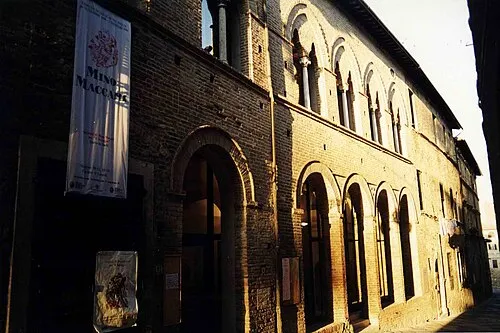
Teatro dei Varii Robyfra1 · Public domain -
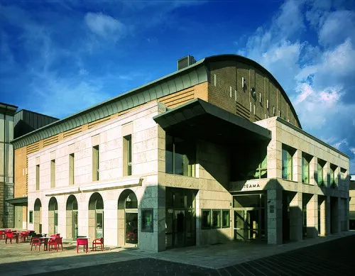
Teatro Politeama Rufilius · CC BY-SA 4.0


Climate of Poggibonsi
Best months for sightseeingBest months for sightseeing: May–June, September–October.
This month · November
A wet month
Day 15° · Night 7° · Rain 100 mm
- Hottest month
- July (day 30°)
- Coldest month
- January (night 3°)
- Wettest month
- November (100 mm)
- Driest month
- July (32 mm)
Bars: average monthly low and high temperature. Below: precipitation. Monthly averages for 1970–2000 at about 18 km resolution, adjusted for elevation. Highlighted months are mild and relatively dry. Source: WorldClim 2.1 (CC BY 4.0).
Show values as a table
| Month | Jan | Feb | Mar | Apr | May | Jun | Jul | Aug | Sep | Oct | Nov | Dec |
|---|---|---|---|---|---|---|---|---|---|---|---|---|
| Average high (°C) | 11° | 12° | 15° | 18° | 23° | 26° | 30° | 30° | 26° | 20° | 15° | 11° |
| Average low (°C) | 3° | 4° | 5° | 8° | 12° | 15° | 18° | 18° | 15° | 11° | 7° | 4° |
| Precipitation (mm) | 60 | 59 | 62 | 70 | 58 | 48 | 32 | 47 | 75 | 89 | 100 | 72 |
Other places to visit in this season: May June September October
How to get to Poggibonsi
The nearest airport is Florence Airport, Peretola (FLR), 38 km to the north as the crow flies. The nearest large city is Nice, 314 km to the west.
Airports
- Florence Airport, Peretola (FLR) Firenze (FI) 38 kmnorth
- Pisa International Airport (PSA) Pisa (PI) 65 kmwest
- Marina di Campo Airport (EBA) Campo nell'Elba (LI) 108 kmsouthwest
Nearby large cities
- Nice Population: 342.7K 314 kmwest
- Rijeka Population: 108K 334 kmnortheast
- Ljubljana Population: 272.2K 391 kmnortheast
Straight-line distances; road distances are longer. Airport data: OurAirports.
Day trips from Poggibonsi
Within 100 km: 143 historic and cultural sites, 225 natural sites, 42 lakes, rivers and coasts.
0–25 km22 places
- Monte Vasone Mountain 15 kmS
- Le Masse di Siena Mountain 24 kmSE
- Poggio di Ricavo Mountain 11 kmE
- Montagnola Mountain 21 kmS
25–60 km77 places
- Poggio di Iavello Mountain 55 kmN
- Cormorano Beach 56 kmSW
- Spiagge bianche Beach 58 kmW
- Spiaggia Velico Pietrabianca Beach 58 kmW
60–100 km311 places
- Poggio Mosconcino Mountain 73 kmS
- Parco della Rimembranza Natural site 79 kmS
- Parco di Villa Pizzetti Natural site 80 kmS
- Parco del fiume Ombrone Silvano Signori Natural site 80 kmS
Straight-line distances.
Places in Poggibonsi
40 places- 1 Poggibonsi 21.7K
- 2 Staggia 2.5K
- 3 Bellavista 1.5K
- 4 Fontana 203
- 5 Castiglioni 187
- 6 Lecchi 159
- 7 Gavignano 93
- 8 Casastieri 80
- 9 San Lucchese 61
- 10 La Strolla 53
- 11 La Gruccia 48
- 12 Castagneto di Melachecca 44
- 13 San Giorgio 44
- 14 Torri 44
- 15 Talciona 43
- 16 Poggiagrilli 38
- 17 Ellerone 36
- 18 Pini 36
- 19 Gaggiano 34
- 20 Piandicampi 34
- 21 Montemorli 30
- 22 Campostaggia 28
- 23 Case Bolzano 28
- 24 Poggiarello 26
- 25 Montelonti 25
- 26 Vivaia 25
- 27 Campomaggio 24
- 28 Caduta 23
- 29 Montefalconi 23
- 30 Pian dei Pini 22
- 31 Lecchi II 21
- 32 Volponi 21
- 33 Campotatti 20
- 34 Megognano 19
- 35 Cedda 17
- 36 Spedaletto 16
- 37 Vivaia II 16
- 38 Maltraverso 15
- 39 Poggio di Villore 13
Bar: population relative to the most populous place in this list.
Heritage & sights1
- Teatro Politeama · Attraction
Nearby attractions & nature
Everything nearby-
Teatro dei Varii Attraction, Colle di Val d'Elsa5.8 km S
-
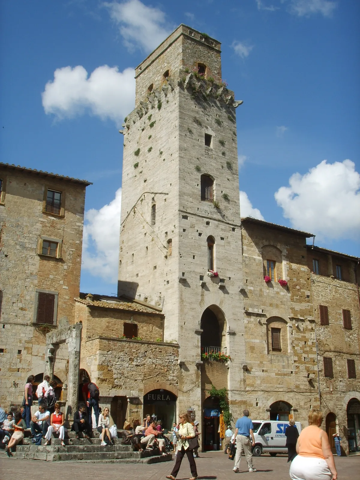 Torre del Diavolo Historic site, San Gimignano8.3 km W
-
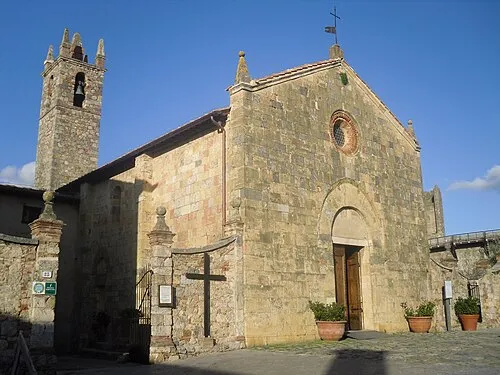 Church of Santa Maria Assunta Attraction, Monteriggioni11 km SE
-
 Torre del Mangia Landmark, Siena23 km SE
-
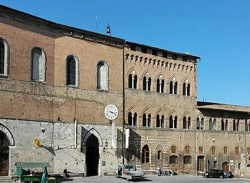 Santa Maria della Scala Museum, Siena23 km SE
-
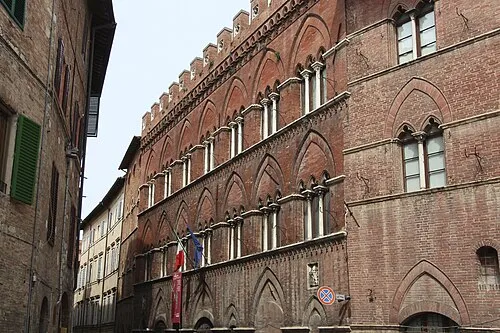 Pinacoteca Nazionale Museum, Siena23 km SE
-
Poggio di Ricavo Mountain, Castellina in Chianti11 km E
-
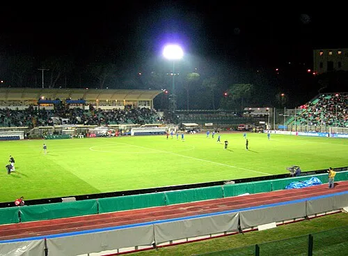 Stadio Comunale "Artemio Franchi" Landmark, Siena22 km SE
Sources & licences
Data last updated: