- Population
- 4,609
- 4.6K
- Elevation
- -1 m
- above sea level
- Local time
- UTC+09:00
- Asia/Tokyo · UTC+09:00
- Airports
- NGO Chubu Centrair International Airport23 km
- NKM Nagoya Airport / JASDF Komaki Air Base23 km
About Tobishima Mura
Tobishima Mura is a municipality. Location: Ama, Aichi. Population: 4,609. Elevation: -1 m.
Tobishima (飛島村, Tobishima-mura) is a village located in Ama District, Aichi Prefecture, in the Tōkai region of Japan. As of 1 October 2019, the town had an estimated population of 4,609 in 1765 households, and a population density of 206 persons per km2. The total area of the village was 22.42 square kilometres (8.66 sq mi). The village contains the place "Aichi-ken Ama-gun Tobishima-mura Ooaza-tobishima Shinden-aza Take-no-gou Yotare Minami-no-wari", which has a claim on having the longest name in Japan.
Source: Wikipedia · CC BY-SA 4.0
Places bordering Tobishima Mura
- Nagoya
- Yatomi-shi
- Kanie
Twin towns and sister cities of Tobishima Mura
- Minamitane Chō· Japan
Source: Wikidata. Only places with a page on this site are shown.
Population of Tobishima Mura over time
| 2010 | 4,525 | |
|---|---|---|
| 2015 | 4,397 | |
| 2021 | 4,596 |
Censuses and official estimates; source: Wikidata.
Climate of Tobishima Mura
Best months for sightseeingBest months for sightseeing: May–June, October.
This month · November
Outside the best season
Day 17° · Night 8° · Rain 92 mm
Better nearby cities in November
- Fujinomiya · 165 km east18°
- Fuji · 171 km east20°
- Kofu · 173 km northeast17°
- Hottest month
- August (day 31°)
- Coldest month
- January (night 1°)
- Wettest month
- June (263 mm)
- Driest month
- December (51 mm)
Bars: average monthly low and high temperature. Below: precipitation. Monthly averages for 1970–2000 at about 18 km resolution, adjusted for elevation. Highlighted months are mild and relatively dry. Source: WorldClim 2.1 (CC BY 4.0).
Show values as a table
| Month | Jan | Feb | Mar | Apr | May | Jun | Jul | Aug | Sep | Oct | Nov | Dec |
|---|---|---|---|---|---|---|---|---|---|---|---|---|
| Average high (°C) | 9° | 9° | 13° | 19° | 23° | 26° | 29° | 31° | 27° | 22° | 17° | 11° |
| Average low (°C) | 1° | 1° | 3° | 9° | 14° | 18° | 22° | 23° | 20° | 13° | 8° | 3° |
| Precipitation (mm) | 57 | 79 | 127 | 180 | 182 | 263 | 256 | 169 | 240 | 140 | 92 | 51 |
How to get to Tobishima Mura
The nearest airport is Chubu Centrair International Airport (NGO), 23 km to the south as the crow flies. The nearest large city is Tōkai, 10 km to the southeast.
Airports
- Chubu Centrair International Airport (NGO) Tokoname 23 kmsouth
- Nagoya Airport / JASDF Komaki Air Base (NKM) Nagoya 23 kmnortheast
- Osaka Itami International Airport (ITM) Osaka 129 kmwest
Nearby large cities
- Tōkai Population: 113.8K 10 kmsoutheast
- Kuwana Population: 140.1K 13 kmwest
- Kariya Population: 153.8K 19 kmsoutheast
- Inazawa Population: 134.8K 20 kmnorth
- Yokkaichi Population: 305.4K 21 kmsouthwest
Straight-line distances; road distances are longer. Airport data: OurAirports.
Nearby attractions & nature
Everything nearby-
Nikkō River River, Aichi2.1 km NE
-
Shonai River River, Japan4.6 km SE
-
SCMaglev and Railway Park Museum, Minato-ku4.5 km SE
-
Kiso River River, Mie6.5 km SW
-
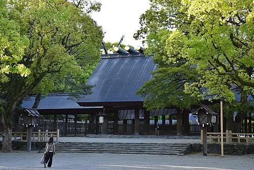 Atsuta Shrine Noh Stage Attraction, Atsuta11 km NE
-
Nagara River River, Japan9.3 km W
-
Hori River River, Aichi8 km E
-
Ibi River River, Japan8.9 km W
Sources & licences
Data last updated: · 2 independent sources