- Population
- 50,273
- 50.3K
- Elevation
- 22 m
- above sea level
- Local time
- UTC+09:00
- Asia/Tokyo · UTC+09:00
- Places inside
- 1
- listed under Higashiura Chō
- Airports
- NGO Chubu Centrair International Airport18 km
- NKM Nagoya Airport / JASDF Komaki Air Base32 km
About Higashiura Chō
Higashiura Chō is a municipality. Location: Chita-gun, Aichi. Population: 50,273. Elevation: 22 m.
Higashiura (東浦町, Higashiura-chō) is a town located in Chita District, Aichi Prefecture, Japan. On 31 April 2023, the town had an estimated population of 50,182 in 21,426 households, and a population density of 1,611 per square kilometre (4,170/sq mi). This makes the town the most populous town in Aichi Prefecture, surpassing Takahama, Iwakura in population. The town is also the second most populous town in Japan, being surpassed by Fuchū, Hiroshima. The total area was 31.14 square kilometres (12.02 sq mi).
Source: Wikipedia · CC BY-SA 4.0
Places bordering Higashiura Chō
- Kariya
- Takahama Shi
- Ōbu
- Chita
- Tōkai-shi
- Handa
- Agui Chō
Population of Higashiura Chō over time
| 2010 | 49,800 | |
|---|---|---|
| 2015 | 49,230 | |
| 2021 | 49,252 |
Censuses and official estimates; source: Wikidata.
Climate of Higashiura Chō
Best months for sightseeingBest months for sightseeing: May–June, October.
This month · November
Outside the best season
Day 17° · Night 8° · Rain 97 mm
Better nearby cities in November
- Fujinomiya · 154 km east18°
- Fuji · 159 km east20°
- Kofu · 166 km northeast17°
- Hottest month
- August (day 31°)
- Coldest month
- January (night 1°)
- Wettest month
- June (259 mm)
- Driest month
- December (49 mm)
Bars: average monthly low and high temperature. Below: precipitation. Monthly averages for 1970–2000 at about 18 km resolution, adjusted for elevation. Highlighted months are mild and relatively dry. Source: WorldClim 2.1 (CC BY 4.0).
Show values as a table
| Month | Jan | Feb | Mar | Apr | May | Jun | Jul | Aug | Sep | Oct | Nov | Dec |
|---|---|---|---|---|---|---|---|---|---|---|---|---|
| Average high (°C) | 9° | 9° | 13° | 19° | 23° | 26° | 29° | 31° | 27° | 22° | 17° | 12° |
| Average low (°C) | 1° | 1° | 4° | 9° | 14° | 18° | 22° | 23° | 20° | 14° | 8° | 3° |
| Precipitation (mm) | 53 | 76 | 126 | 179 | 185 | 259 | 243 | 193 | 248 | 159 | 97 | 49 |
How to get to Higashiura Chō
The nearest airport is Chubu Centrair International Airport (NGO), 18 km to the southwest as the crow flies. The nearest large city is Kariya, 3 km to the northeast.
Airports
- Chubu Centrair International Airport (NGO) Tokoname 18 kmsouthwest
- Nagoya Airport / JASDF Komaki Air Base (NKM) Nagoya 32 kmnorth
- Mount Fuji Shizuoka Airport (FSZ) Makinohara / Shimada 115 kmeast
Nearby large cities
- Kariya Population: 153.8K 3 kmnortheast
- Tōkai Population: 113.8K 7 kmnorthwest
- Handa Population: 117.9K 10 kmsouth
- Anjo Population: 188.7K 12 kmeast
- Nishio Population: 170K 14 kmsoutheast
Straight-line distances; road distances are longer. Airport data: OurAirports.
Day trips from Higashiura Chō
Within 100 km: 8 historic and cultural sites, 15 natural sites, 29 lakes, rivers and coasts.
0–25 km13 places
- Chita-hantō Natural site 16 kmSW
- Okazaki castle Historic site 19 kmE
- Toyota Stadium Landmark 24 kmNE
- Nikkō River River 17 kmNW
25–60 km25 places
- Tōshi-jima Island 50 kmS
- Himakajima Island 30 kmS
- Sakate-jima Island 54 kmS
- Kami-jima Island 47 kmS
60–100 km14 places
- Kashiko Island Island 74 kmS
- Takami Yama Mountain 99 kmSW
- Lake Biwa Lake 85 kmW
- Mount Mikami Mountain 84 kmW
Straight-line distances.
Higashiura Chō and similar cities
Side by side with cities of similar size in the same country: population, elevation and climate.
| Measure | Higashiura Chō | Asakura | Midori | Nanao |
|---|---|---|---|---|
| Population | 50.3K | 50.3K | 50.3K | 50.3K |
| Elevation | 22 m | 51 m | 254 m | 2 m |
| Summer day (hottest month) | 31° | 31° | 30° | 30° |
| Winter night (coldest month) | 1° | 1° | -3° | 0° |
| Annual rainfall | 1,867 mm | 1,923 mm | 1,335 mm | 2,122 mm |
| Best months | May–Jun, Oct | May, Oct | May–Jun, Sep–Oct | May–Jun, Sep–Oct |
| Distance | — | 600 km | 267 km | 231 km |
Climate values are 1970–2000 monthly averages; straight-line distance.
Places in Higashiura Chō
1 placeBar: population relative to the most populous place in this list.
Nearby attractions & nature
Everything nearby-
Shonai River River, Japan13 km NW
-
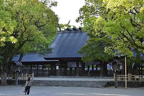 Atsuta Shrine Noh Stage Attraction, Atsuta18 km N
-
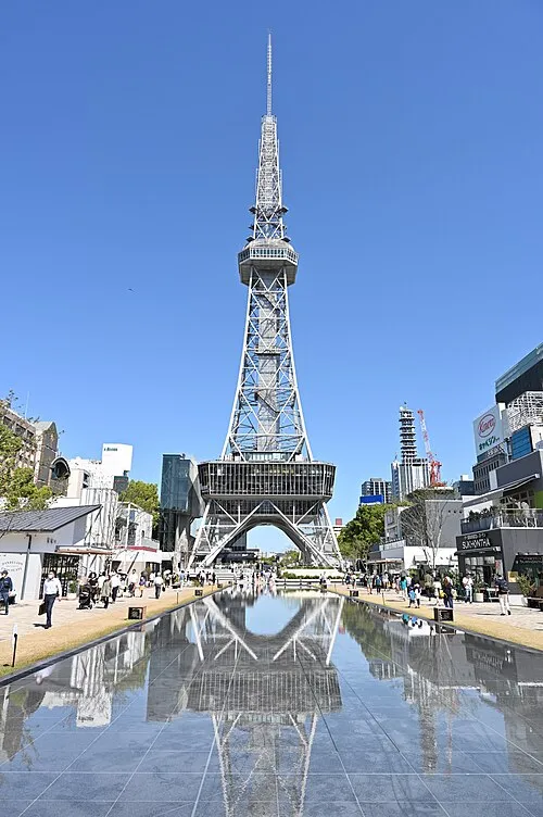 Nagoya TV Tower Landmark, Naka23 km N
-
SCMaglev and Railway Park Museum, Minato-ku13 km NW
-
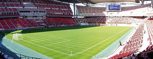 Toyota Stadium Landmark, Toyota-shi24 km NE
-
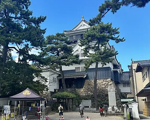 Okazaki castle Historic site, Okazaki-shi19 km E
-
Kiso River River, Mie20 km W
-
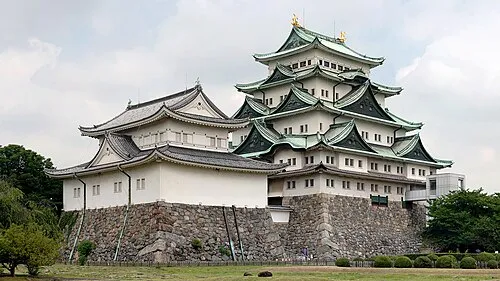 Nagoya castle Historic site, Naka25 km N
Other cities and towns in Chita-gun
-
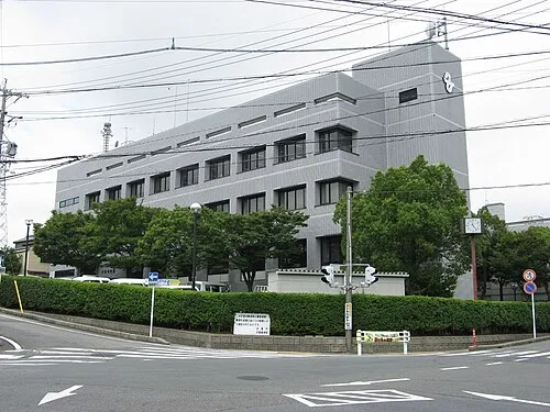 Taketoyo Town, Taketoyo Chō14 km S
-
Mihama Chō Municipality, Chita-gun22 km S
-
Taketoyo Chō Municipality, Chita-gun15 km S
-
Minamichita Chō Municipality, Chita-gun27 km S
-
Kaminoma Town, Mihama Chō20 km SW
-
Toyohama Town, Minamichita Chō29 km S
Sources & licences
Data last updated: · 2 independent sources