- Population
- 23,372
- 23.4K
- Elevation
- 4 m
- above sea level
- Local time
- UTC+09:00
- Asia/Tokyo · UTC+09:00
- Airports
- NKM Nagoya Airport / JASDF Komaki Air Base19 km
- NGO Chubu Centrair International Airport44 km
About Sobue
Sobue is a town. Location: Inazawa-shi, Aichi. Population: 23,372. Elevation: 4 m.
Sobue (祖父江町, Sobue-chō) was a town located in Nakashima District, Aichi Prefecture, Japan. As of 2005, the town had an estimated population of 22,829 and a population density of 1,032.05 persons per km2. The total area was 22.12 km2. On April 1, 2005, Sobue, along with the town of Heiwa (also from Nakashima District), was merged into the expanded city of Inazawa.
Source: Wikipedia · CC BY-SA 4.0
At a glance
- Built
- 1896
Source: Wikidata
Climate of Sobue
Best months for sightseeingBest months for sightseeing: May–June, October.
This month · November
Outside the best season
Day 17° · Night 7° · Rain 93 mm
Better nearby cities in November
- Fujinomiya · 173 km east18°
- Kofu · 174 km east17°
- Fuji · 179 km east20°
- Hottest month
- August (day 31°)
- Coldest month
- January (night 0°)
- Wettest month
- June (271 mm)
- Driest month
- December (54 mm)
Bars: average monthly low and high temperature. Below: precipitation. Monthly averages for 1970–2000 at about 18 km resolution, adjusted for elevation. Highlighted months are mild and relatively dry. Source: WorldClim 2.1 (CC BY 4.0).
Show values as a table
| Month | Jan | Feb | Mar | Apr | May | Jun | Jul | Aug | Sep | Oct | Nov | Dec |
|---|---|---|---|---|---|---|---|---|---|---|---|---|
| Average high (°C) | 9° | 9° | 13° | 19° | 23° | 26° | 30° | 31° | 27° | 22° | 17° | 11° |
| Average low (°C) | 0° | 0° | 3° | 9° | 14° | 18° | 22° | 23° | 19° | 13° | 7° | 2° |
| Precipitation (mm) | 62 | 84 | 130 | 186 | 187 | 271 | 268 | 170 | 243 | 136 | 93 | 54 |
How to get to Sobue
The nearest airport is Nagoya Airport / JASDF Komaki Air Base (NKM), 19 km to the east as the crow flies. For international flights: Chubu Centrair International Airport (NGO) (44 km). The nearest large city is Inazawa, 6 km to the east.
Airports
- Nagoya Airport / JASDF Komaki Air Base (NKM) Nagoya 19 kmeast
- Chubu Centrair International Airport (NGO) Tokoname 44 kmsouth
- Osaka Itami International Airport (ITM) Osaka 128 kmsouthwest
Nearby large cities
- Inazawa Population: 134.8K 6 kmeast
- Ichinomiya Population: 380.1K 9 kmnortheast
- Ōgaki Population: 161.5K 14 kmnorthwest
- Komaki Population: 148.9K 19 kmeast
- Gifu Population: 402.6K 20 kmnorth
Straight-line distances; road distances are longer. Airport data: OurAirports.
Nearby attractions & nature
Everything nearby-
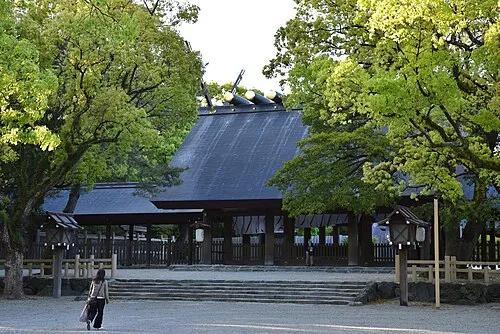 Atsuta Shrine Noh Stage Attraction, Atsuta22 km SE
-
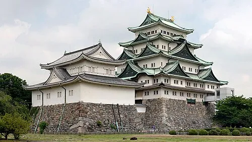 Nagoya castle Historic site, Naka18 km SE
-
Kiso River River, Mie24 km S
-
Nagara River River, Japan20 km S
-
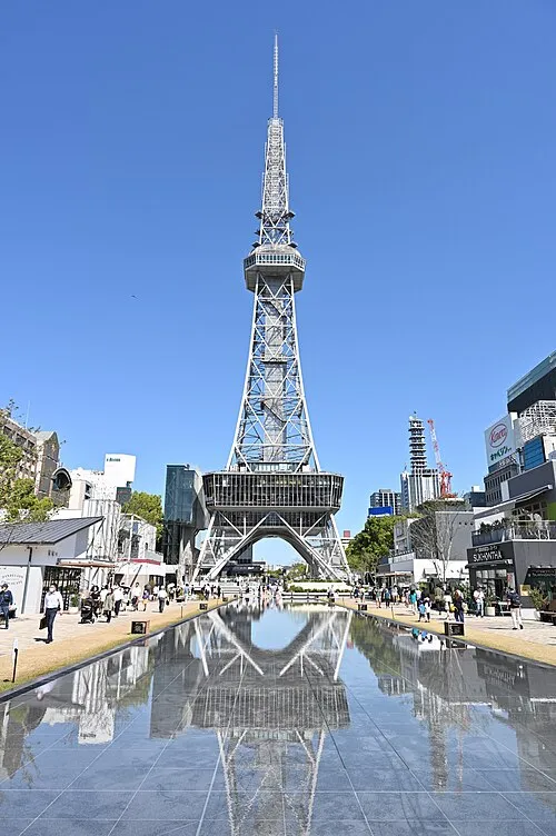 Nagoya TV Tower Landmark, Naka19 km SE
-
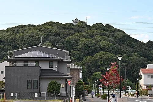 Mount Komaki Mountain, Komaki18 km E
-
Ibi River River, Japan22 km S
-
Nikkō River River, Aichi21 km SE
Sources & licences
Data last updated: · 2 independent sources