Goshogawara
Local name: 五所川原市
Located in Goshogawara Shi, Aomori Coordinates: 40°48′16″ N 140°26′29″ E
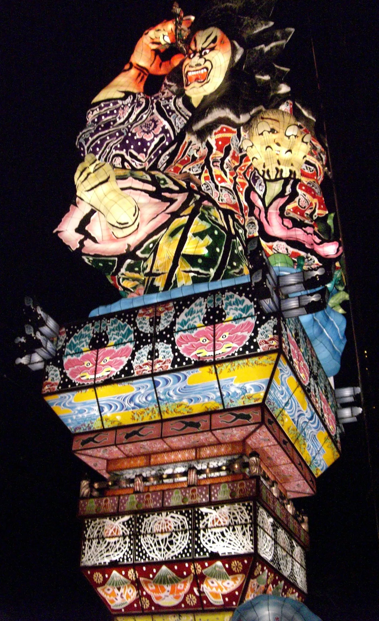
- Population
- 53,576
- 53.6K
- Elevation
- 9 m
- above sea level
- Local time
- UTC+09:00
- Asia/Tokyo · UTC+09:00
- Airports
- AOJ Aomori Airport22 km
- ONJ Odate Noshiro Airport68 km
About Goshogawara
Goshogawara is a city. Location: Goshogawara Shi, Aomori. Population: 53,576. Elevation: 9 m.
Goshogawara (五所川原市, Goshogawara-shi) is a city located in Aomori Prefecture, Japan. As of 31 January 2023, the city had an estimated population of 51,578 in 25,615 households, and a population density of 130 persons per km2. The total area of the city is 404.18 square kilometres (156.05 sq mi).
Source: Wikipedia · CC BY-SA 4.0
Photos of Goshogawara
-
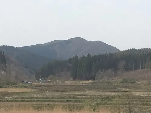
Mount Bonju Mccunicano · CC BY-SA 4.0

Travel notes for Goshogawara
From Wikivoyage
Goshogawara (五所川原) is a city in Aomori prefecture in Japan.
Understand+
Tourist information sites:
The city government has an official multilingual guide site.
The local tourist association has a Japanese-only guide site with integrated Google Translate.
Get in+
By plane:
The nearest airport is Aomori, which is about 40 minutes away by car. There are no direct buses to Goshogawara from the airport; those using public transport must take the buses to either Hirosaki or Aomori. Taxis to Goshogawara cost ¥7600.
By train:
The JR Gonō Line provides rail access to Goshogawara. Most trains run from Hirosaki (50 min, ¥500), which is where to change if coming from Ōdate, Noshiro and Akita.
If coming from Aomori (or Shin-Aomori, the nearest Shinkansen station), take a local train towards Hirosaki and change at Kawabe, which is where Gonō Line trains actually leave the Ōu Main Line. With a reasonable connection, this should take 1hr 10mins and cost ¥970 (if you stick to local trains).
By long-distance bus:
Goshogawara is served by two overnight bus services from Tokyo:
The Nocturne runs from Yokohama Station East Exit and Hamamatsuchō Bus Terminal, taking 10hrs 45mins and costing up to ¥10,900 (cheaper outside peak periods; return tickets available). Operated by Kōnan Bus and Keikyū Bus.
The Panda runs from Shinjuku and Kajibashi (5 minutes walk from Tokyo Station Yaesu Exit, on Sotobori Dōri), taking 10hrs 30mins and costing up to ¥6500 (cheaper outside peak periods). Operated by Kōnan Bus.
If you're wondering why this bus is so cheap, it's because it does not have toilets on board; you will have to wait for one of the scheduled rest breaks along the Tōhoku Expressway.
Those using Willer Express should take the overnight bus between Disneyland, Shinjuku and Aomori and get off at Hirosaki station (which is the first stop in the morning).
If taking the bus from Sendai or Morioka, services to Hirosaki are more frequent than to Aomori.
By local bus:
Kōnan Bus run buses from Aomori, which are direct and more frequent than the train; these take 1 hr 25 min from Aomori Station Stop 9 (1 hr 5 min from Shin-Aomori Station South Exit Stop 2), and cost ¥1090 (¥1040 from Shin-Aomori).
Source: Wikivoyage · CC BY-SA 4.0 · abridged
Places bordering Goshogawara
- Aomori
- Tsugaru
- Sotogahama-machi
- Imabetsu Machi
- Yomogita Mura
- Itayanagi Machi
- Tsuruta Machi
Twin towns and sister cities of Goshogawara
- Fujikawaguchiko· Japan
- Kaminokuni· Japan
Source: Wikidata. Only places with a page on this site are shown.
Population of Goshogawara over time
| 2010 | 58,421 | |
|---|---|---|
| 2015 | 55,181 | |
| 2021 | 50,757 |
Censuses and official estimates; source: Wikidata.
Climate of Goshogawara
Best months for sightseeingBest months for sightseeing: May–July, September.
This month · November
A wet month
Day 11° · Night 3° · Rain 122 mm
- Hottest month
- August (day 27°)
- Coldest month
- January (night -5°)
- Wettest month
- September (154 mm)
- Driest month
- April (79 mm)
Bars: average monthly low and high temperature. Below: precipitation. Monthly averages for 1970–2000 at about 18 km resolution, adjusted for elevation. Highlighted months are mild and relatively dry. Source: WorldClim 2.1 (CC BY 4.0).
Show values as a table
| Month | Jan | Feb | Mar | Apr | May | Jun | Jul | Aug | Sep | Oct | Nov | Dec |
|---|---|---|---|---|---|---|---|---|---|---|---|---|
| Average high (°C) | 0° | 1° | 6° | 13° | 19° | 22° | 25° | 27° | 24° | 18° | 11° | 4° |
| Average low (°C) | -5° | -5° | -1° | 4° | 9° | 14° | 18° | 20° | 15° | 9° | 3° | -2° |
| Precipitation (mm) | 115 | 93 | 82 | 79 | 81 | 90 | 125 | 142 | 154 | 120 | 122 | 126 |
Other places to visit in this season: May June July September
How to get to Goshogawara
The nearest airport is Aomori Airport (AOJ), 22 km to the east as the crow flies. The nearest large city is Hirosaki, 24 km to the south.
Airports
- Aomori Airport (AOJ) Aomori 22 kmeast
- Odate Noshiro Airport (ONJ) Kitaakita 68 kmsouth
- Misawa Airport / Misawa Air Base (MSJ) Misawa 79 kmeast
Nearby large cities
- Hirosaki Population: 168.7K 24 kmsouth
- Aomori Population: 298.4K 25 kmeast
- Hachinohe Population: 239K 96 kmeast
- Hakodate Population: 275.7K 111 kmnorth
- Akita Population: 307.7K 124 kmsouth
Straight-line distances; road distances are longer. Airport data: OurAirports.
Day trips from Goshogawara
Within 100 km: 4 historic and cultural sites, 14 natural sites, 14 lakes, rivers and coasts.
0–25 km6 places
- Seibi En Attraction 24 kmSE
- Mount Iwaki Mountain 20 kmSW
- Mount Bonju Mountain 11 kmE
- Iwaki River River 24 kmN
25–60 km12 places
- Oirase Gawa River 42 kmW
- Lake Jūsan Lake 26 kmN
- Shirakami Sanchi Mountain 44 kmSW
- Tai-jima Island 48 kmNE
60–100 km14 places
- Usoriyama-ko Lake 79 kmNE
- Osore-zan Mountain 76 kmNE
- Mount Nagayama Mountain 89 kmN
- Daisengen-dake Mountain 89 kmN
Straight-line distances.
Goshogawara and similar cities
Side by side with cities of similar size in the same country: population, elevation and climate.
| Measure | Goshogawara | Nihommatsu | Miyoshi | Arao |
|---|---|---|---|---|
| Population | 53.6K | 53.6K | 53.6K | 53.7K |
| Elevation | 9 m | 224 m | 154 m | 28 m |
| Summer day (hottest month) | 27° | 28° | 31° | 31° |
| Winter night (coldest month) | -5° | -3° | 0° | 1° |
| Annual rainfall | 1,329 mm | 1,176 mm | 1,624 mm | 1,784 mm |
| Best months | May–Jul, Sep | May–Jun, Sep | May–Jun, Oct | May, Oct |
| Distance | — | 358 km | 943 km | 1,243 km |
Climate values are 1970–2000 monthly averages; straight-line distance.
Nearby attractions & nature
Everything nearby-
Mount Bonju Mountain, Goshogawara Shi11 km E
-
 Mount Iwaki Mountain, Aomori20 km SW
-
Iwaki River River, Aomori24 km N
-
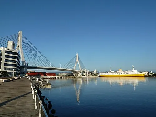 Aomori Bay Bridge Landmark, Aomori Shi25 km E
-
Seibi En Attraction, Hirakawa Shi24 km SE
-
Nakamura River River, Aomori19 km W
Sources & licences
Data last updated: · 2 independent sources