Mount Mizugasawa
Located in Hiranai Machi, Higashitsugaru-gun Coordinates: 40°57′09″ N 140°54′56″ E
- Elevation
- 323 m
- above sea level
- Local time
- UTC+09:00
- Asia/Tokyo · UTC+09:00
- Airports
- AOJ Aomori Airport31 km
- MSJ Misawa Airport / Misawa Air Base47 km
About Mount Mizugasawa
Mount Mizugasawa is a mountain. Location: Hiranai Machi, Higashitsugaru-gun. Elevation: 323 m.
Mount Mizugasawa (水ヶ沢山, Mizugasawa-yama) is a mountain located in Hiranai, Aomori, Japan at the northern end of the Ōu Mountain Range. It is the tallest mountain on Natsudomari Peninsula at a height of 323.4 meters (1,061 ft).
Source: Wikipedia · CC BY-SA 4.0
Photos of Mount Mizugasawa
-

Natsudomari Hantō Okapia2 · CC BY-SA 3.0

Climate of Mount Mizugasawa
Best months for sightseeingBest months for sightseeing: June–September.
This month · November
A wet month
Day 9° · Night 1° · Rain 111 mm
- Hottest month
- August (day 24°)
- Coldest month
- January (night -6°)
- Wettest month
- September (148 mm)
- Driest month
- April (72 mm)
Bars: average monthly low and high temperature. Below: precipitation. Monthly averages for 1970–2000 at about 18 km resolution, adjusted for elevation. Highlighted months are mild and relatively dry. Source: WorldClim 2.1 (CC BY 4.0).
Show values as a table
| Month | Jan | Feb | Mar | Apr | May | Jun | Jul | Aug | Sep | Oct | Nov | Dec |
|---|---|---|---|---|---|---|---|---|---|---|---|---|
| Average high (°C) | 0° | 0° | 3° | 10° | 15° | 18° | 22° | 24° | 21° | 15° | 9° | 2° |
| Average low (°C) | -6° | -6° | -3° | 2° | 7° | 11° | 16° | 17° | 13° | 7° | 1° | -3° |
| Precipitation (mm) | 108 | 89 | 75 | 72 | 75 | 88 | 113 | 140 | 148 | 108 | 111 | 108 |
Other places to visit in this season: June July August September
How to get to Mount Mizugasawa
The nearest airport is Aomori Airport (AOJ), 31 km to the southwest as the crow flies. The nearest large city is Aomori, 22 km to the southwest.
Airports
- Aomori Airport (AOJ) Aomori 31 kmsouthwest
- Misawa Airport / Misawa Air Base (MSJ) Misawa 47 kmsoutheast
- Hakodate Airport (HKD) Hakodate 91 kmnorth
Nearby large cities
- Aomori Population: 298.4K 22 kmsouthwest
- Hirosaki Population: 168.7K 55 kmsouthwest
- Hachinohe Population: 239K 70 kmsoutheast
- Hakodate Population: 275.7K 93 kmnorth
- Morioka Population: 290.7K 141 kmsouth
Straight-line distances; road distances are longer. Airport data: OurAirports.
Day trips from Mount Mizugasawa
Within 100 km: 6 historic and cultural sites, 16 natural sites, 13 lakes, rivers and coasts.
0–25 km6 places
- Tai-jima Island 19 kmN
- Eboshi-dake Mountain 17 kmSE
- Mutsu Bay Natural site 16 kmNW
- Natsudomari Hantō Natural site 2 kmS
25–60 km12 places
- Usoriyama-ko Lake 43 kmN
- Osore-zan Mountain 41 kmN
- Seibi En Attraction 47 kmSW
- Lake Jūsan Lake 49 kmW
60–100 km17 places
- Oirase Gawa River 85 kmW
- Shirakami Sanchi Mountain 82 kmSW
- Mount Iwaki Mountain 61 kmSW
- Daisengen-dake Mountain 94 kmNW
Straight-line distances.
Nearest towns and villages
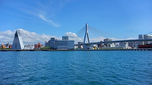

Nearby attractions & nature
Everything nearby-
Natsudomari Hantō Natural site, Aomori2.1 km S
-
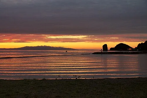 Aomori Wan Natural site, Aomori12 km W
-
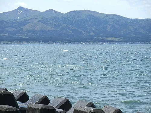 Eboshi-dake Mountain, Tōhoku Machi17 km SE
-
 Mutsu Bay Natural site, Aomori16 km NW
-
Tai-jima Island, Japan19 km N
-
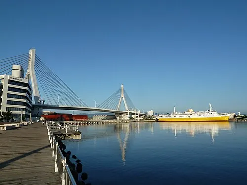 Aomori Bay Bridge Landmark, Aomori Shi20 km SW
Sources & licences
Data last updated: · 2 independent sources