- Population
- 168,739
- 168.7K
- Elevation
- 45 m
- above sea level
- Local time
- UTC+09:00
- Asia/Tokyo · UTC+09:00
- Airports
- AOJ Aomori Airport24 km
- ONJ Odate Noshiro Airport45 km
About Hirosaki
Hirosaki is a city. Location: Hirosaki Shi, Aomori. Population: 168,739. Elevation: 45 m.
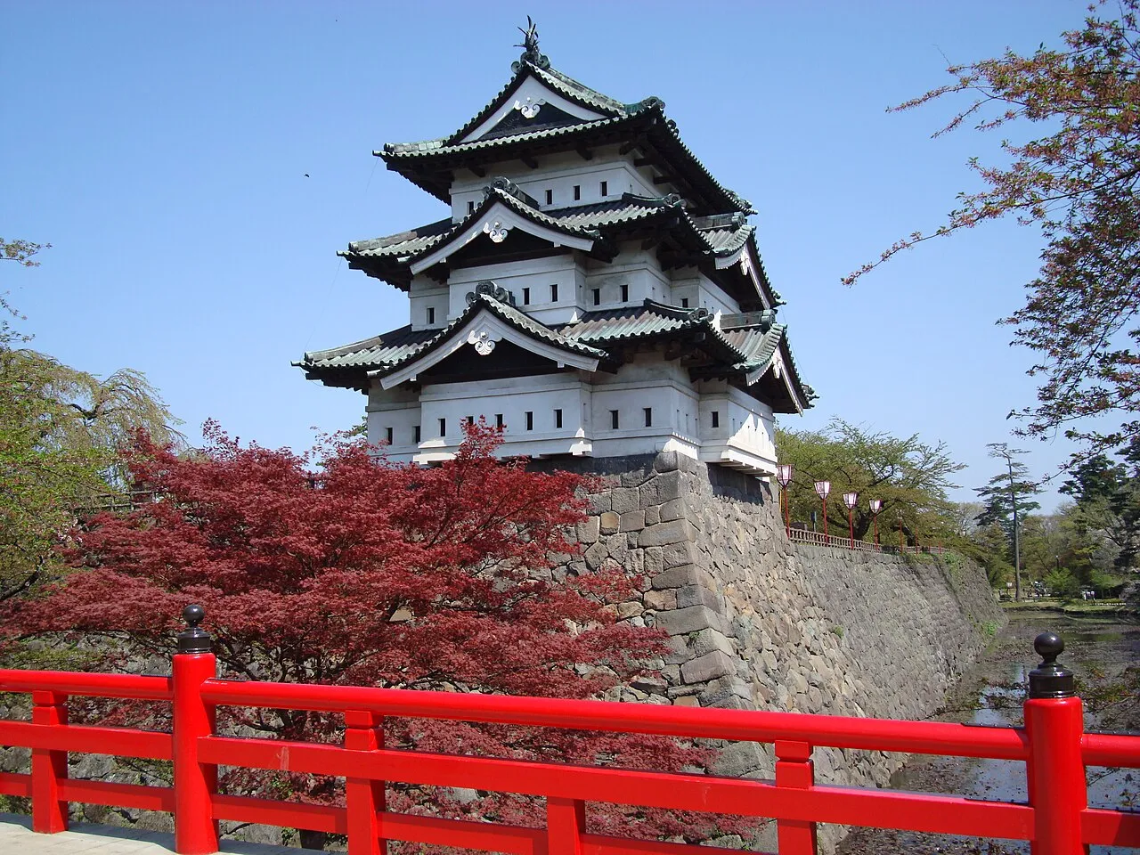
Hirosaki (弘前市, Hirosaki-shi) is a city located in western Aomori Prefecture, Japan. As of 1 January 2026, the city had an estimated population of 157,031 in 84,998 households, and a population density of 300 per square kilometre (780/sq mi). The total area of the city is 524.20 square kilometers (202.39 sq mi). Hirosaki developed as a castle town for the 100,000 koku Hirosaki Domain ruled by the Tsugaru clan. The city is currently a regional commercial center, and the largest producer of apples in Japan.
Source: Wikipedia · CC BY-SA 4.0
Photos of Hirosaki
-

Raita Futo from Tokyo, Japan · CC BY 2.0 -

歯河長瀞夫 · CC BY 4.0 -

Qurren · CC BY-SA 4.0 -

くろふね · CC BY 3.0 -

Kaburamata · CC BY-SA 4.0


Travel notes for Hirosaki
From Wikivoyage
Hirosaki (弘前) is a city in Aomori prefecture, in the northern Tohoku region of the main Japanese island Honshu.
Understand+
Hirosaki was the capital of the Tsugaru clan that once ruled over much of Tohoku's northern parts. Occasionally called "the Kyoto of the North", this hyperbole is backed up mostly by an abundance of temples, a castle's remains, and a famous version of the Nebuta Festival, called the Neputa Festival in Hirosaki.
Tourist information site:
The local tourist association has a multilingual guide site.
Get in+
By plane:
The closest airport is in Aomori (AOJ IATA).
By train:
Hirosaki is on the JR Ōu Main Line (奥羽本線) connecting Aomori, Akita and Fukushima.
From Tokyo Station, take the Tohoku Shinkansen Hayate or Hayabusa train to Shin-Aomori, then change to the Tsugaru Limited Express train or a Local Ou Main Line train bound for Akita/Odate. The trip takes 4 hours 15 minutes at a cost of ¥16,700. There is also a seasonal "Resort Shirakami" train connecting Akita and Aomori via the Gono line that makes a stop here. If you are coming in from Akita, unless you are taking the Resort Shirakami train for the view, it is far quicker to take the Tsugaru train. For foreign tourists heading from Tokyo, the better deal is to purchase a JR East Rail Pass or the national Japan Rail Pass.
Local trains from Aomori depart once per hour and take about 45 minutes (¥650). There are also additional Rapid trains at the same price during rush hour.
Source: Wikivoyage · CC BY-SA 4.0 · abridged
Places bordering Hirosaki
- Tsugaru
- Hirakawa
- Ōdate
- Tsuruta Machi
- Itayanagi Machi
- Nishimeya Mura
- Ajigasawa Machi
- Ōwani Machi
- Fujisaki
- Inakadate Mura
Twin towns and sister cities of Hirosaki
- Shari Chō· Japan
- Ōta· Japan
Source: Wikidata. Only places with a page on this site are shown.
Population of Hirosaki over time
| 2010 | 183,473 | |
|---|---|---|
| 2015 | 177,411 | |
| 2021 | 167,803 |
Censuses and official estimates; source: Wikidata.
Climate of Hirosaki
Best months for sightseeingBest months for sightseeing: May–July, September.
This month · November
A wet month
Day 11° · Night 3° · Rain 126 mm
- Hottest month
- August (day 28°)
- Coldest month
- January (night -5°)
- Wettest month
- September (160 mm)
- Driest month
- May (85 mm)
Bars: average monthly low and high temperature. Below: precipitation. Monthly averages for 1970–2000 at about 18 km resolution, adjusted for elevation. Highlighted months are mild and relatively dry. Source: WorldClim 2.1 (CC BY 4.0).
Show values as a table
| Month | Jan | Feb | Mar | Apr | May | Jun | Jul | Aug | Sep | Oct | Nov | Dec |
|---|---|---|---|---|---|---|---|---|---|---|---|---|
| Average high (°C) | 1° | 2° | 5° | 13° | 18° | 22° | 26° | 28° | 24° | 18° | 11° | 4° |
| Average low (°C) | -5° | -4° | -1° | 4° | 9° | 14° | 19° | 20° | 15° | 9° | 3° | -2° |
| Precipitation (mm) | 114 | 93 | 86 | 86 | 85 | 99 | 139 | 152 | 160 | 121 | 126 | 129 |
Other places to visit in this season: May June July September
How to get to Hirosaki
The nearest airport is Aomori Airport (AOJ), 24 km to the northeast as the crow flies. The nearest large city is Aomori, 33 km to the northeast.
Airports
- Aomori Airport (AOJ) Aomori 24 kmnortheast
- Odate Noshiro Airport (ONJ) Kitaakita 45 kmsouth
- Misawa Airport / Misawa Air Base (MSJ) Misawa 77 kmeast
Nearby large cities
- Aomori Population: 298.4K 33 kmnortheast
- Hachinohe Population: 239K 88 kmeast
- Akita Population: 307.7K 102 kmsouth
- Morioka Population: 290.7K 115 kmsoutheast
- Hakodate Population: 275.7K 133 kmnorth
Straight-line distances; road distances are longer. Airport data: OurAirports.
Day trips from Hirosaki
Within 100 km: 5 historic and cultural sites, 17 natural sites, 15 lakes, rivers and coasts.
0–25 km3 places
- Seibi En Attraction 9 kmE
- Mount Iwaki Mountain 16 kmNW
- Mount Bonju Mountain 25 kmN
25–60 km14 places
- Oirase Gawa River 44 kmW
- Lake Jūsan Lake 49 kmN
- Shirakami Sanchi Mountain 28 kmSW
- Eboshi-dake Mountain 54 kmNE
60–100 km20 places
- Oga Quasi National Park Natural site 97 kmSW
- Oga Peninsula Natural site 93 kmSW
- Akita Port Tower Landmark 100 kmS
- Lake Tazawa Lake 99 kmS
Straight-line distances.
Hirosaki and similar cities
Side by side with cities of similar size in the same country: population, elevation and climate.
| Measure | Hirosaki | Chuo | Kushiro | Oyama |
|---|---|---|---|---|
| Population | 168.7K | 169.2K | 167.9K | 167.6K |
| Elevation | 45 m | 1 m | 6 m | 41 m |
| Summer day (hottest month) | 28° | 31° | 21° | 30° |
| Winter night (coldest month) | -5° | 1° | -11° | -2° |
| Annual rainfall | 1,390 mm | 1,432 mm | 1,054 mm | 1,289 mm |
| Best months | May–Jul, Sep | May–Jun, Oct | Jul–Sep | May–Jun, Sep–Oct |
| Distance | — | 550 km | 419 km | 480 km |
Climate values are 1970–2000 monthly averages; straight-line distance.
Nearby attractions & nature
Everything nearby-
Seibi En Attraction, Hirakawa Shi8.6 km E
-
 Mount Iwaki Mountain, Aomori16 km NW
-
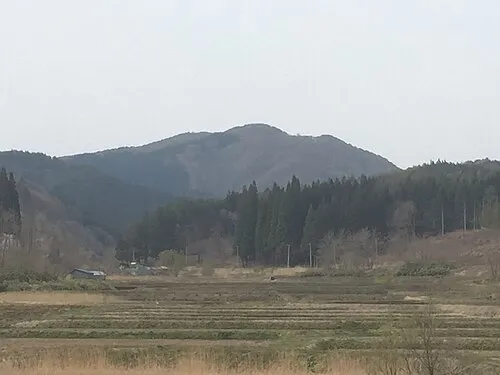 Mount Bonju Mountain, Goshogawara Shi25 km N
Sources & licences
Data last updated: · 2 independent sources