- Population
- 37,427
- 37.4K
- Elevation
- 3 m
- above sea level
- Local time
- UTC+09:00
- Asia/Tokyo · UTC+09:00
- Places inside
- 4
- listed under Kitatsugaru Gun
- Airports
- AOJ Aomori Airport33 km
- MSJ Misawa Airport / Misawa Air Base84 km
About Kitatsugaru Gun
Kitatsugaru Gun is a district. Location: Aomori, Japan. Population: 37,427.
Japan > Tōhoku region > Aomori Prefecture > Kitatsugaru District Kitatsugaru District (北津軽郡, Kitatsugaru-gun) is a rural district located in Aomori Prefecture, Japan. As of September 2013, the district had an estimated population of 40,171 and an area of 304.54 km2. Much the city of Goshogawara and part of the city of Aomori was formerly part of Kitatsugaru District. In terms of national politics, the district is represented in the Diet of Japan's House of Representatives as a part of the Aomori 3rd district.
Source: Wikipedia · CC BY-SA 4.0
At a glance
- Built
- 1878
- Area
- 305 km²
Source: Wikidata
Places bordering Kitatsugaru Gun
- Hirosaki
- Tsugaru
- Goshogawara
Climate of Kitatsugaru Gun
Best months for sightseeingBest months for sightseeing: May–September.
This month · November
A wet month
Day 10° · Night 3° · Rain 118 mm
- Hottest month
- August (day 27°)
- Coldest month
- January (night -6°)
- Wettest month
- September (153 mm)
- Driest month
- April (76 mm)
Bars: average monthly low and high temperature. Below: precipitation. Monthly averages for 1970–2000 at about 18 km resolution, adjusted for elevation. Highlighted months are mild and relatively dry. Source: WorldClim 2.1 (CC BY 4.0).
Show values as a table
| Month | Jan | Feb | Mar | Apr | May | Jun | Jul | Aug | Sep | Oct | Nov | Dec |
|---|---|---|---|---|---|---|---|---|---|---|---|---|
| Average high (°C) | 0° | 1° | 6° | 13° | 18° | 21° | 24° | 27° | 23° | 17° | 10° | 3° |
| Average low (°C) | -6° | -5° | -1° | 4° | 9° | 14° | 18° | 20° | 15° | 9° | 3° | -3° |
| Precipitation (mm) | 111 | 90 | 80 | 76 | 82 | 88 | 121 | 138 | 153 | 117 | 118 | 119 |
Other places to visit in this season: May June July August September
How to get to Kitatsugaru Gun
The nearest airport is Aomori Airport (AOJ), 33 km to the southeast as the crow flies. The nearest large city is Aomori, 30 km to the southeast.
Airports
- Aomori Airport (AOJ) Aomori 33 kmsoutheast
- Misawa Airport / Misawa Air Base (MSJ) Misawa 84 kmeast
- Odate Noshiro Airport (ONJ) Kitaakita 85 kmsouth
Nearby large cities
- Aomori Population: 298.4K 30 kmsoutheast
- Hirosaki Population: 168.7K 41 kmsouth
- Hakodate Population: 275.7K 94 kmnorth
- Hachinohe Population: 239K 104 kmsoutheast
- Akita Population: 307.7K 141 kmsouth
Straight-line distances; road distances are longer. Airport data: OurAirports.
Places in Kitatsugaru Gun
4 placesBar: population relative to the most populous place in this list.
Cities & villages1
- Kodomari · Village
Nearby attractions & nature
Everything nearby-
Iwaki River River, Aomori8.1 km NW
-
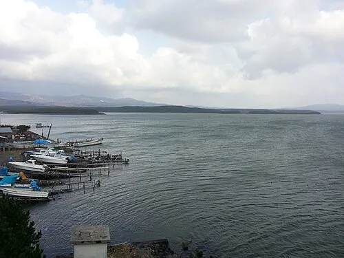 Lake Jūsan Lake, Aomori10 km NW
-
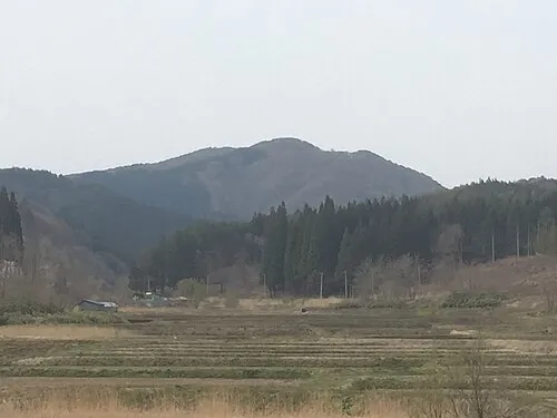 Mount Bonju Mountain, Goshogawara Shi22 km SE
Sources & licences
Data last updated: · 2 independent sources