Cape Shiriya
Located in Higashidōri Mura, Shimokita-gun Coordinates: 41°25′51″ N 141°27′45″ E
- Elevation
- 4 m
- above sea level
- Local time
- UTC+09:00
- Asia/Tokyo · UTC+09:00
- Airports
- HKD Hakodate Airport65 km
- MSJ Misawa Airport / Misawa Air Base81 km
About Cape Shiriya
Cape Shiriya is a natural site. Location: Higashidōri Mura, Shimokita-gun.
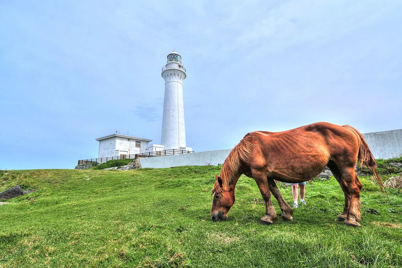
Cape Shiriya (尻屋崎, Shiriyazaki) is a headland on the northeastern point of the island of Honshu in Japan. It is located within the borders of the town of Higashidōri, Aomori in northern Shimokita Peninsula, and is part of the Shimokita Hantō Quasi-National Park. The cape is on the border of Tsugaru Strait separating Honshu from Hokkaido, and the Pacific Ocean. Shiriyazaki Lighthouse is located on Cape Shiriya.
Source: Wikipedia · CC BY-SA 4.0
Climate of Cape Shiriya
Best months for sightseeingBest months for sightseeing: June–September.
This month · November
A wet month
Day 11° · Night 3° · Rain 104 mm
- Hottest month
- August (day 25°)
- Coldest month
- February (night -4°)
- Wettest month
- September (167 mm)
- Driest month
- February (65 mm)
Bars: average monthly low and high temperature. Below: precipitation. Monthly averages for 1970–2000 at about 18 km resolution, adjusted for elevation. Highlighted months are mild and relatively dry. Source: WorldClim 2.1 (CC BY 4.0).
Show values as a table
| Month | Jan | Feb | Mar | Apr | May | Jun | Jul | Aug | Sep | Oct | Nov | Dec |
|---|---|---|---|---|---|---|---|---|---|---|---|---|
| Average high (°C) | 3° | 3° | 5° | 11° | 16° | 18° | 22° | 25° | 22° | 17° | 11° | 6° |
| Average low (°C) | -3° | -4° | -2° | 3° | 8° | 12° | 16° | 18° | 15° | 8° | 3° | -1° |
| Precipitation (mm) | 81 | 65 | 68 | 84 | 87 | 103 | 131 | 147 | 167 | 108 | 104 | 81 |
Other places to visit in this season: June July August September
How to get to Cape Shiriya
The nearest airport is Hakodate Airport (HKD), 65 km to the northwest as the crow flies. The nearest large city is Hakodate, 72 km to the northwest.
Airports
- Hakodate Airport (HKD) Hakodate 65 kmnorthwest
- Misawa Airport / Misawa Air Base (MSJ) Misawa 81 kmsouth
- Aomori Airport (AOJ) Aomori 101 kmsouthwest
Nearby large cities
- Hakodate Population: 275.7K 72 kmnorthwest
- Aomori Population: 298.4K 92 kmsouthwest
- Hachinohe Population: 239K 103 kmsouth
- Hirosaki Population: 168.7K 125 kmsouthwest
- Tomakomai Population: 174.8K 134 kmnorth
Straight-line distances; road distances are longer. Airport data: OurAirports.
Day trips from Cape Shiriya
Within 100 km: 3 historic and cultural sites, 12 natural sites, 7 lakes, rivers and coasts.
0–25 km1 place
- Ōhata-gawa River 25 kmW
25–60 km5 places
- Mount E Mountain 48 kmNW
- Usoriyama-ko Lake 33 kmSW
- Osore-zan Mountain 36 kmSW
- Mount Maru Mountain 56 kmNW
60–100 km16 places
- Lake Ogarawa Lake 73 kmS
- Oirase River River 92 kmS
- Tokoro River River 83 kmNW
- Shiryōkaku Historic site 72 kmNW
Straight-line distances.
Nearest towns and villages
-
 Mutsu City, Mutsu Shi26 km SW
-
 Yokohama Machi Municipality, Kamikita-gun43 km S
-
Kazamaura Mura Municipality, Shimokita-gun38 km W
-
 Rokkasho Mura Municipality, Kamikita-gun54 km S
-
 Ōma Machi Municipality, Shimokita-gun45 km W
-
Ōma Town, Ōma Machi47 km W
Sources & licences
Data last updated: · 2 independent sources