- Elevation
- 54 m
- above sea level
- Local time
- UTC+09:00
- Asia/Tokyo · UTC+09:00
- Places inside
- 4
- listed under Shimokita-gun
- Airports
- MSJ Misawa Airport / Misawa Air Base64 km
- HKD Hakodate Airport70 km
About Shimokita-gun
Shimokita-gun is a district. Location: Aomori, Japan.
Shimokita District (下北郡, Shimokita-gun) is a district located in Aomori Prefecture, Japan. It occupies most of the northern handle of Shimokita Peninsula with the exception of Mutsu City and contains the most northern point on the island of Honshū. It is also home to the Japanese macaque, making it the northernmost natural habitat for monkeys anywhere in the world. As of 2009, the district has an estimated population of 18,297 and a density of 33.2 persons per km2. The total area was 551.08 km2.
Source: Wikipedia · CC BY-SA 4.0
At a glance
- Built
- 1878
- Area
- 552 km²
Source: Wikidata
Places bordering Shimokita-gun
- Mutsu
Climate of Shimokita-gun
Best months for sightseeingBest months for sightseeing: June–September.
This month · November
A wet month
Day 10° · Night 3° · Rain 103 mm
- Hottest month
- August (day 25°)
- Coldest month
- February (night -5°)
- Wettest month
- September (167 mm)
- Driest month
- February (67 mm)
Bars: average monthly low and high temperature. Below: precipitation. Monthly averages for 1970–2000 at about 18 km resolution, adjusted for elevation. Highlighted months are mild and relatively dry. Source: WorldClim 2.1 (CC BY 4.0).
Show values as a table
| Month | Jan | Feb | Mar | Apr | May | Jun | Jul | Aug | Sep | Oct | Nov | Dec |
|---|---|---|---|---|---|---|---|---|---|---|---|---|
| Average high (°C) | 2° | 2° | 5° | 11° | 16° | 18° | 22° | 25° | 22° | 17° | 10° | 5° |
| Average low (°C) | -4° | -5° | -2° | 3° | 8° | 12° | 16° | 18° | 14° | 8° | 3° | -2° |
| Precipitation (mm) | 83 | 67 | 69 | 83 | 85 | 103 | 130 | 146 | 167 | 108 | 103 | 82 |
Other places to visit in this season: June July August September
How to get to Shimokita-gun
The nearest airport is Misawa Airport / Misawa Air Base (MSJ), 64 km to the south as the crow flies. For international flights: Hakodate Airport (HKD) (70 km). The nearest large city is Aomori, 72 km to the southwest.
Airports
- Misawa Airport / Misawa Air Base (MSJ) Misawa 64 kmsouth
- Hakodate Airport (HKD) Hakodate 70 kmnorthwest
- Aomori Airport (AOJ) Aomori 81 kmsouthwest
Nearby large cities
- Aomori Population: 298.4K 72 kmsouthwest
- Hakodate Population: 275.7K 75 kmnorthwest
- Hachinohe Population: 239K 87 kmsouth
- Hirosaki Population: 168.7K 105 kmsouthwest
- Tomakomai Population: 174.8K 153 kmnorth
Straight-line distances; road distances are longer. Airport data: OurAirports.
Places in Shimokita-gun
4 placesBar: population relative to the most populous place in this list.
Nearby attractions & nature
Everything nearby-
Ōhata-gawa River, Aomori21 km NW
-
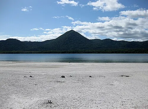 Osore-zan Mountain, Mutsu Shi23 km W
-
Usoriyama-ko Lake, Japan20 km W
Sources & licences
Data last updated: · 2 independent sources