- Elevation
- 76 m
- above sea level
- Local time
- UTC+09:00
- Asia/Tokyo · UTC+09:00
- Airports
- HIJ Hiroshima Airport32 km
- MYJ Matsuyama Airport67 km
About Yuge-habu
Yuge-habu is a village. Location: Kamijima Chō, Ochi-gun. Elevation: 76 m.
Yuge (弓削町, Yuge-chō) was a town located in Ochi District, Ehime Prefecture, Japan. The municipality consisted of the four inhabited islands of Yugeshima, Sashima, Teshima, and Hyakkanjima. The town office was located in Yugeshima (now Kamishima Town Hall). Yugeshima Village was established with the creation of the modern municipalities system on December 15, 1889. In September 1895, Uoshima became a separate village. Yuge was elevated to town status on January 1, 1953.
Source: Wikipedia · CC BY-SA 4.0
At a glance
- Built
- 1953
Source: Wikidata
Climate of Yuge-habu
Best months for sightseeingBest months for sightseeing: May–June, October.
This month · November
Outside the best season
Day 17° · Night 9° · Rain 67 mm
Better nearby cities in November
- Kochi · 85 km south18°
- Ōita · 187 km southwest18°
- Beppu · 192 km southwest17°
- Hottest month
- August (day 31°)
- Coldest month
- February (night 2°)
- Wettest month
- June (229 mm)
- Driest month
- December (34 mm)
Bars: average monthly low and high temperature. Below: precipitation. Monthly averages for 1970–2000 at about 18 km resolution, adjusted for elevation. Highlighted months are mild and relatively dry. Source: WorldClim 2.1 (CC BY 4.0).
Show values as a table
| Month | Jan | Feb | Mar | Apr | May | Jun | Jul | Aug | Sep | Oct | Nov | Dec |
|---|---|---|---|---|---|---|---|---|---|---|---|---|
| Average high (°C) | 9° | 9° | 12° | 17° | 22° | 25° | 29° | 31° | 27° | 22° | 17° | 12° |
| Average low (°C) | 2° | 2° | 4° | 9° | 14° | 18° | 23° | 24° | 20° | 14° | 9° | 4° |
| Precipitation (mm) | 40 | 56 | 88 | 137 | 140 | 229 | 184 | 96 | 185 | 110 | 67 | 34 |
How to get to Yuge-habu
The nearest airport is Hiroshima Airport (HIJ), 32 km to the northwest as the crow flies. The nearest large city is Onomichi, 17 km to the north.
Airports
- Hiroshima Airport (HIJ) Hiroshima 32 kmnorthwest
- Matsuyama Airport (MYJ) Matsuyama 67 kmsouthwest
- Takamatsu Airport (TAK) Takamatsu 75 kmeast
Nearby large cities
- Onomichi Population: 131.2K 17 kmnorth
- Fukuyama Population: 468.8K 28 kmnortheast
- Imabari Population: 171K 29 kmsouthwest
- Niihama Population: 123.1K 35 kmsouth
- Saijō Population: 104.8K 39 kmsouth
Straight-line distances; road distances are longer. Airport data: OurAirports.
Day trips from Yuge-habu
Within 100 km: 10 historic and cultural sites, 12 natural sites, 32 lakes, rivers and coasts.
0–25 km5 places
- Ikuchi Jima Island 9 kmW
- Ōmi Shima Island 17 kmW
- Ō Shima Island 19 kmSW
- Ōkuno Shima Island 20 kmW
25–60 km17 places
- Shiwaku Islands Island 49 kmE
- Manabe Island Island 36 kmE
- Mount Inamura Mountain 59 kmS
- Shikoku-sammyaku Mountain 52 kmSE
60–100 km32 places
- Shikoku Island 63 kmSE
- Nao Shima Island 75 kmE
- Te Shima Island 84 kmE
- Ao Island Island 89 kmSW
Straight-line distances.
Nearby attractions & nature
Everything nearby-
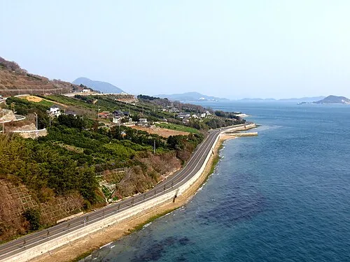 Ikuchi Jima Island, Hiroshima9.4 km W
-
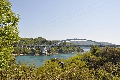 Ōmi Shima Island, Imabari17 km W
-
 Tatara Bridge Landmark, Japan13 km W
-
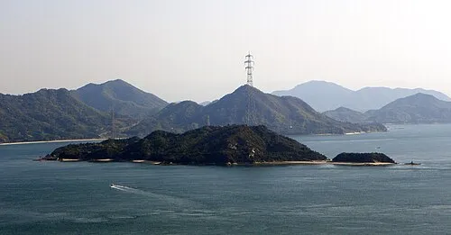 Ōkuno Shima Island, Hiroshima20 km W
-
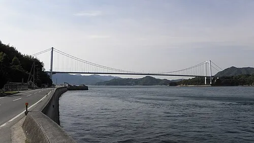 Ō Shima Island, Ehime19 km SW
Sources & licences
Data last updated: · 2 independent sources