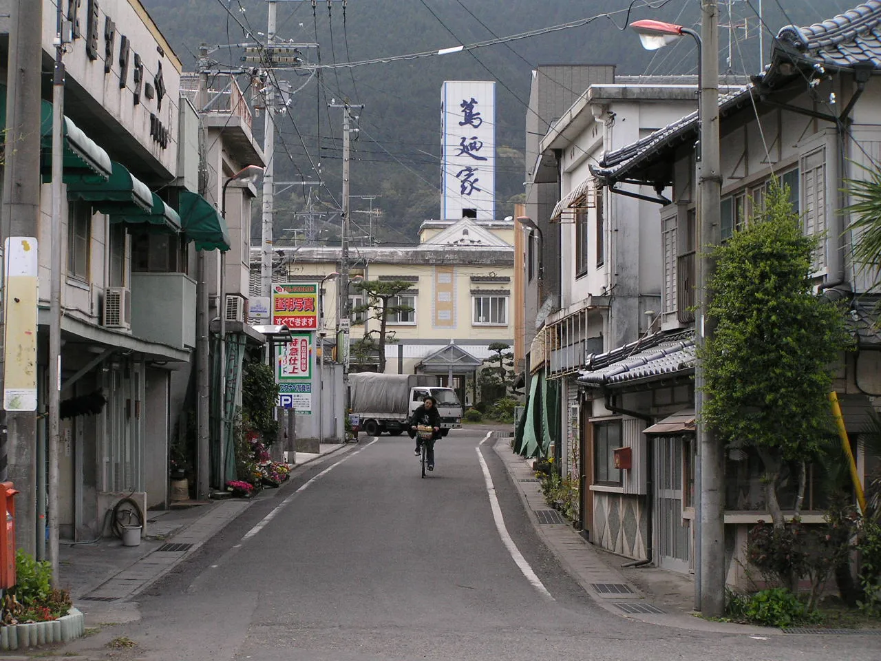
- Population
- 82,754
- 82.8K
- Elevation
- 41 m
- above sea level
- Local time
- UTC+09:00
- Asia/Tokyo · UTC+09:00
- Airports
- KCZ Kochi Ryoma Airport49 km
- TAK Takamatsu Airport51 km
About Shikokuchūō
Shikokuchūō is a city. Location: Shikoku-chūō Shi, Ehime. Population: 82,754. Elevation: 41 m. The best months to visit are May–June, October. The nearest airport is Kochi Ryoma Airport (49 km). Nearby sights include Seki River and Shikoku-sammyaku.
Travel notes for Shikokuchūō
From Wikivoyage
Shikokuchuo (四国中央) is a city in Ehime prefecture.
Understand+
Shikokuchuo City is located in the eastern end of Ehime Prefecture. Shikokuchuo's name translates to "Central Shikoku" and is the only district where all four of Shikoku's prefectures touch.
Tourist information site:
The local tourist association has a Japanese-only guide site.
Source: Wikivoyage · CC BY-SA 4.0 · abridged
Climate of Shikokuchūō
Best months for sightseeingBest months for sightseeing: May–June, October.
This month · November
Outside the best season
Day 17° · Night 9° · Rain 91 mm
Better nearby cities in November
- Kochi · 47 km south18°
- Ōita · 198 km southwest18°
- Beppu · 205 km west17°
- Hottest month
- August (day 31°)
- Coldest month
- January (night 2°)
- Wettest month
- June (317 mm)
- Driest month
- December (54 mm)
Bars: average monthly low and high temperature. Below: precipitation. Monthly averages for 1970–2000 at about 18 km resolution, adjusted for elevation. Highlighted months are mild and relatively dry. Source: WorldClim 2.1 (CC BY 4.0).
Show values as a table
| Month | Jan | Feb | Mar | Apr | May | Jun | Jul | Aug | Sep | Oct | Nov | Dec |
|---|---|---|---|---|---|---|---|---|---|---|---|---|
| Average high (°C) | 9° | 10° | 13° | 19° | 23° | 26° | 30° | 31° | 27° | 22° | 17° | 12° |
| Average low (°C) | 2° | 2° | 5° | 11° | 16° | 20° | 24° | 25° | 21° | 15° | 9° | 4° |
| Precipitation (mm) | 56 | 80 | 123 | 195 | 213 | 317 | 292 | 165 | 263 | 151 | 91 | 54 |
How to get to Shikokuchūō
The nearest airport is Kochi Ryoma Airport (KCZ), 49 km to the south as the crow flies. The nearest large city is Niihama, 23 km to the west.
Airports
- Kochi Ryoma Airport (KCZ) Nankoku 49 kmsouth
- Takamatsu Airport (TAK) Takamatsu 51 kmnortheast
- Hiroshima Airport (HIJ) Hiroshima 77 kmnorthwest
Nearby large cities
- Niihama Population: 123.1K 23 kmwest
- Saijō Population: 104.8K 34 kmwest
- Marugame Population: 109.5K 40 kmnortheast
- Kochi Population: 332.1K 47 kmsouth
- Imabari Population: 171K 52 kmwest
Straight-line distances; road distances are longer. Airport data: OurAirports.
Day trips from Shikokuchūō
Within 100 km: 9 historic and cultural sites, 7 natural sites, 30 lakes, rivers and coasts.
0–25 km3 places
- Shikoku-sammyaku Mountain 19 kmSW
- Seki River River 9 kmW
- Dōzan River River 19 kmE
25–60 km19 places
- Shikoku Island 25 kmS
- Ikuchi Jima Island 54 kmNW
- Ōmi Shima Island 58 kmNW
- Shiwaku Islands Island 48 kmN
60–100 km24 places
- Nao Shima Island 67 kmNE
- Te Shima Island 74 kmNE
- Ogi Shima Island 69 kmNE
- Megi Shima Island 66 kmNE
Straight-line distances.
Shikokuchūō and similar cities
Side by side with cities of similar size in the same country: population, elevation and climate.
| Measure | Shikokuchūō | Kimitsu | Echizen | Amakusa |
|---|---|---|---|---|
| Population | 82.8K | 83.1K | 83.1K | 83.1K |
| Elevation | 41 m | 4 m | 40 m | 6 m |
| Summer day (hottest month) | 31° | 30° | 31° | 31° |
| Winter night (coldest month) | 2° | 1° | 0° | 3° |
| Annual rainfall | 2,000 mm | 1,553 mm | 2,275 mm | 2,085 mm |
| Best months | May–Jun, Oct | May–Jun, Sep–Oct | May–Jun, Sep–Oct | May, Oct |
| Distance | — | 599 km | 320 km | 355 km |
Climate values are 1970–2000 monthly averages; straight-line distance.
Nearby attractions & nature
Everything nearby-
Seki River River, Japan9 km W
-
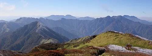 Shikoku-sammyaku Mountain, Japan19 km SW
-
Dōzan River River, Japan19 km E
Sources & licences
Data last updated: