Nishi
Local name: 西区
Located in Fukuoka City, Fukuoka Coordinates: 33°35′26″ N 130°15′41″ E

- Population
- 212,211
- 212.2K
- Elevation
- 21 m
- above sea level
- Local time
- UTC+09:00
- Asia/Tokyo · UTC+09:00
- Places inside
- 1
- listed under Nishi
- Airports
- FUK Fukuoka Airport18 km
- IKI Iki Airport48 km
About Nishi
Nishi is a municipality. Location: Fukuoka City, Fukuoka. Population: 212,211. Elevation: 21 m.
Nishi-ku (西区) is one of the seven wards of Fukuoka City, Japan. Meaning literally "west ward," it is bordered to the east by Sawara-ku, and to the west by Itoshima. As of 2003, it has a population of 173,813 people and an area of 83.81 km2. As of 2016, its population had increased to 206,000 people. It has recently gained additional infrastructure in the form of the Nanakuma Line, in addition to the Fukuoka City Subway and the Chikuhi Line.
Source: Wikipedia · CC BY-SA 4.0
Photos of Nishi
-
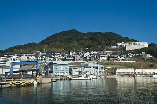
Genkai Island Chihaya Sta · CC BY-SA 4.0

Places bordering Nishi
- Sawara
- Chūō-ku
- Higashi Ku
Population of Nishi over time
| 2010 | 193,280 | |
|---|---|---|
| 2015 | 206,868 | |
| 2020 | 212,211 |
Censuses and official estimates; source: Wikidata.
Climate of Nishi
Best months for sightseeingBest months for sightseeing: May–June, October.
This month · November
Outside the best season
Day 17° · Night 9° · Rain 79 mm
Better nearby cities in November
- Beppu · 120 km east17°
- Ōita · 130 km east18°
- Nobeoka · 172 km southeast18°
- Hottest month
- August (day 30°)
- Coldest month
- January (night 3°)
- Wettest month
- June (288 mm)
- Driest month
- December (62 mm)
Bars: average monthly low and high temperature. Below: precipitation. Monthly averages for 1970–2000 at about 18 km resolution, adjusted for elevation. Highlighted months are mild and relatively dry. Source: WorldClim 2.1 (CC BY 4.0).
Show values as a table
| Month | Jan | Feb | Mar | Apr | May | Jun | Jul | Aug | Sep | Oct | Nov | Dec |
|---|---|---|---|---|---|---|---|---|---|---|---|---|
| Average high (°C) | 9° | 10° | 13° | 18° | 22° | 25° | 29° | 30° | 27° | 22° | 17° | 12° |
| Average low (°C) | 3° | 3° | 6° | 11° | 15° | 19° | 23° | 24° | 20° | 15° | 9° | 5° |
| Precipitation (mm) | 70 | 76 | 108 | 143 | 148 | 288 | 275 | 175 | 204 | 94 | 79 | 62 |
How to get to Nishi
The nearest airport is Fukuoka Airport (FUK), 18 km to the east as the crow flies. The nearest large city is Kasuga, 20 km to the east.
Airports
- Fukuoka Airport (FUK) Fukuoka 18 kmeast
- Iki Airport (IKI) Iki 48 kmwest
- Kyushu Saga International Airport (HSG) Saga 49 kmsouth
Nearby large cities
- Kasuga Population: 111K 20 kmeast
- Ōnojō Population: 102.1K 21 kmeast
- Chikushino-shi Population: 103.3K 26 kmsoutheast
- Karatsu Population: 117.7K 32 kmsouthwest
- Kurume Population: 303.6K 39 kmsoutheast
Straight-line distances; road distances are longer. Airport data: OurAirports.
Day trips from Nishi
Within 100 km: 20 historic and cultural sites, 16 natural sites, 13 lakes, rivers and coasts.
0–25 km17 places
- Shika Island Island 10 kmN
- Mt. Abura Mountain 13 kmSE
- Shōfū-en Natural site 13 kmE
- Rakusui-en Natural site 14 kmE
25–60 km10 places
- Iki Island Island 54 kmNW
- Chikugo River River 51 kmS
- Mount Sarakura Mountain 57 kmNE
- Space World Natural site 60 kmNE
60–100 km22 places
- Hiko Shima Island 71 kmNE
- Hario Jima Island 70 kmSW
- Okino-shima Island 74 kmN
- Mount Unzen Mountain 93 kmS
Straight-line distances.
Nishi and similar cities
Side by side with cities of similar size in the same country: population, elevation and climate.
| Measure | Nishi | Isesaki | Kure | Nishi-Tokyo-shi |
|---|---|---|---|---|
| Population | 212.2K | 211.8K | 214.6K | 207.4K |
| Elevation | 21 m | 62 m | 102 m | 58 m |
| Summer day (hottest month) | 30° | 31° | 31° | 30° |
| Winter night (coldest month) | 3° | -2° | 2° | -1° |
| Annual rainfall | 1,722 mm | 1,256 mm | 1,786 mm | 1,461 mm |
| Best months | May–Jun, Oct | Apr–May, Oct | May–Jun, Oct | May–Jun, Oct |
| Distance | — | 870 km | 225 km | 882 km |
Climate values are 1970–2000 monthly averages; straight-line distance.
Places in Nishi
1 placeNearby attractions & nature
Everything nearby-
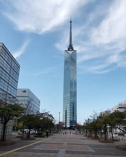 Fukuoka Tower Landmark, Sawara8.4 km E
-
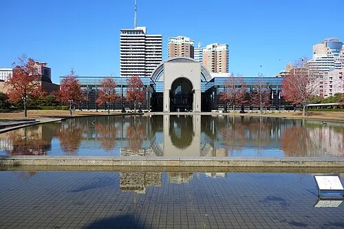 Fukuoka City Museum Museum, Sawara8.5 km E
-
 FUKUOKA PayPay Dome Landmark, Chūō-ku9.4 km E
-
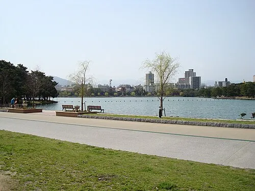 Ōhori Park Natural site, Chūō-ku11 km E
-
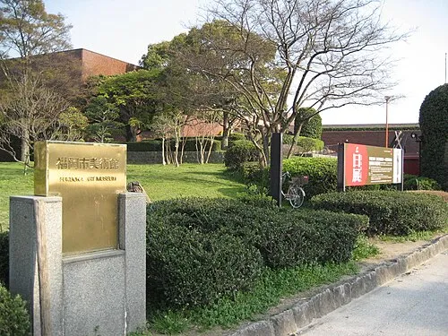 Fukuoka Art Museum Museum, Chūō-ku11 km E
-
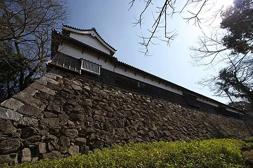 Fukuoka Castle ruins Historic site, Chūō-ku11 km E
-
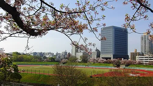 Heiwadai Athletic Stadium Landmark, Chūō-ku11 km E
-
 Our Lady of Victory Cathedral, Fukuoka Attraction, Chūō-ku12 km E
Other cities and towns in Fukuoka City
-
 Hakata Municipality, Fukuoka City17 km E
-
 Higashi Ku Municipality, Fukuoka City16 km NE
Sources & licences
Data last updated: · 2 independent sources