Aizu-Wakamatsu
Local name: 会津若松市
Located in Aizu-wakamatsu Shi, Fukushima Coordinates: 37°29′29″ N 139°56′44″ E
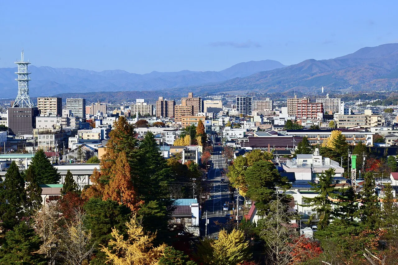
- Population
- 118,159
- 118.2K
- Elevation
- 238 m
- above sea level
- Local time
- UTC+09:00
- Asia/Tokyo · UTC+09:00
- Airports
- FKS Fukushima Airport52 km
- KIJ Niigata Airport90 km
About Aizu-Wakamatsu
Aizu-Wakamatsu is a city. Location: Aizu-wakamatsu Shi, Fukushima. Population: 118,159. Elevation: 238 m.
Aizuwakamatsu (会津若松市, Aizuwakamatsu-shi; Japanese pronunciation: [ä̀í.(d͡)zɨ́.β̞ä́.kä́.mä̀.t͡sɨ̀, -mä́.t͡sɨ̥.ɕì]) is a city in Fukushima Prefecture, Japan. As of 1 January 2021, the city had an estimated population of 118,159 in 50,365 households, and a population density of 310 persons per km2. The total area of the city was 382.97 square kilometres (147.87 sq mi).
Source: Wikipedia · CC BY-SA 4.0
At a glance
- Built
- 1955
- Area
- 383 km²
- Official website
- city.aizuwakamatsu.fukushima.jp
Source: Wikidata
Photos of Aizu-Wakamatsu
-

lumoplank · CC0 -

くろふね · CC BY 3.0 -

Lake Inawashiro Brian Adler 10:14, 1 July 2007 · Public domain -
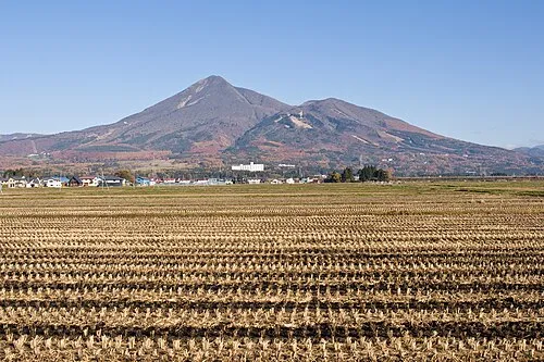
Mount Bandai Σ64 · CC BY 3.0 -
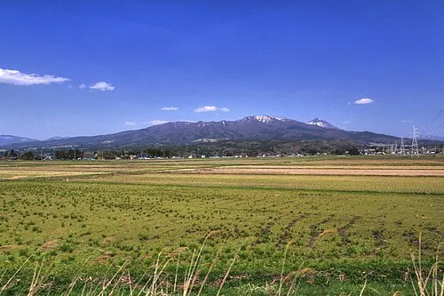
Nekomaga Dake くろふね · CC BY 3.0


Travel notes for Aizu-Wakamatsu
From Wikivoyage
Aizuwakamatsu (会津若松) is the main city in the Aizu region of Fukushima Prefecture, in the north of Honshū island, the largest of Japan. With a population of 120,000, Aizuwakamatsu has a rich warrior history, stretching back 1,000 years. Although the city is most known for the Byakkotai, a force of about 300 young samurai (13-17 year olds) in the Boshin Civil War. Nineteen of them committed suicide, declining surrender. Today, sake and lacquerware are the two main industries in Aizuwakamatsu. The Aizu region has spectacular natural scenery. Most visitors also make a journey to Mt. Bandai and Inawashiro for skiing, fishing and onsen.
Understand+
Tourist Information:
1 Aizu Wakamatsu Station Tourist Information Center (会津若松駅観光案内所). Has pamphlets, maps, and information about local sights, restaurants, and events. If you are a guest staying at any of the ryokan in Higashiyama Onsen or Ashinomaki Onsen, they have a baggage delivery service that will take your baggage to your hotel so you can enjoy the day sightseeing and collect your bags when you check-in. (updated Feb 2024)
2 Aizu Area Information Center (あいづ広域観光情報センターiらんしょ). Pamphlets, maps, and information about each of the cities and towns in the Aizu Region (Western Fukukushima Prefecture). (updated Feb 2024)
SAMURAI CITY Aizuwakamatsu is the city's official multilingual guide site.
Get in+
By plane:
Fukushima Airport only has flights to Osaka Itami Airport and Sapporo Chitose Airport. If you're using this airport, there are buses from the airport to Koriyama Station where you can catch a train bound for Aizu-Wakamatsu Station. For most travelers, Sendai Airport or one of Tokyo's airports will be more convenient. Sendai Airport has buses that travel directly to Aizu-Wakamatsu Station. If you fly into Tokyo, you can transfer to the Shinkansen or take a bus (see below).
By train:
The fastest and most convenient way to access Aizuwakamatsu is to take the Shinkansen from Tokyo to Koriyama, and transfer to the Ban-etsu Saisen Line. It takes about 3 hours and ¥9480.
Tobu Railway and Aizu Railway also serve the area. Although Tobu Railway runs from Asakusa in Tokyo, it takes a lot more time to reach Aizu Wakamatsu than using JR, so these will be most useful for people in the Nikko/Kinugawa Onsen area or those who purchased travel passes from these railways.
By bus:
JR East offers a direct highway bus service to Aizuwakamatsu from Tokyo's Shinjuku Highway Bus Terminal (located near the New South Exit of Shinjuku Station) to Aizuwakamatsu Bus Terminal (located opposite Aizuwakamatsu Station). There are also limited connections from Tokyo Station. It takes about 4 hours with 2 rest stops along the way. A one-way ticket costs around ¥2,500 and can be purchased at any JR ticket office.
There are also buses from Niigata and 4-6 departures arrive per day from Sendai. From Nagoya, there is a night bus to Koriyama from which you can catch a train to Aizu-Wakamatsu Station.
From within the prefecture, there are also buses from Iwaki.
By car:
Source: Wikivoyage · CC BY-SA 4.0 · abridged
Places bordering Aizu-Wakamatsu
- Kōriyama
- Kitakata
- Inawashiro
- Aizu-bange Machi
- Yugawa Mura
- Ten’ei Mura
- Shimogō Machi
- Aizu-misato Machi
Twin towns and sister cities of Aizu-Wakamatsu
- Mutsu· Japan
- Yokosuka· Japan
- Lee's Summit· United States
Source: Wikidata. Only places with a page on this site are shown.
Population of Aizu-Wakamatsu over time
| 2010 | 126,220 | |
|---|---|---|
| 2015 | 124,062 | |
| 2021 | 117,924 |
Censuses and official estimates; source: Wikidata.
Climate of Aizu-Wakamatsu
Best months for sightseeingBest months for sightseeing: May–June, September–October.
This month · November
Outside the best season
Day 12° · Night 4° · Rain 86 mm
Better nearby cities in November
- Kofu · 237 km southwest17°
- Isehara · 239 km south18°
- Odawara · 258 km south19°
- Hottest month
- August (day 29°)
- Coldest month
- January (night -4°)
- Wettest month
- July (169 mm)
- Driest month
- February (74 mm)
Bars: average monthly low and high temperature. Below: precipitation. Monthly averages for 1970–2000 at about 18 km resolution, adjusted for elevation. Highlighted months are mild and relatively dry. Source: WorldClim 2.1 (CC BY 4.0).
Show values as a table
| Month | Jan | Feb | Mar | Apr | May | Jun | Jul | Aug | Sep | Oct | Nov | Dec |
|---|---|---|---|---|---|---|---|---|---|---|---|---|
| Average high (°C) | 4° | 4° | 7° | 16° | 21° | 24° | 28° | 29° | 24° | 18° | 12° | 7° |
| Average low (°C) | -4° | -4° | -1° | 5° | 10° | 15° | 19° | 21° | 16° | 10° | 4° | -1° |
| Precipitation (mm) | 86 | 74 | 81 | 90 | 96 | 142 | 169 | 165 | 169 | 113 | 86 | 82 |
Other places to visit in this season: May June September October
How to get to Aizu-Wakamatsu
The nearest airport is Fukushima Airport (FKS), 52 km to the southeast as the crow flies. For international flights: Niigata Airport (KIJ) (90 km). The nearest large city is Kōriyama, 40 km to the east.
Airports
- Fukushima Airport (FKS) Sukagawa 52 kmsoutheast
- Niigata Airport (KIJ) Niigata 90 kmnorthwest
- Yamagata Airport (GAJ) Higashine 109 kmnorth
Nearby large cities
- Kōriyama Population: 327.7K 40 kmeast
- Fukushima Population: 294.2K 54 kmnortheast
- Yamagata Population: 248.8K 90 kmnortheast
- Iwaki Population: 357.3K 97 kmsoutheast
- Nagaoka Population: 266.9K 97 kmwest
Straight-line distances; road distances are longer. Airport data: OurAirports.
Day trips from Aizu-Wakamatsu
Within 100 km: 1 historic or cultural site, 22 natural sites, 7 lakes, rivers and coasts.
0–25 km6 places
- Lake Hibara Lake 24 kmNE
- Tadami River River 23 kmNW
- Lake Inawashiro Lake 14 kmE
- Tsuruga Castle Historic site 1 kmW
25–60 km9 places
- Echigo Sanmyaku Mountain 39 kmN
- Mount Azuma-kofuji Mountain 38 kmNE
- Mount Adatara Mountain 34 kmNE
- Iimori Yama Mountain 36 kmN
60–100 km15 places
- Asahi Dake Mountain 87 kmN
- Mount Zaō Mountain 84 kmNE
- Mount Zaō Mountain 83 kmNE
- Uono River River 99 kmW
Straight-line distances.
Aizu-Wakamatsu and similar cities
Side by side with cities of similar size in the same country: population, elevation and climate.
| Measure | Aizu-Wakamatsu | Kakegawa | Handa | Sano |
|---|---|---|---|---|
| Population | 118.2K | 117.9K | 117.9K | 117.7K |
| Elevation | 238 m | 32 m | 1 m | 36 m |
| Summer day (hottest month) | 29° | 30° | 31° | 30° |
| Winter night (coldest month) | -4° | 1° | 1° | -2° |
| Annual rainfall | 1,353 mm | 2,254 mm | 1,867 mm | 1,265 mm |
| Best months | May–Jun, Sep–Oct | May–Jun, Sep–Oct | May–Jun, Oct | May–Jun, Sep–Oct |
| Distance | — | 349 km | 396 km | 134 km |
Climate values are 1970–2000 monthly averages; straight-line distance.
Nearby attractions & nature
Everything nearby-
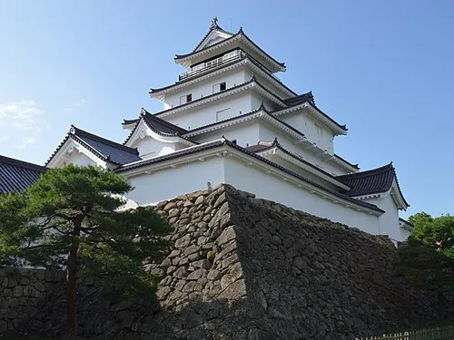 Tsuruga Castle Historic site, Aizu-wakamatsu Shi1.5 km W
-
Lake Inawashiro Lake, Fukushima14 km E
-
Nekomaga Dake Mountain, Bandai Machi15 km NE
-
Mount Bandai Mountain, Bandai Machi16 km NE
-
 Lake Hibara Lake, Fukushima24 km NE
-
 Tadami River River, Fukushima23 km NW
Sources & licences
Data last updated: · 2 independent sources