Tatebayashi
Local name: 館林市
Located in Tatebayashi Shi, Gunma Coordinates: 36°15′00″ N 139°32′00″ E
- Population
- 81,274
- 81.3K
- Elevation
- 28 m
- above sea level
- Local time
- UTC+09:00
- Asia/Tokyo · UTC+09:00
- Airports
- IBR Ibaraki Airport80 km
- HND Tokyo Haneda International Airport81 km
About Tatebayashi
Tatebayashi is a city. Location: Tatebayashi Shi, Gunma. Population: 81,274. Elevation: 28 m.
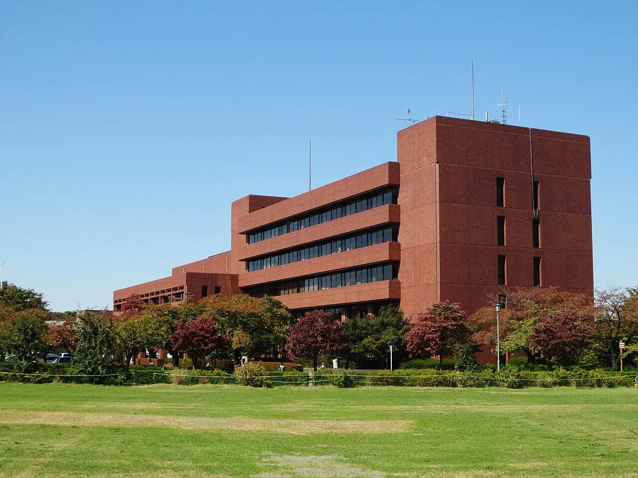
Tatebayashi (館林市, Tatebayashi-shi) is a city located in Gunma Prefecture, Japan. As of 1 February 2024, the city had an estimated population of 74,027 in 34,486 households, and a population density of 1200 people per km². The total area of the city is 60.97 square kilometres (23.54 sq mi). Tatebayashi is famous for Azalea Hill Park and Bunbuku Chagama of Morin-ji temple.
Source: Wikipedia · CC BY-SA 4.0
Photos of Tatebayashi
-

Qurren · CC BY-SA 3.0 -

Iizuka 龍 · CC BY 3.0 -

Taketarou · Public domain -

竹太郎(taketarou) · CC BY-SA 3.0 -

Taketarou · CC BY-SA 1.0


Travel notes for Tatebayashi
From Wikivoyage
Tatebayashi (館林) is a city in Gunma prefecture in the Kanto region of Japan.
Understand+
Situated on the Kanto Plain approximately 60 km north of Tokyo, Tatebayashi City covers an area of 61 square kilometers sandwiched between Watarase River northward and Tone River southward. As of 2007, the city has an estimated population of 80,629.
This city prospered as a castle town since 1590 and is now a cultural town with the motto of "Clean water and green vegetation".
From spring till early summer, many people visit this town to see moss phlox, cherry blossoms, azaleas, Japanese irises and in winter swans fly to Tatara Lake from Siberia.
Tourist information site:
The local tourist association has a multilingual guide site.
Get in+
By plane:
By train:
The Tōbu Isesaki line express train Ryōmō, which requires seat reservations, stops at Tatebayashi on its run between Asakusa and Akagi (or Kuzuu or Isesaki). It takes one hour from Asakusa and 50 minutes from Kita-Senju.
By car:
Take the Tatebayashi exit from the Tōhoku Expressway and follow National Route 354 west toward Ota.
National Route 50 runs along the north beyond Watarase River.
National Route 122 runs from the north, Ota to the south, Hanyu.
National Route 354 runs from the east, Koga to the west, Ota.
Source: Wikivoyage · CC BY-SA 4.0 · abridged
Places bordering Tatebayashi
- Ōra Machi
- Meiwa Machi
- Itakura-machi
- Ashikaga
- Sano
Twin towns and sister cities of Tatebayashi
- Toyota· Japan
- Tendō· Japan
Source: Wikidata. Only places with a page on this site are shown.
Population of Tatebayashi over time
| 2010 | 78,608 | |
|---|---|---|
| 2015 | 76,667 | |
| 2021 | 73,991 |
Censuses and official estimates; source: Wikidata.
Climate of Tatebayashi
Best months for sightseeingBest months for sightseeing: May–June, October.
This month · November
Outside the best season
Day 16° · Night 6° · Rain 68 mm
Better nearby cities in November
- Isehara · 97 km south18°
- Kofu · 109 km southwest17°
- Odawara · 116 km south19°
- Hottest month
- August (day 30°)
- Coldest month
- January (night -2°)
- Wettest month
- September (185 mm)
- Driest month
- January (36 mm)
Bars: average monthly low and high temperature. Below: precipitation. Monthly averages for 1970–2000 at about 18 km resolution, adjusted for elevation. Highlighted months are mild and relatively dry. Source: WorldClim 2.1 (CC BY 4.0).
Show values as a table
| Month | Jan | Feb | Mar | Apr | May | Jun | Jul | Aug | Sep | Oct | Nov | Dec |
|---|---|---|---|---|---|---|---|---|---|---|---|---|
| Average high (°C) | 9° | 9° | 12° | 18° | 23° | 25° | 28° | 30° | 26° | 21° | 16° | 11° |
| Average low (°C) | -2° | -1° | 2° | 8° | 13° | 17° | 21° | 22° | 18° | 12° | 6° | 0° |
| Precipitation (mm) | 36 | 51 | 72 | 97 | 116 | 162 | 145 | 154 | 185 | 141 | 68 | 38 |
How to get to Tatebayashi
The nearest airport is Ibaraki Airport (IBR), 80 km to the east as the crow flies. The nearest large city is Sano, 9 km to the northeast.
Airports
- Ibaraki Airport (IBR) Omitama 80 kmeast
- Tokyo Haneda International Airport (HND) Tokyo 81 kmsouth
- Narita International Airport (NRT) Narita 94 kmsoutheast
Nearby large cities
- Sano Population: 117.7K 9 kmnortheast
- Ashikaga Population: 144.7K 12 kmnorthwest
- Ōta Population: 224.4K 16 kmwest
- Kazo Population: 112.8K 16 kmsouth
- Koga Population: 139.3K 18 kmsoutheast
Straight-line distances; road distances are longer. Airport data: OurAirports.
Day trips from Tatebayashi
Within 100 km: 40 historic and cultural sites, 40 natural sites, 27 lakes, rivers and coasts.
0–25 km2 places
- Watarase River River 18 kmSE
- Kumagaya Rugby Ground Landmark 15 kmSW
25–60 km17 places
- Saitama Super Arena Landmark 40 kmS
- Umeda Ko Lake 28 kmNW
- Mount Bukō Mountain 51 kmSW
- Iruma River River 38 kmS
60–100 km88 places
- Tanzawa Ōyama Kokutei Kōen Natural site 94 kmSW
- Sagami-ko Lake 77 kmSW
- Tanzawa Sanchi Mountain 94 kmSW
- Mount Takao Mountain 75 kmS
Straight-line distances.
Tatebayashi and similar cities
Side by side with cities of similar size in the same country: population, elevation and climate.
| Measure | Tatebayashi | Akiruno | Hannō | Ōmihachiman |
|---|---|---|---|---|
| Population | 81.3K | 81.9K | 80.4K | 82.2K |
| Elevation | 28 m | 163 m | 113 m | 91 m |
| Summer day (hottest month) | 30° | 30° | 30° | 31° |
| Winter night (coldest month) | -2° | -2° | -2° | 0° |
| Annual rainfall | 1,265 mm | 1,429 mm | 1,357 mm | 1,630 mm |
| Best months | May–Jun, Oct | Apr–Jun, Sep–Oct | May–Jun, Sep–Oct | May–Jun, Oct |
| Distance | — | 64 km | 48 km | 335 km |
Climate values are 1970–2000 monthly averages; straight-line distance.
Nearby attractions & nature
Everything nearby-
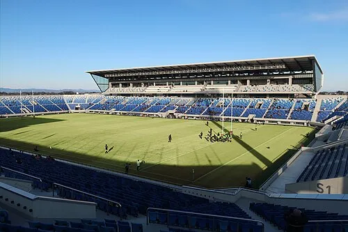 Kumagaya Rugby Ground Landmark, Kumagaya15 km SW
-
Watarase River River, Ibaraki18 km SE
Sources & licences
Data last updated: · 2 independent sources