
- Elevation
- 49 m
- above sea level
- Local time
- UTC+09:00
- Asia/Tokyo · UTC+09:00
- Airports
- SHB Nakashibetsu Airport60 km
- KUH Kushiro Airport74 km
About Kenbokke Tō
Kenbokke Tō is an island. Location: Hokkaido, Japan.
Kenbokki Island (嶮暮帰島, Kenbokki-tō) is an uninhabited island in Hamanaka, Hokkaidō, Japan. The island, with a 4.5-kilometer coastline, forms part of Akkeshi Prefectural Natural Park. The name is derived from the Ainu kene-pok or "beneath the alder" (Alnus japonica). During studies in 1999, four species of mammal (long-clawed shrew, grey-sided vole, harbour seal, and visiting sika deer) and forty-one species of birds were recorded on the island; there were no amphibians or reptiles.
Source: Wikipedia · CC BY-SA 4.0
Climate of Kenbokke Tō
Best months for sightseeingBest months for sightseeing: July–September.
This month · November
A cold month
Day 8° · Night 2° · Rain 83 mm
- Hottest month
- August (day 21°)
- Coldest month
- February (night -8°)
- Wettest month
- September (164 mm)
- Driest month
- February (39 mm)
Bars: average monthly low and high temperature. Below: precipitation. Monthly averages for 1970–2000 at about 18 km resolution, adjusted for elevation. Highlighted months are mild and relatively dry. Source: WorldClim 2.1 (CC BY 4.0).
Show values as a table
| Month | Jan | Feb | Mar | Apr | May | Jun | Jul | Aug | Sep | Oct | Nov | Dec |
|---|---|---|---|---|---|---|---|---|---|---|---|---|
| Average high (°C) | -1° | -2° | 2° | 7° | 12° | 15° | 19° | 21° | 19° | 15° | 8° | 2° |
| Average low (°C) | -8° | -8° | -4° | 1° | 6° | 9° | 13° | 16° | 14° | 8° | 2° | -4° |
| Precipitation (mm) | 53 | 39 | 65 | 80 | 101 | 94 | 103 | 120 | 164 | 119 | 83 | 52 |
How to get to Kenbokke Tō
The nearest airport is Nakashibetsu Airport (SHB), 60 km to the north as the crow flies. The nearest large city is Kushiro, 60 km to the west.
Airports
- Nakashibetsu Airport (SHB) Nakashibetsu 60 kmnorth
- Kushiro Airport (KUH) Kushiro 74 kmwest
- Memanbetsu Airport (MMB) Ōzora 120 kmnorthwest
Nearby large cities
- Kushiro Population: 167.9K 60 kmwest
- Kitami Population: 119.1K 129 kmnorthwest
- Obihiro Population: 166.5K 156 kmwest
- Asahikawa Population: 333.5K 236 kmwest
- Ebetsu Population: 134K 290 kmwest
Straight-line distances; road distances are longer. Airport data: OurAirports.
Nearest towns and villages
-
Hamanaka Chō Municipality, Akkeshi-gun12 km N
-
Hamanaka-sakuraminami Town, Hamanaka Chō11 km N
-
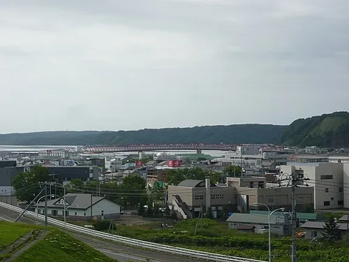 Akkeshi Town, Akkeshi Chō21 km W
-
Akkeshi Chō Municipality, Akkeshi-gun25 km W
-
bekkai Village, Betsukai Chō38 km N
-
Kushiro-cho Municipality, Kushiro-gun52 km W
More lakes, rivers and coasts in Japan
-
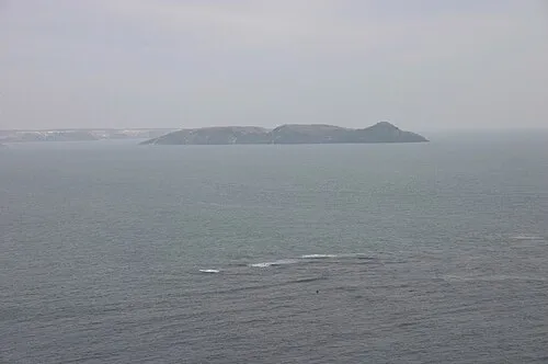 Daikoku Island Island, Hokkaido22 km SW
-
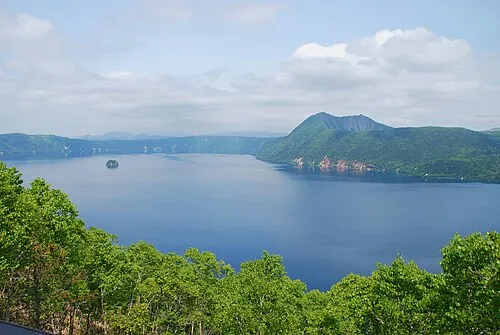 Lake Mashū Lake, Hokkaido75 km NW
-
Kusiro River River, Hokkaido60 km W
-
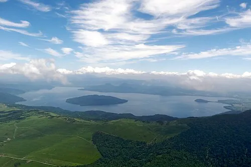 Kussharo Ko Lake, Hokkaido90 km NW
-
 Akan Ko Lake, Hokkaido93 km NW
-
Akan River River, Hokkaido68 km W
Sources & licences
Data last updated: · 2 independent sources