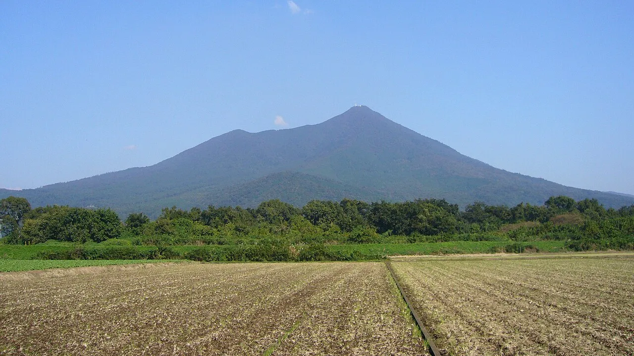
- Elevation
- 877 m
- above sea level
- Local time
- UTC+09:00
- Asia/Tokyo · UTC+09:00
- Airports
- IBR Ibaraki Airport29 km
- NRT Narita International Airport57 km
About Mount_Tsukuba
Mount_Tsukuba is a mountain. Location: Tsukuba Shi, Ibaraki. Elevation: 877 m.
Mount Tsukuba (筑波山, Tsukuba-san) is an 877 m (2,877 ft) mountain located at the northern-end of Tsukuba, Japan. It is one of the most famous mountains in Japan, particularly well known for its double peaks, Nyotai-san (女体山; lit. "female body") 877 m (2,877 ft) and Nantai-san (男体山; lit. "male body") 871 m (2,858 ft). Many people climb the so-called "purple mountain" every year for the panoramic view of the Kantō plain from the summit.
Source: Wikipedia · CC BY-SA 4.0
Climate of Mount_Tsukuba
Best months for sightseeingBest months for sightseeing: July–September.
This month · November
A cold month
Day 10° · Night 0° · Rain 75 mm
Better nearby cities in November
- Isehara · 117 km southwest18°
- Odawara · 138 km southwest19°
- Kofu · 152 km southwest17°
- Hottest month
- August (day 24°)
- Coldest month
- January (night -8°)
- Wettest month
- September (189 mm)
- Driest month
- January (33 mm)
Bars: average monthly low and high temperature. Below: precipitation. Monthly averages for 1970–2000 at about 18 km resolution, adjusted for elevation. Highlighted months are mild and relatively dry. Source: WorldClim 2.1 (CC BY 4.0).
Show values as a table
| Month | Jan | Feb | Mar | Apr | May | Jun | Jul | Aug | Sep | Oct | Nov | Dec |
|---|---|---|---|---|---|---|---|---|---|---|---|---|
| Average high (°C) | 3° | 3° | 6° | 12° | 16° | 18° | 22° | 24° | 20° | 15° | 10° | 6° |
| Average low (°C) | -8° | -7° | -4° | 2° | 7° | 11° | 15° | 16° | 13° | 7° | 0° | -6° |
| Precipitation (mm) | 33 | 52 | 85 | 113 | 126 | 165 | 149 | 150 | 189 | 167 | 75 | 39 |
How to get to Mount_Tsukuba
The nearest airport is Ibaraki Airport (IBR), 29 km to the east as the crow flies. The nearest large city is Chikusei, 15 km to the northwest.
Airports
- Ibaraki Airport (IBR) Omitama 29 kmeast
- Narita International Airport (NRT) Narita 57 kmsoutheast
- Tokyo Haneda International Airport (HND) Tokyo 80 kmsouth
Nearby large cities
- Chikusei Population: 100.8K 15 kmnorthwest
- Tsukuba Population: 241.7K 16 kmsouth
- Tsuchiura Population: 144.4K 18 kmsoutheast
- Oyama Population: 167.6K 28 kmwest
- Mito Population: 270.7K 34 kmnortheast
Straight-line distances; road distances are longer. Airport data: OurAirports.
Nearest towns and villages
Sources & licences
Data last updated: · 2 independent sources