- Elevation
- 8 m
- above sea level
- Local time
- UTC+09:00
- Asia/Tokyo · UTC+09:00
- Population
- 164
- 164
- Airports
- NTQ Noto Satoyama Airport62 km
- SDS Sado Airport134 km
About Hegura Jima
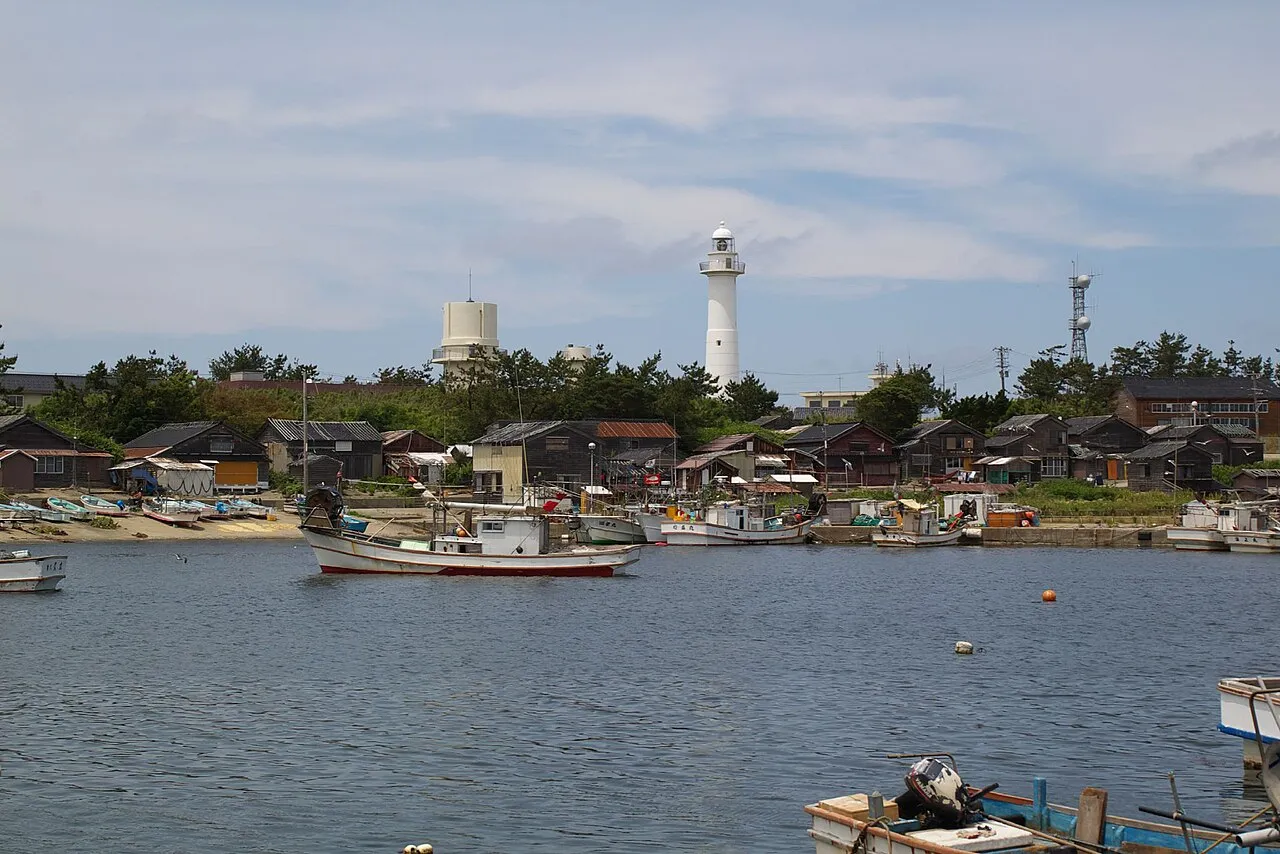
Hegura Jima is an island. Location: Ishikawa, Japan. Population: 164.
Hegurajima (舳倉島) (anglicised as Hegura or Hekura) is a small island located in the Sea of Japan at the far north of Ishikawa Prefecture, Japan. It lies approximately 47 km from the northern tip of Noto Peninsula, and is administratively part of Amamachi township within the city of Wajima. Hegurajima (literally helm-storehouse island) is approximately 2 km by 1 km in size and can easily be walked around in less than an hour.
Source: Wikipedia · CC BY-SA 4.0
At a glance
- Length
- 1.6 km
- Area
- 55 ha
Source: Wikidata
Climate of Hegura Jima
Best months for sightseeingBest months for sightseeing: June–October.
This month · November
A wet month
Day 14° · Night 9° · Rain 253 mm
Better nearby cities in November
- Kofu · 284 km southeast17°
- Fujinomiya · 330 km southeast18°
- Fuji · 338 km southeast20°
- Hottest month
- August (day 28°)
- Coldest month
- February (night 2°)
- Wettest month
- December (285 mm)
- Driest month
- April (121 mm)
Bars: average monthly low and high temperature. Below: precipitation. Monthly averages for 1970–2000 at about 18 km resolution, adjusted for elevation. Highlighted months are mild and relatively dry. Source: WorldClim 2.1 (CC BY 4.0).
Show values as a table
| Month | Jan | Feb | Mar | Apr | May | Jun | Jul | Aug | Sep | Oct | Nov | Dec |
|---|---|---|---|---|---|---|---|---|---|---|---|---|
| Average high (°C) | 6° | 6° | 8° | 13° | 17° | 21° | 25° | 28° | 24° | 19° | 14° | 10° |
| Average low (°C) | 2° | 2° | 4° | 8° | 12° | 17° | 21° | 23° | 20° | 15° | 9° | 5° |
| Precipitation (mm) | 246 | 165 | 133 | 121 | 129 | 154 | 181 | 167 | 240 | 184 | 253 | 285 |
Other places to visit in this season: June July August September October
How to get to Hegura Jima
The nearest airport is Noto Satoyama Airport (NTQ), 62 km to the south as the crow flies. The nearest large city is Takaoka, 122 km to the south.
Airports
- Noto Satoyama Airport (NTQ) Wajima 62 kmsouth
- Sado Airport (SDS) Sado 134 kmeast
- Toyama Kitokito Airport (TOY) Toyama 135 kmsouth
Nearby large cities
- Takaoka Population: 170.1K 122 kmsouth
- Toyama Population: 415.8K 130 kmsouth
- Jōetsu Population: 189.4K 140 kmsoutheast
- Kanazawa Population: 466K 141 kmsouth
- Matsutō Population: 110.4K 151 kmsouth
Straight-line distances; road distances are longer. Airport data: OurAirports.
Nearest towns and villages
More lakes, rivers and coasts in Japan
-
 Mitsuke Jima Island, Ishikawa58 km SE
-
 Noto Jima Island, Ishikawa80 km S
-
Asano River River, Ishikawa137 km S
Sources & licences
Data last updated: · 2 independent sources