- Population
- 356
- 356
- Elevation
- 515 m
- above sea level
- Local time
- UTC+09:00
- Asia/Tokyo · UTC+09:00
- Places inside
- 3
- listed under Mishima Mura
- Airports
- KUM Yakushima Airport57 km
- TNE New Tanegashima Airport69 km
About Mishima Mura
Mishima Mura is a municipality. Location: Kagoshima-gun, Kagoshima. Population: 356. Elevation: 515 m.
Mishima (三島村, Mishima-mura) is a village consisting of the inhabited islands of Iōjima, Kuroshima and Takeshima and the uninhabited islands of Shōwa Iōjima and Denshima located in Kagoshima District, Kagoshima Prefecture, Japan. The village office is located in the city of Kagoshima, outside the village. As of 1 October 2020, the village has an estimated population of 405 and a population density of 12.9 persons per square kilometre (33 per square mile). The total area is 31.36 km2 (12.11 sq mi).
Source: Wikipedia · CC BY-SA 4.0
Photos of Mishima Mura
-
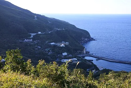
Kuro Shima LT sfm · CC BY-SA 4.0 -
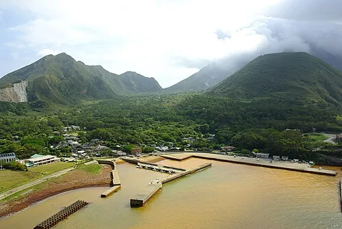
Iō-jima 名古屋太郎 · CC BY-SA 3.0 -
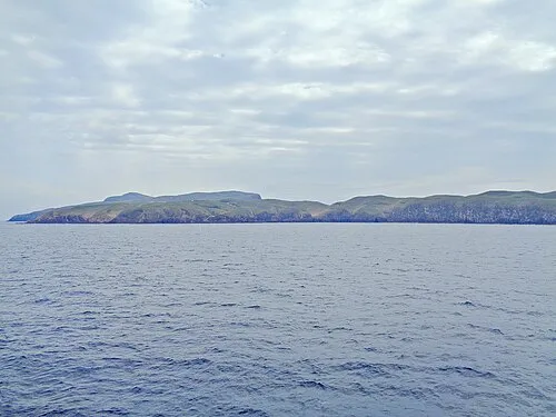
Take-shima ブルーノ・プラス · CC BY-SA 4.0 -
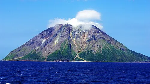
Mount Iō 名古屋太郎 · CC BY-SA 3.0


Population of Mishima Mura over time
| 2010 | 418 | |
|---|---|---|
| 2015 | 407 | |
| 2021 | 404 |
Censuses and official estimates; source: Wikidata.
Climate of Mishima Mura
Best months for sightseeingBest months for sightseeing: May–June, September–October.
This month · November
A wet month
Day 17° · Night 10° · Rain 134 mm
Better nearby cities in November
- Kanoya · 84 km northeast19°
- Kagoshima · 89 km north19°
- Kirishima · 114 km north19°
- Hottest month
- August (day 27°)
- Coldest month
- January (night 4°)
- Wettest month
- June (463 mm)
- Driest month
- December (116 mm)
Bars: average monthly low and high temperature. Below: precipitation. Monthly averages for 1970–2000 at about 18 km resolution, adjusted for elevation. Highlighted months are mild and relatively dry. Source: WorldClim 2.1 (CC BY 4.0).
Show values as a table
| Month | Jan | Feb | Mar | Apr | May | Jun | Jul | Aug | Sep | Oct | Nov | Dec |
|---|---|---|---|---|---|---|---|---|---|---|---|---|
| Average high (°C) | 10° | 11° | 13° | 17° | 20° | 23° | 27° | 27° | 25° | 21° | 17° | 13° |
| Average low (°C) | 4° | 4° | 7° | 11° | 14° | 17° | 21° | 21° | 19° | 15° | 10° | 6° |
| Precipitation (mm) | 145 | 145 | 171 | 227 | 298 | 463 | 228 | 216 | 227 | 146 | 134 | 116 |
Other places to visit in this season: May June September October
How to get to Mishima Mura
The nearest airport is Yakushima Airport (KUM), 57 km to the southeast as the crow flies. For international flights: Kagoshima Airport (KOJ) (119 km). The nearest large city is Kanoya, 84 km to the northeast.
Airports
- Yakushima Airport (KUM) Yakushima 57 kmsoutheast
- New Tanegashima Airport (TNE) Tanegashima 69 kmeast
- Kagoshima Airport (KOJ) Kagoshima 119 kmnorth
Nearby large cities
- Kanoya Population: 101.1K 84 kmnortheast
- Kagoshima Population: 595K 89 kmnorth
- Kirishima Population: 123.2K 114 kmnorth
- Miyakonojō Population: 161.1K 127 kmnortheast
- Miyazaki Population: 401.3K 164 kmnortheast
Straight-line distances; road distances are longer. Airport data: OurAirports.
Day trips from Mishima Mura
Within 100 km: 8 natural sites, 14 lakes, rivers and coasts.
0–25 km6 places
- Ōsumi-shotō Island 23 kmSW
- Iō-jima Island 1 kmW
- Take-shima Island 12 kmE
- Den Shima Island 20 kmW
25–60 km8 places
- Yaku-shima Island 54 kmS
- Yakushima Mountain 54 kmS
- Kuro Shima Island 36 kmW
- Kuchinoerabu-jima Island 38 kmS
60–100 km8 places
- Tanega Shima Island 70 kmE
- Kuchino-shima Island 98 kmS
- Satsuma Peninsula Natural site 70 kmN
- Sakura Jima Island 94 kmN
Straight-line distances.
Places in Mishima Mura
3 places-
Kuro Shima
Population: 194
-
Take-shima
Population: 72
-
Nearby attractions & nature
Everything nearby-
Iō-jima Island, Kagoshima0.7 km W
-
Shōwa’iō Jima Island, Kagoshima3.9 km E
-
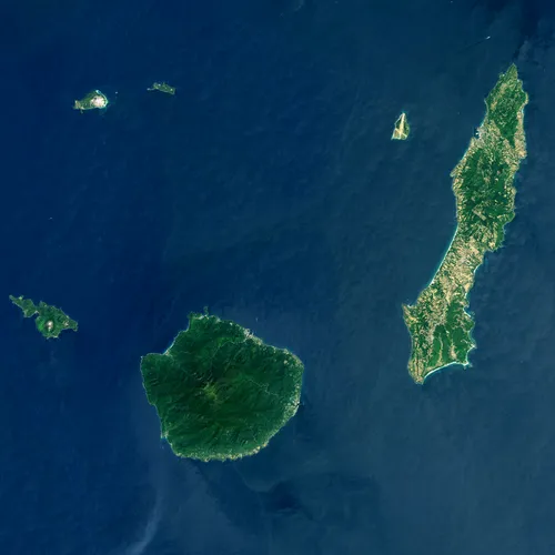 Ōsumi-shotō Island, Kagoshima23 km SW
-
Den Shima Island, Kagoshima20 km W
Sources & licences
Data last updated: · 2 independent sources