- Elevation
- 346 m
- above sea level
- Local time
- UTC+09:00
- Asia/Tokyo · UTC+09:00
- Places inside
- 2
- listed under Kagoshima-gun
- Airports
- KUM Yakushima Airport85 km
- TNE New Tanegashima Airport125 km
About Kagoshima-gun
Kagoshima-gun is a district. Location: Kagoshima, Japan.
Kagoshima (鹿児島郡, Kagoshima-gun) is a district located in Kagoshima Prefecture, Japan. As of 2020, the district has a population of 1,145. The total area is 132.71 km2. The district has two villages and both of them were islands within Oshima District. The district once located on the mainland is now entirely merged into the city of Kagoshima. Mishima Toshima
Source: Wikipedia · CC BY-SA 4.0
At a glance
- Built
- 1879
Source: Wikidata
Climate of Kagoshima-gun
Best months for sightseeingBest months for sightseeing: May–June, September–October.
This month · November
A wet month
Day 19° · Night 14° · Rain 211 mm
Better nearby cities in November
- Kanoya · 181 km northeast19°
- Kagoshima · 188 km north19°
- Kirishima · 214 km north19°
- Hottest month
- August (day 28°)
- Coldest month
- January (night 8°)
- Wettest month
- June (559 mm)
- Driest month
- December (142 mm)
Bars: average monthly low and high temperature. Below: precipitation. Monthly averages for 1970–2000 at about 18 km resolution, adjusted for elevation. Highlighted months are mild and relatively dry. Source: WorldClim 2.1 (CC BY 4.0).
Show values as a table
| Month | Jan | Feb | Mar | Apr | May | Jun | Jul | Aug | Sep | Oct | Nov | Dec |
|---|---|---|---|---|---|---|---|---|---|---|---|---|
| Average high (°C) | 13° | 13° | 16° | 19° | 22° | 25° | 28° | 28° | 26° | 23° | 19° | 15° |
| Average low (°C) | 8° | 8° | 10° | 14° | 17° | 20° | 23° | 23° | 22° | 18° | 14° | 10° |
| Precipitation (mm) | 157 | 183 | 199 | 255 | 369 | 559 | 225 | 232 | 237 | 159 | 211 | 142 |
Other places to visit in this season: May June September October
How to get to Kagoshima-gun
The nearest airport is Yakushima Airport (KUM), 85 km to the northeast as the crow flies. The nearest large city is Kanoya, 181 km to the northeast.
Airports
- Yakushima Airport (KUM) Yakushima 85 kmnortheast
- New Tanegashima Airport (TNE) Tanegashima 125 kmnortheast
- Amami Airport (ASJ) Amami 171 kmsouth
Nearby large cities
- Kanoya Population: 101.1K 181 kmnortheast
- Kagoshima Population: 595K 188 kmnorth
- Kirishima Population: 123.2K 213 kmnorth
- Miyakonojō Population: 161.1K 225 kmnortheast
- Miyazaki Population: 401.3K 260 kmnortheast
Straight-line distances; road distances are longer. Airport data: OurAirports.
Day trips from Kagoshima-gun
Within 100 km: 2 natural sites, 14 lakes, rivers and coasts.
0–25 km2 places
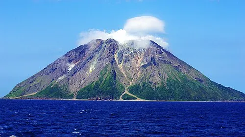
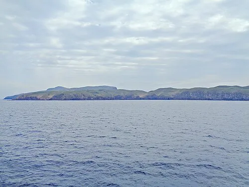
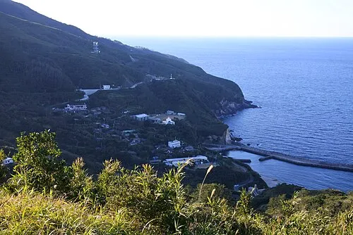
- Nakano Shima Island 13 kmSW
- Kuchino-shima Island 1 kmN
25–60 km4 places
- Taira-shima Island 48 kmSW
- Suwanose-jima Island 41 kmSW
- Ko-gaja-shima Island 30 kmW
- Gaja-shima Island 37 kmW
60–100 km10 places
- Ōsumi-shotō Island 76 kmN
- Yaku-shima Island 69 kmNE
- Yakushima Mountain 69 kmNE
- Tokara-rettō Island 68 kmS
Straight-line distances.
Places in Kagoshima-gun
2 placesBar: population relative to the most populous place in this list.
Nature and heritage in Kagoshima-gun

Nearby attractions & nature
Everything nearby-
Kuchino-shima Island, Japan0.9 km N
-
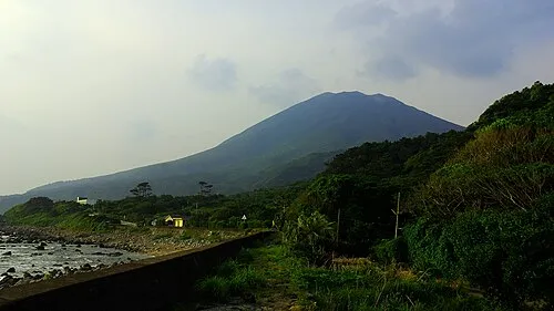 Nakano Shima Island, Kagoshima13 km SW
Sources & licences
Data last updated: · 2 independent sources