Toshima-mura
Local name: 十島村
Located in Kagoshima-gun, Kagoshima Coordinates: 29°50′50″ N 129°51′18″ E
- Population
- 636
- 636
- Elevation
- 295 m
- above sea level
- Local time
- UTC+09:00
- Asia/Tokyo · UTC+09:00
- Places inside
- 3
- listed under Toshima-mura
- Airports
- KUM Yakushima Airport98 km
- TNE New Tanegashima Airport138 km
About Toshima-mura
Toshima-mura is a municipality. Location: Kagoshima-gun, Kagoshima. Population: 636. Elevation: 295 m.
Toshima (十島村, Toshima-mura; Japanese pronunciation: [tó̞.ɕì.mä̀, tò̞.ɕí.mä́]) is a village consisting of the islands of the Tokara Islands located in the Satsunan Islands of Kagoshima District, Kagoshima Prefecture, Japan. The village office is located in the city of Kagoshima, outside the village. As of 1 October 2020, the village has an estimated population of 740 and a density of 7.3 persons per km2. The total area is 101.35 km2.
Source: Wikipedia · CC BY-SA 4.0
Photos of Toshima-mura
-

Takara Jima 名古屋太郎 · Public domain -
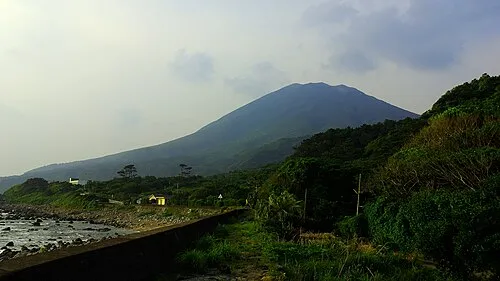
Nakano Shima 名古屋太郎 · Public domain


Population of Toshima-mura over time
| 2010 | 657 | |
|---|---|---|
| 2015 | 756 | |
| 2021 | 761 |
Censuses and official estimates; source: Wikidata.
Climate of Toshima-mura
Best months for sightseeingBest months for sightseeing: April–June, September–November.
This month · November
A good month to visit
Day 19° · Night 14° · Rain 211 mm
- Hottest month
- August (day 29°)
- Coldest month
- January (night 8°)
- Wettest month
- June (559 mm)
- Driest month
- December (142 mm)
Bars: average monthly low and high temperature. Below: precipitation. Monthly averages for 1970–2000 at about 18 km resolution, adjusted for elevation. Highlighted months are mild and relatively dry. Source: WorldClim 2.1 (CC BY 4.0).
Show values as a table
| Month | Jan | Feb | Mar | Apr | May | Jun | Jul | Aug | Sep | Oct | Nov | Dec |
|---|---|---|---|---|---|---|---|---|---|---|---|---|
| Average high (°C) | 13° | 14° | 16° | 20° | 22° | 25° | 28° | 29° | 27° | 23° | 19° | 15° |
| Average low (°C) | 8° | 9° | 11° | 14° | 17° | 20° | 24° | 24° | 22° | 18° | 14° | 10° |
| Precipitation (mm) | 157 | 183 | 199 | 255 | 369 | 559 | 225 | 232 | 237 | 159 | 211 | 142 |
Other places to visit in this season: April May June September October November
How to get to Toshima-mura
The nearest airport is Yakushima Airport (KUM), 98 km to the northeast as the crow flies. The nearest large city is Kanoya, 195 km to the northeast.
Airports
- Yakushima Airport (KUM) Yakushima 98 kmnortheast
- New Tanegashima Airport (TNE) Tanegashima 138 kmnortheast
- Amami Airport (ASJ) Amami 158 kmsouth
Nearby large cities
- Kanoya Population: 101.1K 195 kmnortheast
- Kagoshima Population: 595K 202 kmnorth
- Kirishima Population: 123.2K 227 kmnorth
- Miyakonojō Population: 161.1K 239 kmnortheast
- Miyazaki Population: 401.3K 274 kmnortheast
Straight-line distances; road distances are longer. Airport data: OurAirports.
Day trips from Toshima-mura
Within 100 km: 1 natural site, 13 lakes, rivers and coasts.
0–25 km3 places
- Nakano Shima Island 1 kmE
- Kuchino-shima Island 15 kmNE
- Ko-gaja-shima Island 23 kmW
25–60 km5 places
- Tokara-rettō Island 54 kmS
- Akuseki-shima Island 49 kmSW
- Taira-shima Island 36 kmSW
- Suwanose-jima Island 27 kmSW
60–100 km6 places
- Ōsumi-shotō Island 90 kmN
- Yaku-shima Island 82 kmNE
- Yakushima Mountain 82 kmNE
- Takara Jima Island 100 kmSW
Straight-line distances.
Places in Toshima-mura
3 placesBar: population relative to the most populous place in this list.
Lakes, rivers & coasts1
- Yokoate-shima · Island
Nearby attractions & nature
Everything nearby-
Nakano Shima Island, Kagoshima1.2 km E
-
Kuchino-shima Island, Japan15 km NE
-
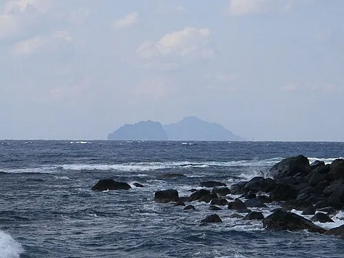 Ko-gaja-shima Island, Japan23 km W
Sources & licences
Data last updated: · 2 independent sources