- Local time
- UTC+09:00
- Asia/Tokyo · UTC+09:00
- Population
- 84
- 84
- Airports
- KUM Yakushima Airport133 km
- ASJ Amami Airport141 km
About Taira-shima
Taira-shima is an island. Location: Toshima-mura, Kagoshima-gun. Population: 84.
Tairajima (平島), is one of the Tokara Islands, a sub-group of the Satsunan Islands belonging to Kagoshima Prefecture, Japan. The island, 2.08 km² in area, has a population of 89 persons. The island can only be reached by boat as it has no airport; there is a ferry service twice per week to the city of Kagoshima on the mainland and Naze in Amami Oshima. Travel time is about 9 hours to Kagoshima and 6 to Amami Oshima. The islanders are dependent mainly on fishing, seasonal tourism, and agriculture.
Source: Wikipedia · CC BY-SA 4.0
At a glance
- Length
- 1.5 km
- Area
- 2.1 km²
Source: Wikidata
Climate of Taira-shima
Best months for sightseeingBest months for sightseeing: April–May, October–December.
This month · November
A good month to visit
Day 22° · Night 18° · Rain 207 mm
- Hottest month
- August (day 31°)
- Coldest month
- January (night 12°)
- Wettest month
- June (518 mm)
- Driest month
- December (138 mm)
Bars: average monthly low and high temperature. Below: precipitation. Monthly averages for 1970–2000 at about 18 km resolution, adjusted for elevation. Highlighted months are mild and relatively dry. Source: WorldClim 2.1 (CC BY 4.0).
Show values as a table
| Month | Jan | Feb | Mar | Apr | May | Jun | Jul | Aug | Sep | Oct | Nov | Dec |
|---|---|---|---|---|---|---|---|---|---|---|---|---|
| Average high (°C) | 17° | 17° | 19° | 22° | 24° | 27° | 31° | 31° | 29° | 26° | 22° | 19° |
| Average low (°C) | 12° | 12° | 14° | 17° | 20° | 23° | 26° | 26° | 24° | 21° | 18° | 14° |
| Precipitation (mm) | 149 | 174 | 188 | 246 | 350 | 518 | 201 | 209 | 220 | 149 | 207 | 138 |
Other places to visit in this season: April May October November December
How to get to Taira-shima
The nearest airport is Yakushima Airport (KUM), 133 km to the northeast as the crow flies. The nearest large city is Kanoya, 226 km to the northeast.
Airports
- Yakushima Airport (KUM) Yakushima 133 kmnortheast
- Amami Airport (ASJ) Amami 141 kmsouth
- Kikai Airport (KKX) Kikai 156 kmsouth
Nearby large cities
- Kanoya Population: 101.1K 226 kmnortheast
- Kagoshima Population: 595K 230 kmnortheast
- Kirishima Population: 123.2K 256 kmnortheast
- Miyakonojō Population: 161.1K 270 kmnortheast
- Miyazaki Population: 401.3K 306 kmnortheast
Straight-line distances; road distances are longer. Airport data: OurAirports.
Day trips from Taira-shima
Within 100 km: 9 lakes, rivers and coasts.
0–25 km3 places
- Suwanose-jima Island 18 kmE
- Ko-gaja-shima Island 23 kmN
- Gaja-shima Island 24 kmN
25–60 km4 places
- Tokara-rettō Island 41 kmSE
- Nakano Shima Island 37 kmNE
- Kuchino-shima Island 49 kmNE
- Akuseki-shima Island 26 kmS
60–100 km2 places
- Takara Jima Island 68 kmSW
- Satsunan Islands Island 89 kmSE
Straight-line distances.
Nearby attractions & nature
Everything nearby-
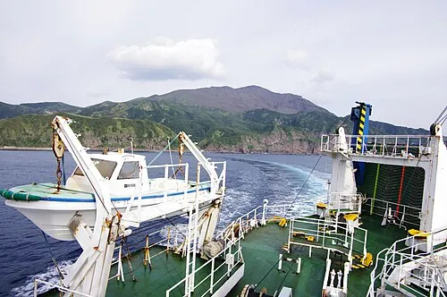 Suwanose-jima Island, Japan18 km E
-
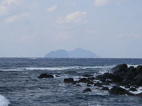 Ko-gaja-shima Island, Japan23 km N
-
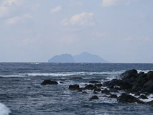 Gaja-shima Island, Kagoshima24 km N
More lakes, rivers and coasts in Japan
-
 Takara Jima Island, Toshima-mura68 km SW
-
Yokoate-shima Island, Toshima-mura112 km SW
Sources & licences
Data last updated: · 2 independent sources