Yakushima Chō
Local name: 屋久島町
Located in Kumage-gun, Kagoshima Coordinates: 30°20′49″ N 130°30′05″ E
- Population
- 13,503
- 13.5K
- Elevation
- 1,494 m
- above sea level
- Local time
- UTC+09:00
- Asia/Tokyo · UTC+09:00
- Places inside
- 1
- listed under Yakushima Chō
- Airports
- KUM Yakushima Airport16 km
- TNE New Tanegashima Airport55 km
About Yakushima Chō
Yakushima Chō is a municipality. Location: Kumage-gun, Kagoshima. Population: 13,503. Elevation: 1,494 m.
Yakushima (屋久島町, Yakushima-chō) is a town located in Kumage District, Kagoshima, Japan. The town is on the island of Yakushima and Kuchinoerabujima.
Source: Wikipedia · CC BY-SA 4.0
Photos of Yakushima Chō
-
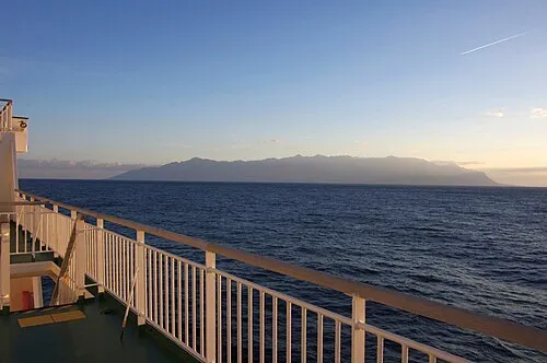
Yaku-shima tsuda from Tsushima, Aichi, Japan · CC BY-SA 2.0

Twin towns and sister cities of Yakushima Chō
- Aomori· Japan
Source: Wikidata. Only places with a page on this site are shown.
Population of Yakushima Chō over time
| 2010 | 13,589 | |
|---|---|---|
| 2015 | 12,913 | |
| 2021 | 11,810 |
Censuses and official estimates; source: Wikidata.
Climate of Yakushima Chō
Best months for sightseeingBest months for sightseeing: July–September.
This month · November
A wet month
Day 11° · Night 5° · Rain 178 mm
Better nearby cities in November
- Kanoya · 120 km north19°
- Kagoshima · 136 km north19°
- Kirishima · 157 km north19°
- Hottest month
- August (day 21°)
- Coldest month
- January (night -1°)
- Wettest month
- June (503 mm)
- Driest month
- December (143 mm)
Bars: average monthly low and high temperature. Below: precipitation. Monthly averages for 1970–2000 at about 18 km resolution, adjusted for elevation. Highlighted months are mild and relatively dry. Source: WorldClim 2.1 (CC BY 4.0).
Show values as a table
| Month | Jan | Feb | Mar | Apr | May | Jun | Jul | Aug | Sep | Oct | Nov | Dec |
|---|---|---|---|---|---|---|---|---|---|---|---|---|
| Average high (°C) | 4° | 5° | 8° | 12° | 15° | 18° | 21° | 21° | 19° | 15° | 11° | 7° |
| Average low (°C) | -1° | -1° | 2° | 6° | 9° | 12° | 16° | 16° | 14° | 10° | 5° | 1° |
| Precipitation (mm) | 156 | 181 | 238 | 280 | 366 | 503 | 313 | 292 | 285 | 198 | 178 | 143 |
How to get to Yakushima Chō
The nearest airport is Yakushima Airport (KUM), 16 km to the east as the crow flies. For international flights: Kagoshima Airport (KOJ) (163 km). The nearest large city is Kanoya, 120 km to the north.
Airports
- Yakushima Airport (KUM) Yakushima 16 kmeast
- New Tanegashima Airport (TNE) Tanegashima 55 kmnortheast
- Kagoshima Airport (KOJ) Kagoshima 163 kmnorth
Nearby large cities
- Kanoya Population: 101.1K 120 kmnorth
- Kagoshima Population: 595K 135 kmnorth
- Kirishima Population: 123.2K 157 kmnorth
- Miyakonojō Population: 161.1K 163 kmnorth
- Miyazaki Population: 401.3K 195 kmnortheast
Straight-line distances; road distances are longer. Airport data: OurAirports.
Day trips from Yakushima Chō
Within 100 km: 4 natural sites, 14 lakes, rivers and coasts.
0–25 km2 places
- Yaku-shima Island 2 kmS
- Yakushima Mountain 2 kmS
25–60 km9 places
- Ōsumi-shotō Island 42 kmNW
- Tanega Shima Island 55 kmNE
- Kuchinoerabu-jima Island 30 kmNW
- Iō-jima Island 53 kmN
60–100 km7 places
- Kuro Shima Island 76 kmNW
- Nakano Shima Island 82 kmSW
- Kuchino-shima Island 70 kmSW
- Ko-gaja-shima Island 99 kmSW
Straight-line distances.
Places in Yakushima Chō
1 place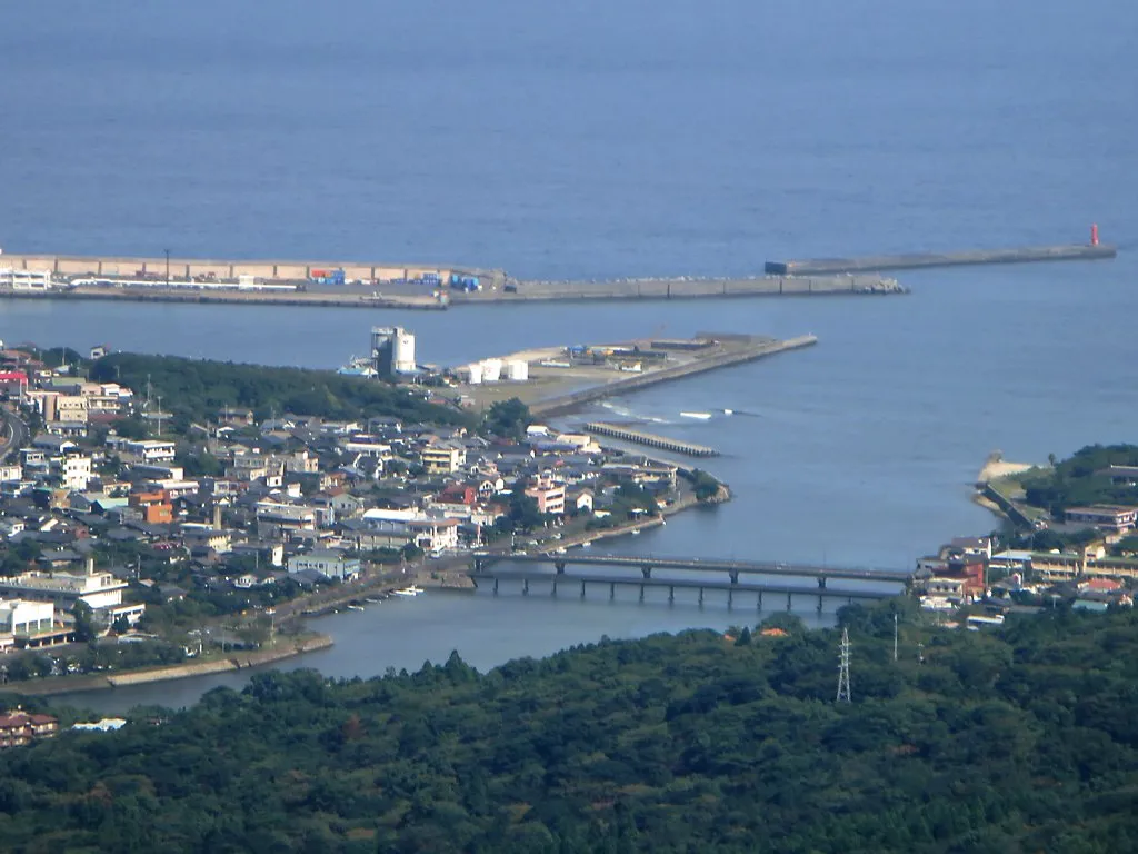
Miyanoura
Population: 6.5K
Nearby attractions & nature
Everything nearby-
Yaku-shima Island, Kagoshima1.5 km S
-
Yakushima Mountain, Kagoshima1.5 km S
Sources & licences
Data last updated: · 2 independent sources