Odawara
Local name: 小田原市
Located in Odawara-shi, Kanagawa Coordinates: 35°15′20″ N 139°09′35″ E
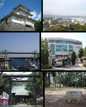
- Population
- 188,856
- 188.9K
- Elevation
- 15 m
- above sea level
- Local time
- UTC+09:00
- Asia/Tokyo · UTC+09:00
- Airports
- OIM Oshima Airport56 km
- HND Tokyo Haneda International Airport66 km
About Odawara
Odawara is a city. Location: Odawara-shi, Kanagawa. Population: 188,856. Elevation: 15 m.
Odawara (小田原市, Odawara-shi; Japanese pronunciation: [ò̞.dä́.β̞ä́.ɾä́(.ɕì)]) is a city in Kanagawa Prefecture, Japan. As of 1 September 2025, the city had an estimated population of 185,027 and a population density of 1,700 persons per km2. The total area of the city is 113.79 square kilometres (43.93 sq mi).
Source: Wikipedia · CC BY-SA 4.0
Photos of Odawara
-

inunami · CC BY 2.0

Travel notes for Odawara
From Wikivoyage
Odawara (小田原) is a city in Kanagawa prefecture in eastern Japan. It is on the coast of Sagami Bay, about 80 km (50 miles) southwest of Tokyo. Odawara is near Hakone, a major hot springs destination and is along the historic Tokaido road between Edo (Tokyo) and Kyoto.
Understand+
1 Odawara Station Tourist Information (小田原駅観光案内所), Sakaecho 1-1-5 (in Odawara Station.), ☏ +81 465-22-2339. Daily 09:00-17:00. Sightseeing information is available here. Don't expect much English to be spoken. (updated Mar 2023)
Odawara-Guide is an English guide site by the local tourism association.
The city's official site has a modest multi-lingual section on tourism.
Get in+
By plane:
Narita Airport: the fastest way to get to Odawara - especially useful if you have a valid Japan Rail Pass - is the JR Narita Express to Shinagawa station, then walk on over to the Shinkansen platforms and take the next Kodama (こだま) all-stations service two stops to Odawara. This takes 1 hour, 45 minutes and the journey is fully covered by the pass. Without a rail pass, the journey costs ¥6,280 with an additional surcharge if you used reserved seating on the Kodama.
The alternative by train is to transfer to a local JR Tokaido Line train at Shinagawa, which brings the fare down to ¥4600 and increases the journey time to 2½ hours.
Haneda Airport: take the Keikyu Railway to Yokohama and transfer to the JR Tokaido Line for Odawara (about 90 minutes, ¥1,420).
If you have a reservation at a ryokan in or around Odawara, unless your plane lands in the morning, it is recommended that you spend your first evening in Tokyo or Yokohama, or else you might miss out on (and be charged for) dinner at the ryokan, or worse, you may be locked out of (and be charged for) your room at the ryokan's curfew time, if there is one.
The Mount Fuji-Shizuoka Airport in Shizuoka serves a few international flights from other points in Asia. Bus service to Shizuoka station takes 55 minutes and costs ¥1000; from here, Kodama bullet trains run to Odawara in 45-50 minutes (¥3,300 unreserved seat).
By train:
1 Odawara Station (小田原駅), Shiroyama 1-1-1. (updated Mar 2023)
By JR:
Odawara is a major transit hub for several rail lines: It is a stop on the Tokaido Shinkansen bullet train line and the regular JR Tokaido Line local services. The private Odakyu railway operates trains from here to Shinjuku, while trains on the Hakone Tozan Line run up to the hot springs gateway of Hakone-Yumoto. Finally, the Izu-Hakone railway offers access to the Buddhist temple at Daiyuzan.
Source: Wikivoyage · CC BY-SA 4.0 · abridged
Places bordering Odawara
- Minamiashigara
- Ninomiya
- Ōi Machi
- Kaisei Machi
- Hakone
- Manazuru
- Yugawara
Twin towns and sister cities of Odawara
- Nikkō· Japan
- Hachiōji· Japan
- Yorii· Japan
Source: Wikidata. Only places with a page on this site are shown.
Population of Odawara over time
| 2010 | 198,327 | |
|---|---|---|
| 2015 | 194,086 | |
| 2020 | 189,038 |
Censuses and official estimates; source: Wikidata.
Climate of Odawara
Best months for sightseeingBest months for sightseeing: April–June, October–November.
This month · November
A good month to visit
Day 19° · Night 10° · Rain 98 mm
- Hottest month
- August (day 31°)
- Coldest month
- January (night 2°)
- Wettest month
- August (232 mm)
- Driest month
- December (52 mm)
Bars: average monthly low and high temperature. Below: precipitation. Monthly averages for 1970–2000 at about 18 km resolution, adjusted for elevation. Highlighted months are mild and relatively dry. Source: WorldClim 2.1 (CC BY 4.0).
Show values as a table
| Month | Jan | Feb | Mar | Apr | May | Jun | Jul | Aug | Sep | Oct | Nov | Dec |
|---|---|---|---|---|---|---|---|---|---|---|---|---|
| Average high (°C) | 12° | 12° | 14° | 20° | 24° | 26° | 29° | 31° | 27° | 23° | 19° | 14° |
| Average low (°C) | 2° | 2° | 5° | 10° | 15° | 19° | 22° | 24° | 21° | 15° | 10° | 5° |
| Precipitation (mm) | 58 | 72 | 123 | 141 | 156 | 222 | 175 | 232 | 232 | 179 | 98 | 52 |
Other places to visit in this season: April May June October November
How to get to Odawara
The nearest airport is Oshima Airport (OIM), 56 km to the south as the crow flies. For international flights: Tokyo Haneda International Airport (HND) (66 km). The nearest large city is Hadano, 14 km to the northeast.
Airports
- Oshima Airport (OIM) Izu Oshima 56 kmsouth
- Tokyo Haneda International Airport (HND) Tokyo 66 kmnortheast
- Mount Fuji Shizuoka Airport (FSZ) Makinohara / Shimada 102 kmsouthwest
Nearby large cities
- Hadano Population: 163.8K 14 kmnortheast
- Hiratsuka Population: 258.4K 18 kmnortheast
- Isehara Population: 103.4K 21 kmnortheast
- Chigasaki Population: 242.8K 24 kmeast
- Mishima Population: 107.9K 27 kmsouthwest
Straight-line distances; road distances are longer. Airport data: OurAirports.
Day trips from Odawara
Within 100 km: 51 historic and cultural sites, 52 natural sites, 46 lakes, rivers and coasts.
0–25 km15 places
- Hatsu-shima Island 24 kmS
- Sagami River River 20 kmE
- Mount Kōbō Mountain 16 kmNE
- Sakawa River River 2 kmE
25–60 km51 places
- Jōga Shima Island 44 kmE
- Enoshima Island 30 kmE
- Lake Shoji Lake 57 kmNW
- Mount Echizen-dake Mountain 33 kmW
60–100 km83 places
- Ō Shima Island 62 kmS
- Nii-jima Island 98 kmS
- To Shima Island 82 kmS
- Mount Aino Mountain 95 kmNW
Straight-line distances.
Odawara and similar cities
Side by side with cities of similar size in the same country: population, elevation and climate.
| Measure | Odawara | Anjo | Tottori-shi | Jōetsu |
|---|---|---|---|---|
| Population | 188.9K | 188.7K | 188.5K | 189.4K |
| Elevation | 15 m | 20 m | 6 m | 10 m |
| Summer day (hottest month) | 31° | 31° | 31° | 31° |
| Winter night (coldest month) | 2° | 1° | 0° | -2° |
| Annual rainfall | 1,740 mm | 1,891 mm | 1,787 mm | 2,305 mm |
| Best months | Apr–Jun, Oct–Nov | May–Jun, Oct | May, Oct | May–Jun, Oct |
| Distance | — | 192 km | 448 km | 226 km |
Climate values are 1970–2000 monthly averages; straight-line distance.
Nearby attractions & nature
Everything nearby-
Sakawa River River, Kanagawa2.2 km E
-
Tama Gawa River, Kanagawa3.7 km SW
-
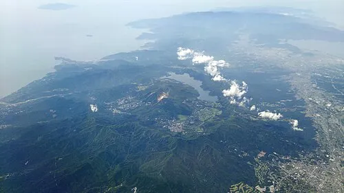 Hakone Yama Mountain, Japan12 km W
-
Nangō San Mountain, Yugawara Machi10 km SW
-
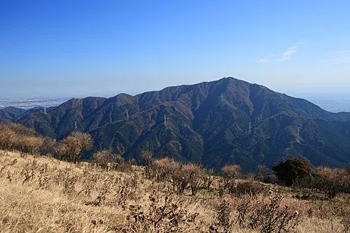 Ō Yama Mountain, Isehara22 km N
-
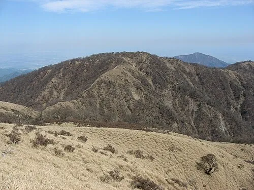 Mount Tanzawa Mountain, Ashigarakami-gun24 km N
-
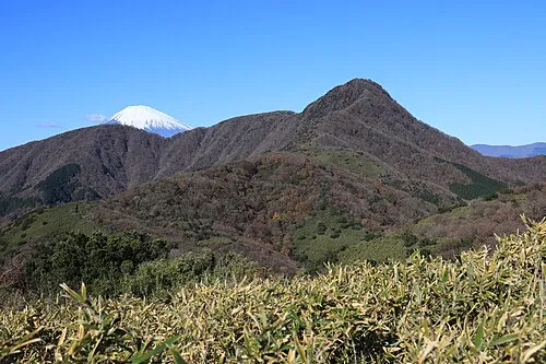 Kintoki Zan Mountain, Hakone-machi15 km W
-
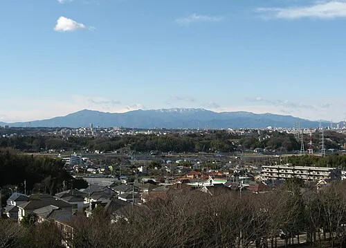 Tanzawa Sanchi Mountain, Kanagawa24 km N
Sources & licences
Data last updated: · 2 independent sources