- Population
- 206,634
- 206.6K
- Elevation
- 56 m
- above sea level
- Local time
- UTC+09:00
- Asia/Tokyo · UTC+09:00
- Airports
- HND Tokyo Haneda International Airport21 km
- OIM Oshima Airport78 km
About Hodogaya
Hodogaya is a municipality. Location: Yokohama, Kanagawa. Population: 206,634. Elevation: 56 m.
Hodogaya-ku (保土ケ谷区) is one of the 18 wards of the city of Yokohama in Kanagawa Prefecture, Japan. As of 2010, Hodogaya Ward had an estimated population of 205,887 and a density of 9,400 inhabitants per square kilometer (24,000/sq mi). The total area was 21.91 km2 (8.46 sq mi).
Source: Wikipedia · CC BY-SA 4.0
Population of Hodogaya over time
| 2010 | 206,634 | |
|---|---|---|
| 2015 | 205,493 | |
| 2020 | 206,013 |
Censuses and official estimates; source: Wikidata.
Climate of Hodogaya
Best months for sightseeingBest months for sightseeing: May–June, September–October.
This month · November
A wet month
Day 17° · Night 8° · Rain 106 mm
Better nearby cities in November
- Isehara · 25 km west18°
- Odawara · 44 km southwest19°
- Mishima · 71 km southwest18°
- Hottest month
- August (day 30°)
- Coldest month
- January (night 1°)
- Wettest month
- September (216 mm)
- Driest month
- December (52 mm)
Bars: average monthly low and high temperature. Below: precipitation. Monthly averages for 1970–2000 at about 18 km resolution, adjusted for elevation. Highlighted months are mild and relatively dry. Source: WorldClim 2.1 (CC BY 4.0).
Show values as a table
| Month | Jan | Feb | Mar | Apr | May | Jun | Jul | Aug | Sep | Oct | Nov | Dec |
|---|---|---|---|---|---|---|---|---|---|---|---|---|
| Average high (°C) | 10° | 10° | 13° | 19° | 23° | 25° | 28° | 30° | 27° | 21° | 17° | 12° |
| Average low (°C) | 1° | 1° | 4° | 10° | 14° | 18° | 22° | 23° | 20° | 14° | 8° | 3° |
| Precipitation (mm) | 56 | 72 | 126 | 141 | 157 | 213 | 162 | 175 | 216 | 195 | 106 | 52 |
Other places to visit in this season: May June September October
How to get to Hodogaya
The nearest airport is Tokyo Haneda International Airport (HND), 21 km to the northeast as the crow flies. The nearest large city is Yokohama, 7 km to the southeast.
Airports
- Tokyo Haneda International Airport (HND) Tokyo 21 kmnortheast
- Oshima Airport (OIM) Izu Oshima 78 kmsouth
- Narita International Airport (NRT) Narita 81 kmnortheast
Nearby large cities
- Yokohama Population: 3.8M 7 kmsoutheast
- Yamato Population: 242.1K 12 kmwest
- Minamirinkan Population: 224K 13 kmwest
- Kawasaki Population: 1.5M 14 kmnortheast
- Machida Population: 431.1K 15 kmnorthwest
Straight-line distances; road distances are longer. Airport data: OurAirports.
Day trips from Hodogaya
Within 100 km: 51 historic and cultural sites, 44 natural sites, 48 lakes, rivers and coasts.
0–25 km33 places
- Enoshima Island 20 kmSW
- Mount Ōyama Natural site 18 kmS
- Sarushima Island 22 kmSE
- Tokyo Bay Natural site 20 kmE
25–60 km74 places
- Jōga Shima Island 36 kmS
- Hatsu-shima Island 60 kmSW
- Saitama Super Arena Landmark 48 kmN
- Iruma River River 50 kmN
60–100 km36 places
- Ō Shima Island 82 kmS
- Mount Bukō Mountain 70 kmNW
- Lake Shoji Lake 88 kmW
- Mount Echizen-dake Mountain 75 kmW
Straight-line distances.
Hodogaya and similar cities
Side by side with cities of similar size in the same country: population, elevation and climate.
| Measure | Hodogaya | Nishi-Tokyo-shi | Kishiwada | Matsue |
|---|---|---|---|---|
| Population | 206.6K | 207.4K | 205.6K | 203.6K |
| Elevation | 56 m | 58 m | 8 m | 8 m |
| Summer day (hottest month) | 30° | 30° | 32° | 31° |
| Winter night (coldest month) | 1° | -1° | 2° | 1° |
| Annual rainfall | 1,671 mm | 1,461 mm | 1,464 mm | 1,570 mm |
| Best months | May–Jun, Sep–Oct | May–Jun, Oct | May, Oct | May–Jun, Oct |
| Distance | — | 30 km | 400 km | 592 km |
Climate values are 1970–2000 monthly averages; straight-line distance.
Nearby attractions & nature
Everything nearby-
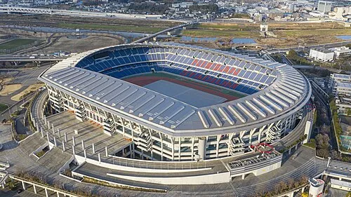 Nissan Stadium Landmark, Kōhoku-ku6 km NE
-
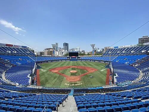 Yokohama Stadium Landmark, Naka Ku5.9 km E
-
 Yokohama Marine Tower Landmark, Naka Ku6.9 km E
-
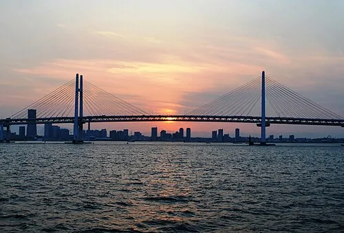 Yokohama Bay Bridge Landmark, Kanagawa8.7 km E
-
Ōoka River River, Kanagawa5.1 km E
-
 Sōji Ji Attraction, Tsurumi Ku9.8 km NE
-
Tsurumi River River, Kanagawa9.7 km E
-
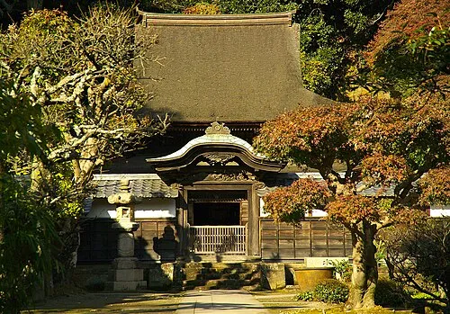 Engaku Ji Attraction, Kamakura14 km S
Sources & licences
Data last updated: · 2 independent sources