Yamanouchi Machi
Local name: 山ノ内町
Located in Shimotakai-gun, Nagano Coordinates: 36°45′05″ N 138°30′38″ E
- Population
- 13,598
- 13.6K
- Elevation
- 1,771 m
- above sea level
- Local time
- UTC+09:00
- Asia/Tokyo · UTC+09:00
- Airports
- MMJ Shinshu-Matsumoto Airport84 km
- TOY Toyama Kitokito Airport119 km
About Yamanouchi Machi
Yamanouchi Machi is a municipality. Location: Shimotakai-gun, Nagano. Population: 13,598. Elevation: 1,771 m.
Yamanouchi (山ノ内町, Yamanouchi-machi) is a town located in Shimotakai District in Nagano Prefecture, Japan. As of 1 April 2019, the town had an estimated population of 12,403 in 5020 households, and a population density of 47 persons per km2. The total area of the town is 265.90 square kilometres (102.66 sq mi). Yamanouchi, located in the Japanese Alps, includes Shiga Highlands, one of the largest ski resorts in Japan.
Source: Wikipedia · CC BY-SA 4.0
Travel notes for Yamanouchi Machi
From Wikivoyage
Yamanouchi (山ノ内町 Yamanouchi-machi) is a hot spring town in Nagano, Japan, famous for its bathing snow monkeys.
Understand+
The tourist information center at Nagano station can give you a bus and local train timetable to get to the monkey park, as well as a brochure with a handy map for the walk from the bus stop to the park. English spoken.
Tourist information sites:
The local tourist association has a bilingual guide site.
The town's official site has a good Japanese-only tourism section with integrated machine translation.
Get in+
Yamanouchi town's Yudanaka Station is 45 minutes from Nagano on the Nagano-Dentetsu rail line; Nagano in turn is 95 minutes from Tokyo on the Asama bullet train. The train from Nagano to Yamanouchi is ¥1210 one way; then you need to catch a bus or walk. Upon arrival at Yudanaka Station you will likely be greeted by the info centre's employees handing out free helpful maps on how to get to the Monkey Park. They will also explain that you can buy bus tickets from the window at the front of Yudanaka Station.
If possible, take the Nagano Electric Limited Express. It makes far fewer stops than the local trains, and the seats are more comfortable as the train is newer. It costs an extra ¥100 each way. If you take one of the local trains, it is possible that you will have to transfer halfway down the line onto a different train, although it is usually just a matter of walking across the platform onto the waiting train.
The monkey park is approximately 1.6 km from where the buses and taxis drop you off. The walk is a pleasant one through the woods. While it isn't very steep or difficult, the trail can be muddy or icy, so appropriate footwear is recommended. If you forgot or didn't have a chance to bring proper boots, there is a gift shop/info center at the base of the trail that rents them for ¥500.
Source: Wikivoyage · CC BY-SA 4.0 · abridged
Places bordering Yamanouchi Machi
- Nakano
- Takayama Mura
- Kijimadaira Mura
- Sakae Mura
- Nakanojō
Population of Yamanouchi Machi over time
| 2010 | 13,678 | |
|---|---|---|
| 2015 | 12,429 | |
| 2021 | 11,106 |
Censuses and official estimates; source: Wikidata.
Climate of Yamanouchi Machi
Best months for sightseeingBest months for sightseeing: July–August.
This month · November
A cold month
Day 6° · Night -4° · Rain 92 mm
Better nearby cities in November
- Kofu · 121 km south17°
- Isehara · 167 km southeast18°
- Fujinomiya · 171 km south18°
- Hottest month
- August (day 22°)
- Coldest month
- February (night -13°)
- Wettest month
- August (257 mm)
- Driest month
- December (60 mm)
Bars: average monthly low and high temperature. Below: precipitation. Monthly averages for 1970–2000 at about 18 km resolution, adjusted for elevation. Highlighted months are mild and relatively dry. Source: WorldClim 2.1 (CC BY 4.0).
Show values as a table
| Month | Jan | Feb | Mar | Apr | May | Jun | Jul | Aug | Sep | Oct | Nov | Dec |
|---|---|---|---|---|---|---|---|---|---|---|---|---|
| Average high (°C) | -4° | -4° | 0° | 7° | 13° | 16° | 20° | 22° | 17° | 11° | 6° | 0° |
| Average low (°C) | -13° | -13° | -10° | -3° | 2° | 7° | 12° | 13° | 9° | 2° | -4° | -9° |
| Precipitation (mm) | 68 | 73 | 92 | 125 | 141 | 213 | 235 | 257 | 246 | 145 | 92 | 60 |
How to get to Yamanouchi Machi
The nearest airport is Shinshu-Matsumoto Airport (MMJ), 84 km to the southwest as the crow flies. For international flights: Niigata Airport (KIJ) (144 km). The nearest large city is Nagano, 31 km to the west.
Airports
- Shinshu-Matsumoto Airport (MMJ) Matsumoto 84 kmsouthwest
- Toyama Kitokito Airport (TOY) Toyama 119 kmwest
- Niigata Airport (KIJ) Niigata 144 kmnorth
Nearby large cities
- Nagano Population: 372.8K 31 kmwest
- Ueda Population: 157.5K 44 kmsouthwest
- Jōetsu Population: 189.4K 50 kmnorthwest
- Maebashi Population: 332.1K 64 kmsoutheast
- Takasaki Population: 373K 65 kmsoutheast
Straight-line distances; road distances are longer. Airport data: OurAirports.
Day trips from Yamanouchi Machi
Within 100 km: 2 historic and cultural sites, 53 natural sites, 13 lakes, rivers and coasts.
0–25 km4 places
- Naeba-san Mountain 19 kmNE
- Azumaya San Mountain 25 kmS
- Mount Kusatsu-Shirane Mountain 12 kmS
- Takama Yama Mountain 25 kmSE
25–60 km20 places
- Mount Azumaya Mountain 55 kmSW
- Hijiri Yama Mountain 53 kmSW
- Arakawa River River 53 kmNW
- Takada castle Historic site 46 kmNW
60–100 km44 places
- Honshu Island 95 kmSW
- Kasaga-take Mountain 99 kmSW
- Mount Kurobegorō Mountain 96 kmSW
- Kamikōchi Natural site 96 kmSW
Straight-line distances.
Nearby attractions & nature
Everything nearby-
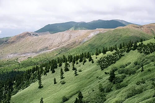 Mount Kusatsu-Shirane Mountain, Gunma12 km S
-
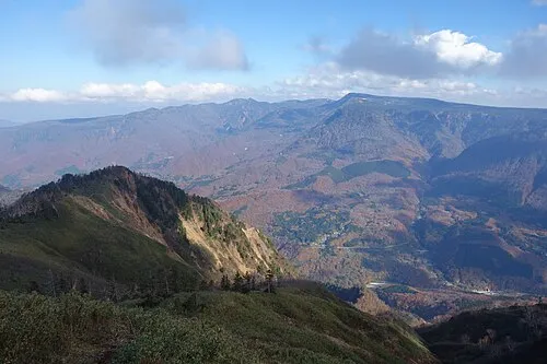 Naeba-san Mountain, Yuzawa Machi19 km NE
-
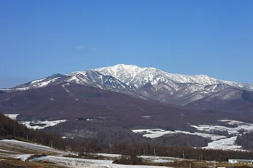 Azumaya San Mountain, Tsumagoi Mura25 km S
-
Takama Yama Mountain, Naganohara Machi25 km SE
Sources & licences
Data last updated: · 2 independent sources