- Population
- 40,395
- 40.4K
- Elevation
- 190 m
- above sea level
- Local time
- UTC+09:00
- Asia/Tokyo · UTC+09:00
- Places inside
- 3
- listed under Gotō Shi
- Airports
- FUJ Fukue Airport7 km
- NGS Nagasaki Airport110 km
About Gotō Shi
Gotō Shi is a district. Location: Nagasaki, Japan. Population: 40,395.
Gotō (五島市, Gotō-shi) is a city in Nagasaki Prefecture, Japan. It comprises the south-west half of the Gotō Islands plus (uninhabited) Danjo and Hizen Torishima archipelagos in the East China Sea. Although the core islands of the city lay some 100 kilometers from Nagasaki, the other archipelagos lay 60 km further to South-West. The city consists of 11 inhabited and 52 uninhabited islands. The three main islands of the city are Fukue, Hisaka, and Naru.
Source: Wikipedia · CC BY-SA 4.0
Population of Gotō Shi over time
| 2010 | 40,622 | |
|---|---|---|
| 2015 | 37,327 | |
| 2021 | 34,425 |
Censuses and official estimates; source: Wikidata.
Climate of Gotō Shi
Best months for sightseeingBest months for sightseeing: May–June, September–October.
This month · November
A wet month
Day 16° · Night 9° · Rain 122 mm
Better nearby cities in November
- Kagoshima · 210 km southeast19°
- Kirishima · 216 km southeast19°
- Miyakonojō · 241 km southeast18°
- Hottest month
- August (day 29°)
- Coldest month
- January (night 3°)
- Wettest month
- June (347 mm)
- Driest month
- December (97 mm)
Bars: average monthly low and high temperature. Below: precipitation. Monthly averages for 1970–2000 at about 18 km resolution, adjusted for elevation. Highlighted months are mild and relatively dry. Source: WorldClim 2.1 (CC BY 4.0).
Show values as a table
| Month | Jan | Feb | Mar | Apr | May | Jun | Jul | Aug | Sep | Oct | Nov | Dec |
|---|---|---|---|---|---|---|---|---|---|---|---|---|
| Average high (°C) | 9° | 10° | 13° | 17° | 21° | 24° | 28° | 29° | 26° | 22° | 16° | 12° |
| Average low (°C) | 3° | 3° | 6° | 10° | 14° | 18° | 22° | 23° | 19° | 15° | 9° | 5° |
| Precipitation (mm) | 108 | 118 | 159 | 248 | 257 | 347 | 315 | 226 | 247 | 107 | 122 | 97 |
Other places to visit in this season: May June September October
How to get to Gotō Shi
The nearest airport is Fukue Airport (FUJ), 7 km to the southeast as the crow flies. For international flights: Nagasaki Airport (NGS) (110 km). The nearest large city is Sasebo, 103 km to the northeast.
Airports
- Fukue Airport (FUJ) Goto 7 kmsoutheast
- Nagasaki Airport (NGS) Nagasaki 110 kmeast
- Amakusa Airport (AXJ) Amakusa 133 kmeast
Nearby large cities
- Sasebo Population: 243.2K 103 kmnortheast
- Nagasaki Population: 409.1K 105 kmeast
- Isahaya Population: 135.5K 120 kmeast
- Karatsu Population: 117.7K 139 kmnortheast
- Saga Population: 233.3K 155 kmnortheast
Straight-line distances; road distances are longer. Airport data: OurAirports.
Places in Gotō Shi
3 placesBar: population relative to the most populous place in this list.
Lakes, rivers & coasts1
- Fukue Island · Island
Nearby attractions & nature
Everything nearby-
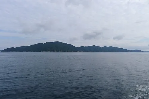 Hisaka Jima Island, Nagasaki15 km NE
-
 Naru Island Island, Nagasaki23 km NE
Sources & licences
Data last updated: · 2 independent sources