Yoshinoyama
Local name: 吉野山
Located in Yoshino-chō, Yoshino-gun Coordinates: 34°21′32″ N 135°52′13″ E

- Elevation
- 448 m
- above sea level
- Local time
- UTC+09:00
- Asia/Tokyo · UTC+09:00
- Airports
- KIX Kansai International Airport58 km
- ITM Osaka Itami International Airport61 km
About Yoshinoyama
Yoshinoyama is a village. Location: Yoshino-chō, Yoshino-gun. Elevation: 448 m.
Mount Yoshino (吉野山, Yoshino-yama) is the general name for the mountain ridge that stretches from the south bank of the Yoshino River in the town of Yoshino central Nara Prefecture, Japan, to the Ōmine Mountains, stretching for about eight kilometers from north-to-south, or the broader name of the area dotted with shrines and temples, centered around Kinpusen-ji Temple. It has long been known as a famous flower spot, especially for its cherry blossoms and is a popular tourist destination.
Source: Wikipedia · CC BY-SA 4.0
At a glance
- Heritage designation
- part of UNESCO World Heritage Site, Historic Site of Japan, Place of Scenic Beauty
- Area
- 34 ha
- Official website
- yoshinoyama-sakura.jp
Source: Wikidata
Photos of Yoshinoyama
-

Utagawa Hiroshige II · Public domain -

Japanexperterna.se · CC BY-SA 3.0 -

KimonBerlin · CC BY-SA 2.0 -

KimonBerlin · CC BY-SA 2.0 -

Enon1979 · Public domain


Climate of Yoshinoyama
Best months for sightseeingBest months for sightseeing: May–June, September–October.
This month · November
Outside the best season
Day 14° · Night 5° · Rain 91 mm
Better nearby cities in November
- Kochi · 234 km west18°
- Fujinomiya · 268 km east18°
- Fuji · 272 km east20°
- Hottest month
- August (day 29°)
- Coldest month
- January (night -2°)
- Wettest month
- June (262 mm)
- Driest month
- December (48 mm)
Bars: average monthly low and high temperature. Below: precipitation. Monthly averages for 1970–2000 at about 18 km resolution, adjusted for elevation. Highlighted months are mild and relatively dry. Source: WorldClim 2.1 (CC BY 4.0).
Show values as a table
| Month | Jan | Feb | Mar | Apr | May | Jun | Jul | Aug | Sep | Oct | Nov | Dec |
|---|---|---|---|---|---|---|---|---|---|---|---|---|
| Average high (°C) | 7° | 7° | 11° | 16° | 20° | 24° | 27° | 29° | 25° | 19° | 14° | 9° |
| Average low (°C) | -2° | -2° | 1° | 7° | 12° | 16° | 20° | 21° | 17° | 11° | 5° | 0° |
| Precipitation (mm) | 58 | 69 | 118 | 167 | 175 | 262 | 221 | 182 | 240 | 153 | 91 | 48 |
Other places to visit in this season: May June September October
How to get to Yoshinoyama
The nearest airport is Kansai International Airport (KIX), 58 km to the west as the crow flies. The nearest large city is Kashiwara, 14 km to the northwest.
Airports
- Kansai International Airport (KIX) Osaka 58 kmwest
- Osaka Itami International Airport (ITM) Osaka 61 kmnorthwest
- Kobe Airport (UKB) Kobe 67 kmnorthwest
Nearby large cities
- Kashiwara Population: 120.9K 14 kmnorthwest
- Kashihara-shi Population: 124.5K 18 kmnorthwest
- Kawachi-Nagano Population: 101.7K 28 kmwest
- Tondabayashi Population: 132.9K 29 kmnorthwest
- Habikino Population: 109.5K 33 kmnorthwest
Straight-line distances; road distances are longer. Airport data: OurAirports.
Day trips from Yoshinoyama
Within 100 km: 28 historic and cultural sites, 43 natural sites, 24 lakes, rivers and coasts.
0–25 km12 places
- Mount Miwa Mountain 19 kmN
- Mount Amanokagu Mountain 16 kmN
- Mount Miminashi Mountain 18 kmN
- Mount Unebi Mountain 17 kmNW
25–60 km21 places
- Mount Ōdaigahara Mountain 27 kmSE
- Mount Kunimi Mountain 27 kmE
- Choshi River River 44 kmSE
- Mukogawa River River 59 kmNW
60–100 km62 places
- Awaji Island Island 96 kmW
- Tōshi-jima Island 95 kmE
- Kii Ōshima Island 99 kmS
- Mount Rokkō Mountain 73 kmNW
Straight-line distances.
Nearby attractions & nature
Everything nearby-
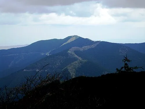 Mount Shisuniwa Mountain, Kurotaki Mura5.5 km SE
-
 Mount Ōtenjō Mountain, Kawakami-mura9.2 km SE
-
 Mount Amanokagu Mountain, Kashihara City16 km N
-
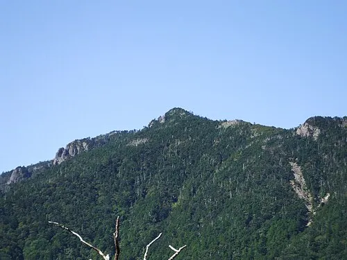 Hakken-san Mountain, Tenkawa-mura21 km S
-
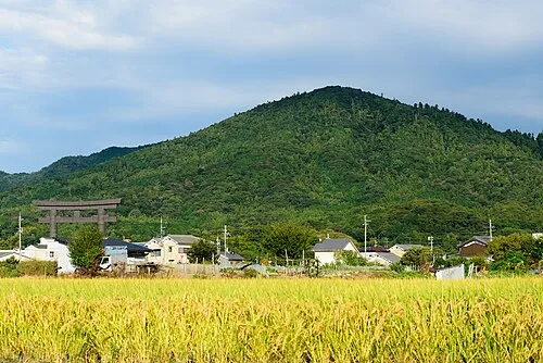 Mount Miwa Mountain, Sakurai-shi19 km N
-
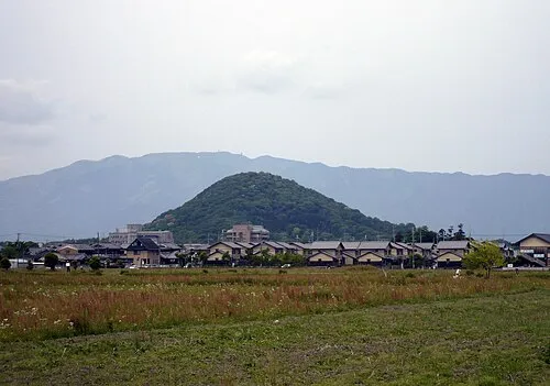 Mount Unebi Mountain, Kashihara City17 km NW
Sources & licences
Data last updated: · 2 independent sources