- Population
- 10,412
- 10.4K
- Elevation
- 557 m
- above sea level
- Local time
- UTC+09:00
- Asia/Tokyo · UTC+09:00
- Airports
- KMJ Kumamoto Airport52 km
- OIT Oita Airport58 km
About Kokonoe Machi
Kokonoe Machi is a municipality. Location: Kusu-gun, Oita. Population: 10,412. Elevation: 557 m.
Kokonoe (九重町, Kokonoe-machi) is a town located in Kusu District, Ōita Prefecture, Japan. As of 30 November 2023, the town had an estimated population of 8,536 in 3,881 households, and a population density of 31 persons per km2. The total area of the city is 271.37 km2 (104.78 sq mi).
Source: Wikipedia · CC BY-SA 4.0
Places bordering Kokonoe Machi
- Takedamachi
- Yufu-shi
- Kusu Machi
- Oguni Machi
- Minamioguni Machi
Population of Kokonoe Machi over time
| 2010 | 10,421 | |
|---|---|---|
| 2015 | 9,645 | |
| 2021 | 8,616 |
Censuses and official estimates; source: Wikidata.
Climate of Kokonoe Machi
Best months for sightseeingBest months for sightseeing: May–July, September–October.
This month · November
Outside the best season
Day 14° · Night 6° · Rain 83 mm
Better nearby cities in November
- Beppu · 28 km east17°
- Ōita · 36 km east18°
- Nobeoka · 80 km southeast18°
- Hottest month
- August (day 27°)
- Coldest month
- January (night -2°)
- Wettest month
- July (442 mm)
- Driest month
- December (63 mm)
Bars: average monthly low and high temperature. Below: precipitation. Monthly averages for 1970–2000 at about 18 km resolution, adjusted for elevation. Highlighted months are mild and relatively dry. Source: WorldClim 2.1 (CC BY 4.0).
Show values as a table
| Month | Jan | Feb | Mar | Apr | May | Jun | Jul | Aug | Sep | Oct | Nov | Dec |
|---|---|---|---|---|---|---|---|---|---|---|---|---|
| Average high (°C) | 5° | 6° | 10° | 16° | 20° | 23° | 26° | 27° | 24° | 19° | 14° | 8° |
| Average low (°C) | -2° | -1° | 2° | 7° | 12° | 16° | 20° | 21° | 17° | 11° | 6° | 0° |
| Precipitation (mm) | 74 | 103 | 143 | 195 | 221 | 396 | 442 | 267 | 231 | 128 | 83 | 63 |
Other places to visit in this season: May June July September October
How to get to Kokonoe Machi
The nearest airport is Kumamoto Airport (KMJ), 52 km to the southwest as the crow flies. The nearest large city is Beppu, 28 km to the east.
Airports
- Kumamoto Airport (KMJ) Kumamoto 52 kmsouthwest
- Oita Airport (OIT) Oita 58 kmnortheast
- Kitakyushu Airport (KKJ) Kitakyushu 74 kmnorth
Nearby large cities
- Beppu Population: 122.6K 28 kmeast
- Ōita Population: 477.7K 36 kmeast
- Kurume Population: 303.6K 66 kmwest
- Iizuka Population: 126.4K 69 kmnorthwest
- Chikushino-shi Population: 103.3K 73 kmnorthwest
Straight-line distances; road distances are longer. Airport data: OurAirports.
Day trips from Kokonoe Machi
Within 100 km: 19 historic and cultural sites, 21 natural sites, 11 lakes, rivers and coasts.
0–25 km3 places
- Mount Tsurumi Mountain 23 kmNE
- Mount Kujū Mountain 13 kmS
- Mount Yufu Mountain 19 kmNE
25–60 km9 places
- Mount Ōkueyama Mountain 58 kmSE
- Mount Sobo Mountain 42 kmS
- Mount Aso Mountain 36 kmS
- Mount Ōmure Mountain 37 kmNE
60–100 km39 places
- Kyūshū Island 87 kmS
- Hiko Shima Island 87 kmN
- Chikugo River River 80 kmW
- Mount Unzen Mountain 100 kmSW
Straight-line distances.
Nearby attractions & nature
Everything nearby-
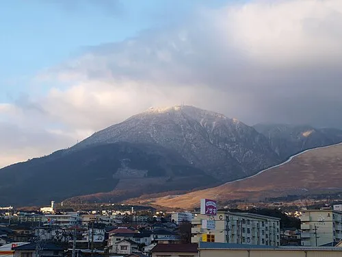 Mount Tsurumi Mountain, Beppu Shi23 km NE
-
Mount Kujū Mountain, Oita13 km S
-
 Mount Yufu Mountain, Yufu-shi19 km NE
Sources & licences
Data last updated: · 2 independent sources