- Population
- 993
- 993
- Elevation
- 605 m
- above sea level
- Local time
- UTC+09:00
- Asia/Tokyo · UTC+09:00
- Places inside
- 1
- listed under Shinjō Son
- Airports
- YGJ Yonago Kitaro Airport / JASDF Miho Air Base44 km
- OKJ Okayama Momotaro Airport56 km
About Shinjō Son
Shinjō Son is a municipality. Location: Maniwa-gun, Okayama. Population: 993. Elevation: 605 m.
Shinjō (新庄村, Shinjō-son) is a village located in Maniwa District, Okayama Prefecture, Japan. As of 30 November 2022, the village had an estimated population of 847 in 378 households and a population density of 13 persons per km2. The total area of the village is 67.11 square kilometres (25.91 sq mi). It is a member of The Most Beautiful Villages in Japan Association.
Source: Wikipedia · CC BY-SA 4.0
Travel notes for Shinjō Son
From Wikivoyage
Shinjo (新庄村 Shinjō-son) is a village in Okayama, Japan.
Understand+
Tourist information site:
The village has an official Japanese-only guide site.
Get in+
If you have a car, Shinjo is on Route 181 (also called the Izumo Kaido after the ancient pilgrimage path), which travels from Yonago in the north to Maniwa where it branches off from the Chugoku Expressway.
There are no train stations in Shinjo, but there are options for those without a car. From Chugoku-Katsuyama Station, there are four buses per day that travel to Shinjo with departures at 08:22, 12:12, 16:02, and 18:59 from Apr to Sep and 18:22 from Oct to Mar. It takes 40 minutes to reach Shinjo from the station. There are also four return buses. By taxi, Shinjo is 20 minutes from Neu Station on the Hakubi Line in Hino.
Source: Wikivoyage · CC BY-SA 4.0 · abridged
Places bordering Shinjō Son
- Niimi
- Maniwa Shi
- Hino Chō
- Kōfu Chō
Population of Shinjō Son over time
| 2010 | 957 | |
|---|---|---|
| 2015 | 866 | |
| 2021 | 805 |
Censuses and official estimates; source: Wikidata.
Climate of Shinjō Son
Best months for sightseeingBest months for sightseeing: May–July, September.
This month · November
Outside the best season
Day 12° · Night 4° · Rain 92 mm
Better nearby cities in November
- Kochi · 184 km south18°
- Ōita · 284 km southwest18°
- Beppu · 286 km southwest17°
- Hottest month
- August (day 28°)
- Coldest month
- February (night -4°)
- Wettest month
- July (263 mm)
- Driest month
- December (83 mm)
Bars: average monthly low and high temperature. Below: precipitation. Monthly averages for 1970–2000 at about 18 km resolution, adjusted for elevation. Highlighted months are mild and relatively dry. Source: WorldClim 2.1 (CC BY 4.0).
Show values as a table
| Month | Jan | Feb | Mar | Apr | May | Jun | Jul | Aug | Sep | Oct | Nov | Dec |
|---|---|---|---|---|---|---|---|---|---|---|---|---|
| Average high (°C) | 3° | 4° | 8° | 15° | 20° | 23° | 27° | 28° | 23° | 18° | 12° | 7° |
| Average low (°C) | -3° | -4° | -1° | 5° | 10° | 15° | 19° | 20° | 16° | 9° | 4° | -1° |
| Precipitation (mm) | 95 | 99 | 114 | 139 | 150 | 232 | 263 | 167 | 223 | 122 | 92 | 83 |
Other places to visit in this season: May June July September
How to get to Shinjō Son
The nearest airport is Yonago Kitaro Airport / JASDF Miho Air Base (YGJ), 44 km to the northwest as the crow flies. For international flights: Okayama Momotaro Airport (OKJ) (56 km). The nearest large city is Yonago, 33 km to the northwest.
Airports
- Yonago Kitaro Airport / JASDF Miho Air Base (YGJ) Yonago 44 kmnorthwest
- Okayama Momotaro Airport (OKJ) Okayama 56 kmsoutheast
- Izumo Enmusubi Airport (IZO) Izumo 65 kmwest
Nearby large cities
- Yonago Population: 148.7K 33 kmnorthwest
- Tsuyama Population: 102.3K 43 kmsoutheast
- Matsue Population: 203.6K 56 kmnorthwest
- Tottori-shi Population: 188.5K 69 kmnortheast
- Kurashiki Population: 483.6K 71 kmsouth
Straight-line distances; road distances are longer. Airport data: OurAirports.
Day trips from Shinjō Son
Within 100 km: 6 historic and cultural sites, 11 natural sites, 21 lakes, rivers and coasts.
0–25 km2 places
- Mount Daisen Mountain 19 kmN
- Mount Hōbutsu Mountain 9 kmNW
25–60 km13 places
- Hino River River 33 kmNW
- Daikon Island Island 47 kmNW
- Lake Nakaumi Lake 44 kmNW
- Mount Hiba Mountain 49 kmW
60–100 km23 places
- Nao Shima Island 91 kmSE
- Shiwaku Islands Island 92 kmS
- Te Shima Island 93 kmSE
- Manabe Island Island 94 kmS
Straight-line distances.
Places in Shinjō Son
1 placeBar: population relative to the most populous place in this list.
Nearby attractions & nature
Everything nearby-
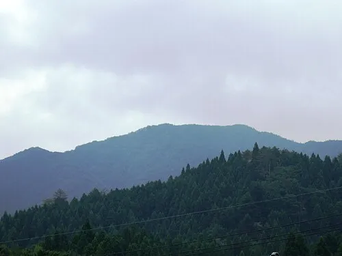 Mount Hōbutsu Mountain, Kōfu Chō9.2 km NW
-
 Mount Daisen Mountain, Daisen Chō19 km N
Sources & licences
Data last updated: · 2 independent sources