- Elevation
- 105 m
- above sea level
- Local time
- UTC+09:00
- Asia/Tokyo · UTC+09:00
- Airports
- OKA Naha International Airport8 km
- UEO Kumejima Airport101 km
About Shuri-ikehatachō
Shuri-ikehatachō is a village. Location: Naha Shi, Okinawa. Elevation: 105 m.
Shuri (首里; Okinawan: スイ Sui or Shui, Northern Ryukyuan: しより Shiyori) is a district of the city of Naha, Okinawa, Japan. Formerly a separate city in and of itself, it was once the royal capital of the Ryūkyū Kingdom, hence the name. A number of famous historical sites are located in Shuri, including Shuri Castle, the Shureimon gate, Sunuhyan-utaki (a sacred space of the native Ryukyuan religion), and royal mausoleum Tamaudun, all of which are designated World Heritage Sites by UNESCO.
Source: Wikipedia · CC BY-SA 4.0
Climate of Shuri-ikehatachō
Best months for sightseeingBest months for sightseeing: November–May.
This month · November
A good month to visit
Day 24° · Night 19° · Rain 131 mm
- Hottest month
- July (day 31°)
- Coldest month
- January (night 14°)
- Wettest month
- August (245 mm)
- Driest month
- December (108 mm)
Bars: average monthly low and high temperature. Below: precipitation. Monthly averages for 1970–2000 at about 18 km resolution, adjusted for elevation. Highlighted months are mild and relatively dry. Source: WorldClim 2.1 (CC BY 4.0).
Show values as a table
| Month | Jan | Feb | Mar | Apr | May | Jun | Jul | Aug | Sep | Oct | Nov | Dec |
|---|---|---|---|---|---|---|---|---|---|---|---|---|
| Average high (°C) | 19° | 19° | 21° | 24° | 26° | 29° | 31° | 31° | 30° | 27° | 24° | 21° |
| Average low (°C) | 14° | 14° | 16° | 19° | 21° | 24° | 26° | 26° | 25° | 22° | 19° | 16° |
| Precipitation (mm) | 123 | 127 | 170 | 187 | 240 | 231 | 175 | 245 | 197 | 171 | 131 | 108 |
Other places to visit in this season: January February March April May November December
How to get to Shuri-ikehatachō
The nearest airport is Naha International Airport (OKA), 8 km to the west as the crow flies. The nearest large city is Naha, 4 km to the west.
Airports
- Naha International Airport (OKA) Naha 8 kmwest
- Kumejima Airport (UEO) Kumejima 101 kmwest
- Yoron Airport (RNJ) Yoron 114 kmnortheast
Nearby large cities
- Naha Population: 317.6K 4 kmwest
- Urasoe Population: 115.7K 4 kmnorth
- Ginowan Population: 100.1K 6 kmnortheast
- Okinawa Population: 142.8K 15 kmnortheast
- Uruma Population: 125.3K 22 kmnortheast
Straight-line distances; road distances are longer. Airport data: OurAirports.
Nearby attractions & nature
Everything nearby-
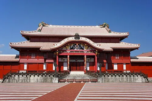 Shuri Castle Historic site, Naha Shi0.5 km S
-
Kokuba Gawa River, Okinawa4.1 km SW
-
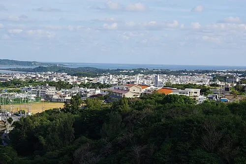 Katsuren Peninsula Natural site, Okinawa21 km NE
-
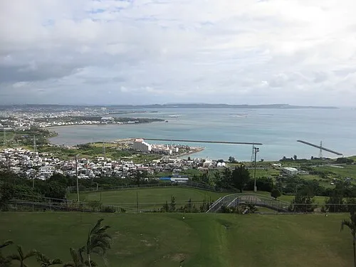 Nakagusuku Bay Natural site, Okinawa17 km E
-
Tsuken Jima Island, Okinawa23 km E
Sources & licences
Data last updated: · 2 independent sources